The Raleigh Naturalist

July 31, 2008

White Squirrels and the Brevard fault: PFI rules!!

Filed under: Exotica, Gems & Surprises, Nature Lore — Tags: , , , , , , — raleighnaturalist @ 7:54 pm


    Teachers in the woods!  Climbing rocks and jumpin’ in waterfalls! That’s what I call a workshop! For 5 very full days, two dozen educators traveled the Land of Waterfalls, centered around the Brevard fault, seeing some amazing geology, flora, and fauna with the staff of, and presenters for, the Pisgah Forest Institute.  We got treated like teacher queens for a day (okay, one other guy besides me as kings in this group of elementary school teachers).  We got free stuff, wonderful information and some great hikes.

teachers in the Little River!

teachers in the Little River!

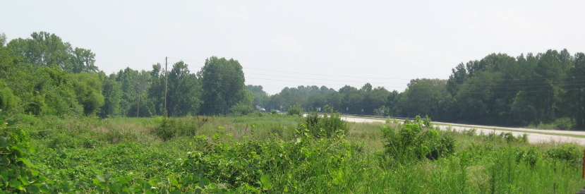
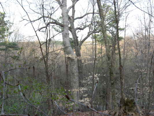
   The Pisgah Forest Institute is an initiative of Brevard College – a beautiful campus that is ancient as a 2 year college but only 14 years old as a 4 year.  PFI focuses on “the earth and environmental science needs educators encounter in their classrooms. ”  The workshops are funded partly through grants from the USDA Forest Service.  This part of the mountains receives more annual rainfall than anywhere in the continental U.S. except for the Northwest temperate rain forests (or would if there weren’t a severe drought).  There is a unique feel to the wilderness areas and even more so to the farmland, it seemed to me this trip.  Rich, well cultivated fields and not so much the hard scrabble feel you see (disappearing) in the northern section of our mountains.

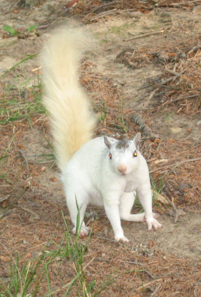
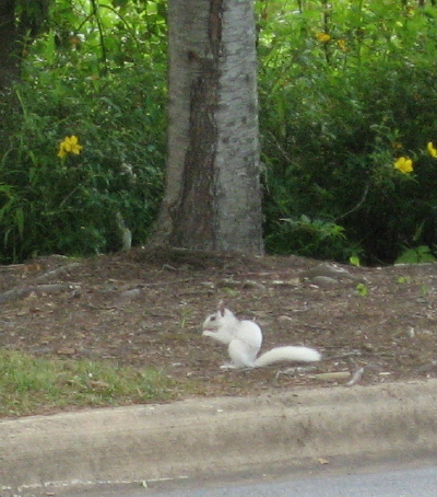
     The town of Brevard hosts a Music Center, has a nice college/tourist shop and bar scene, and is famous for – did I mention them?, – the white squirrels.  These little guys just blew me away, and set me off on an extended online chase to research white squirrels.  There was a lot to find. The local history traces their origin to an overturned carnival truck in 1949.  There is a research institute devoted to them, a White Squirrel Festival each year in Brevard, and of course a White Squirrel Lover’s blog.  The very best picture I found online is on a realty site, and clearly the white squirrel is a promotion bonanza for the town of Brevard, though their claim to fame is not without controversy (other “homes of the white squirrel”).
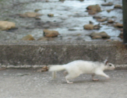
on the move

on the move

White Squirrel Photo Album

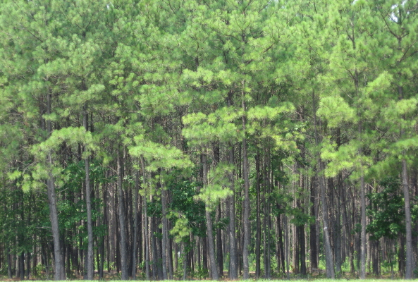
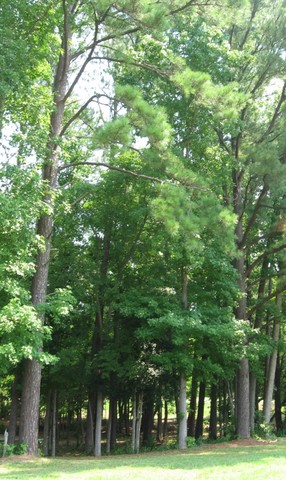
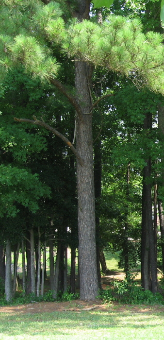
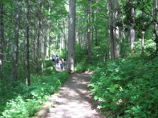
     The PFI would educate and inform us and then take us on a related field trip.  We made 3 major expeditions: Holmes Educational State Forest, Caeser’s Head State Park, and a new amenity, Dupont State Park, which contains several spectacular waterfalls.  We also conducted a stream activity at the trout hatchery on the Davidson River. Each place offered valuable lessons and experiences.  At Holmes, which is open to the public, we practiced tree i.d. and took the “talking tree” walk.  Caeser’s Head offered spectacular views of the Piedmont vista as seen from the edge of the Blue Ridge system.  So many wonderful pictures – I offer an album at the end of the post, and many of the following text images are linked to a picture.

     The park gots its name from a head-shaped rock that protrudes from the highest viewpoint.  Across the chasm, you see Tablerock Mountain, a monolith of intruded younger rock whose side is painted by the staining action of rainwater.

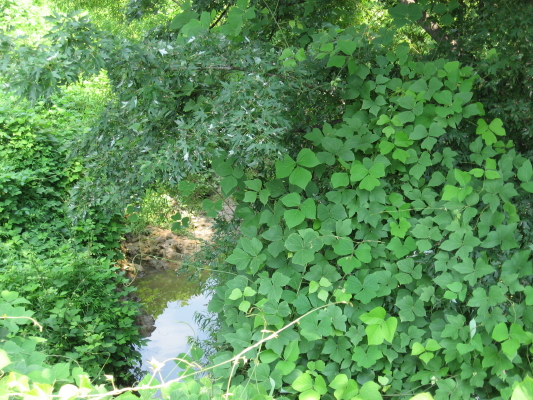
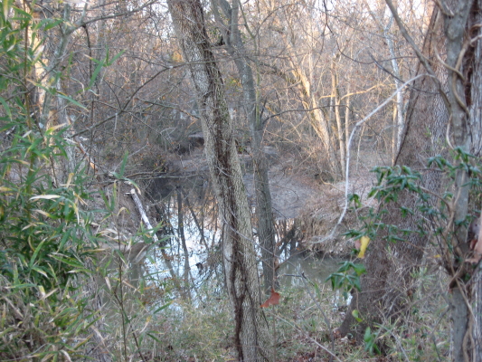
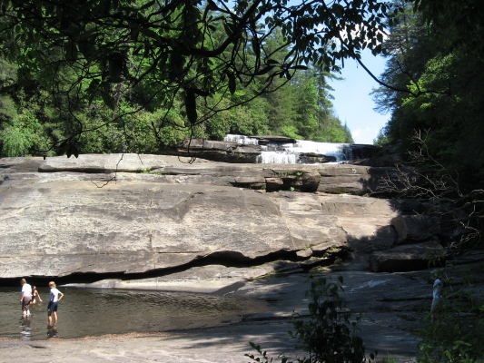
      Dupont, after a decent hike, offered beautiful waterfall views, including some used in The Last of the Mohicans.  Here the Brevard Fault is in full view, fracturing and pushing til some of the huge blocks become square tree planters.  The Little River winds its way down the rock cascades, though it was quite low the day my pictures were taken.

  The young lady below is leaping from Hooker Falls, another fault-block structure in the park.  We learned some background geology at Caeser’s Head and then put it into action at Dupont, locating the folded layers in a piece of gneiss that represent eons of slow bending pressure.

     Kevin, program director for PFI, holds a northern water snake from the Davidson River.  We measured stream quality parameters and took a tour of the trout hatchery, which attracts vultures from miles around.  Back at the Brevard campus, we saw a stream rehabilitation process and surveyed native as well as invasive plant species on campus.  Below is a picture of hemlock infested with wooly adelgid (the small white spots).  Just one of the many ecological challenges faced in the Southern Appalachian mountains.  Thanks, PFI, for such a great trip and for helping me learn so much! 

PFI Brevard Fault Photo Tour


July 22, 2008

The Domain of Mushrooms – raleighnature.com

Filed under: About & reflection, Nature Lore — Tags: , — raleighnaturalist @ 12:33 am

     We have had plentiful rain, in the short run, at least, and when I saw a couple of mushrooms in a row I decided to go on a mushroom walk.  Not much to say:  I am blogging from the library on a timeclock and I don’t know anything about mushroom i.d.  Here they are and we’ll sort them out later.  But what a variety!  And what change in any one over time….now I’ve had time to look at my National Audubon Society Field Guide to North American Mushrooms – and I’m not about to tell you a positive i.d. on any mushroom!  Don’t eat any of them!!  Unless you are an expert or with an expert.  I will try some if T.P. or Katie and Russ have some to share, but I sure don’t trust my judgment.   Fun to watch, though.  And remind yourself the mushrooms we see are just the fruiting body (spore producer) of the fungus organism –  a whole network of tiny filaments in the ground or, more likely, in the dead plant material, especially wood.

Mushrooms are in the kingdom of Fungi in the domain of Eukarya.

NEWS: This blog is now published at the domain www.raleighnature.com and has moved from it’s old site.  If you have the old netweed/raleighnature url as a favorite or on your blogroll, I would greatly appreciate you updating it.


***********************************


***************************


*******************************


************************* 

These pictures were taken at Cedar Hills Park and Fred Fletcher Park.

 August mountain trip with lots of shrooms!

Sept. 2010 Mushroom Madness post

July 15, 2008

From Hwy 50 Horses to Gresham Lake’s Paul Bunyan: Person Street


Straight Streets: nature drives with a Raleigh road theme

     With some finessing, but no turns, you can drive a thoroughfare through Raleigh from Highway 50 in Garner, straight north through the heart of downtown, out to Gresham’s Lake at Capital and 540.  The middle of this 15 mile stretch is called Person Street, and when I was a kid my Dad told me this:

   Son, this piece of asphalt you’re looking at goes from Florida to Maine.  It’s part of one of the country’s great highways – and one of the first.  Indians may have used this path before Columbus came.  This is business US 1.

 Person Street was a big part of my childhood, and now I live on it.  It is the address of the church in which I grew up, Tabernacle Baptist, the Krispy Kreme, a beloved landmark long before they went public, and the Mordecai House, a genuine bridge to another time.  It has been made one way now, so we can count Blount Street as its southbound lane.  It has been extended to the north as Atlantic Avenue, which we will follow out.  But it also has been cut off from its old extension, Wake Forest Road, as seen above, and yet this all intertwines in interesting ways in north Raleigh.


      Let’s start at the farthest extensions southward: Person becomes Hammond, which becomes Timber Drive at 70.  Timber crosses 70 and curves under  the south edge of Garner,ending in a horse pasture just past 50.  Reverse your direction, and you are looking at 3 miles of new suburban projects and shopping centers.  The funny thing is, it all exists in what is recognizably old farm fields with mature trees in the lowlands and various stages of pine plantation everywhere else.  There are loblollies everywhere!

                         
      young pine stand –        juvenile loblollies    –    thinned adults    –    mature stand with crowd
please remember to click and enlarge 

   The drive traverses four watersheds: Swift  Creek in Garner, Walnut Creek at 40 and Hammond, Crabtree over the crest at New Bern Avenue, and the Neuse after the Char-Grill on Atlantic.  Below is Wildcat Creek, a north bearing tributary of Walnut, as it crosses Hammond.  This stretch just south of downtown is still heavily wooded, with side lots and a very large swale bordered by the Lake Wheeler Road offshoots.  There are some trash dumps, plenty of kudzu and microstegia, but really some nice spots.


     Proceeding north through downtown, one encounters many fascinating examples of human nature along Person Street.  After sniffing the pet food factory at the transition from Hammond to Person, you cross Bragg Street, one of the most policed streets in Raleigh, but also some nicely renovated homes and parks, as well as the No Hand King at Person and MLK Blvd. – one of the coolest flag-bearers you will ever see.  Moore Square, the Imax at my old church, the Governor’s Mansion – all are just preludes to the real star of Person Street – THE KRISPY KREME!  The Raleigh Naturalist lives across the street.


******************


     As you leave downtown, you pass the Mordecai House and its spring, garden, and historic building collection.  It will have its own post soon.  At the bottom of the hill, Person hits an old cowpath of an intersection whose traffic patterns have changed many times in my lifetime.  Brookside, Old Louisburg, Capital, Wake Forest (which is now what Person is named) and Atlantic all crisscross.  Atlantic Ave. is new, but The Circus (originally a Dairy Queen, I believe), and Watkins Grill are ancient and revered blue collar eateries.  Each of them has to watch Pigeon House Creek, which crosses here, very carefully after  heavy rains.  You could take the straightest lane and head up US 1 to Maine.  But let’s do as the city’s design suggests, and take the relatively new Atlantic Avenue north.  On your left, you will see the cut off RR underpass where Person used to merge with Wake Forest Road.  Atlantic rises over the railroad line in a tremendous arc which is achieved by a bridge whose shortsighted design is a travesty and an affront to any biker or pedestrian in this part of the city.  There is a guardrail that forces everyone into the same lanes up in midair, and looks and feels just plain dangerous.


     The view above is approaching south from Whitaker Mill, but the other side is just as bad.  At the bottom of this imposing hill, back to the north, you hit Hodges Road which is one of the more versatile spots in all of Raleigh to begin a greenway trek.  Buckeye beckons to the east, this Middle creek section carries you to Lassiter Mill westward, and several interesting bike trails lead other directions. Below is the north side of Atlantic with the underpass, and the marsh on the south side that leaks its water and is fast becoming a scrub bog.


     The drive through northeast Raleigh from here is pretty boring.  There is a huge meadow full of bugs and birds behind and across from the police substation, but both are surely doomed.   Here is the shift from Marsh and Crabtree water to dry hills edging the Neuse drainage.  After Spring Forest, bearing right puts you on Old Wake Forest Road, part of the original route from downtown Raleigh, which leads you directly to – Triangle Town Center!! – no fitting fate for a nature drive.  So finesse to the left and begin your u-turn on Gresham’s Lake Road, which will take you to Litchford, where you can finish your u-turn by turning left and continue in a straight path south all the way back to Garner.   Gresham’s Lake used to be a popular swimming and picnic spot.  It’s eastern end is now part of a quarry operation.  At it’s edge, you can see the huge Paul Bunyan that used to look out from a field on 401.  The Bradshers gave up that property for the Wake Tech campus and moved ole Paul to their landscape business at Gresham’s.

More Person Street another time.  It’s a rich straight street!

 Photo tour of Person Street

July 4, 2008

Back to Basics – East Raleigh beginnings

Filed under: East Raleigh, Gems & Surprises, Greenways & Parks, Nature Lore — Tags: , , , — raleighnaturalist @ 6:35 pm
lower Longview Lake from south

lower Longview Lake from south

    This is the first picture I took with my new camera for this blog, in late January 2007.  Longview Lake was the big body of water in my childhood.  I was more familiar with the upper section, just below  Enloe, which has been surrounded by development and is filling up with silt.  This lower section is in good shape, and some of the homes have small docks, of which I’m quite envious.

   Longview temporarily collects the waters of Bertie Creek, coming down Bertie Drive below Enloe, which then crosses Milburnie at Peartree Lane and makes its way down to Crabtree as seen below.  This lowest stretch of Bertie, which parallels Milburnie and crosses under Buckeye Trail’s beginning, gets some interesting visitors exploring upstream from the larger creek.  Just below the Buckeye bridge over it, the small creek pools up, and I have seen large sliders and snappers meditating a climb over the partly submerged sewer pipe blocking their way.  Above the greenway bridge, there are some nice rock riffles, and I was once amazed ( and too startled to act) by lifting up a large flat rock to reveal an Amphiuma – my only sight ever of this huge, biting salamander.

Bertie Creek hits Crabtree

Bertie Creek hits Crabtree

    Crabtree and Bertie enclose a diagonal of East Raleigh neighborhood, east Rollingwood, that is bordered by rich upland woods.  These high areas surround a large rock outcrop that turns the creek right after it has absorbed the waters of Marsh Creek.   That union, Marsh Creek and Crabtree, creates a huge marshy area highlighted by Raleigh Swamp at Capital Boulevard.  Below that, after the rocky overhang, Crabtree is steadily on its way to becoming a coastal plain waterway.  It’s flat, meandering path is lined with deep, silt-lined walls of clay, gouged regularly by floods.  It is not a pretty creek – the banks give the impression of accumulated eons of ring around the bathtub.  But there are interesting tangles of trees  and the occasional surprise.

Marsh Creek floodplain from Rollingwood

Marsh Creek floodplain from Rollingwood

Crabtree at Milburnie

Crabtree at Milburnie

This “surprise” was a heron which scattered from behind a sewer tower and managed to get caught in my uplifting camera lense.  As I’ve mentioned elsewhere, this easternmost section of Buckeye is very “birdy,” with all three kinds of local woodpeckers, hawks being harassed by crows, and plenty of herons.

Nature News

The Wake County Quarterly

Here, like usual, are so many opportunities to learn about and interact with nature.  Even if you don’t need the structured activities, it’s nice to be reminded of the beavers at Blue Jay Point, the farm history at Oak View Park, the bats at Crowder Park on Ten-ten, and the restored gristmill  at Yates Mill.

Blog at WordPress.com.