The Raleigh Naturalist

November 15, 2009

Hodge Road Creek Levels – Crabtree Changes with the Weather

Filed under: Central Raleigh, Crabtree Creek, Gems & Surprises, waterways — Tags: , — raleighnaturalist @ 2:54 am
Atlantic 11-11-09_1_1

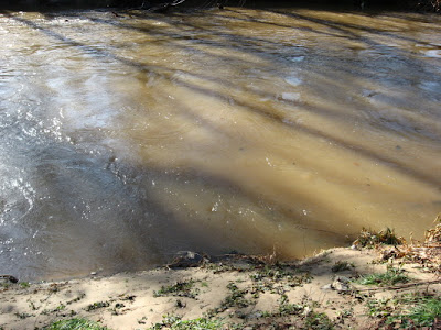
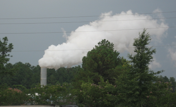
Crabtree under Atlantic Ave at Hodge Road Nov. 11, 2009

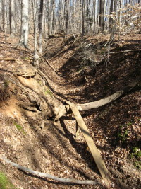
Crabtree is a low -flow system that has carved itself an impressive channel through Raleigh over hundreds of thousands of years.  That course fills to overflowing fairly often, as Crabtree drains a huge swath of Piedmont terrain, from Brier Creek in north Wake County, out to west Cary and down to Walnut Creek south of Raleigh.  Flood control lakes such as Lynn and Shelley have eased flooding in Crabtree Valley, but Middle Crabtree Greenway in central Raleigh, as well as Walnut in East Raleigh, continues to flood after heavy rains.  Above is 12 hours after high water at Atlantic Avenue and Hodge Road.  Below is a high-low pair of pictures for the same spot.

                           Atlantic Ave greenway underpass_1_1          Atlantic Ave Crabtree bridge
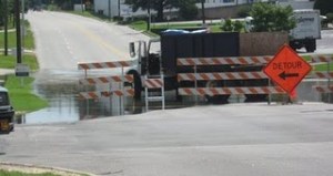
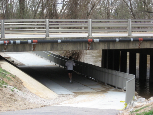
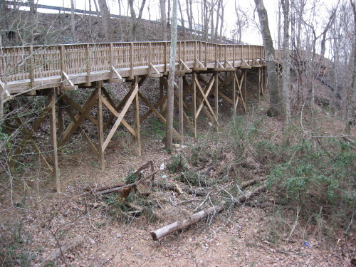
              Crabtree threatens 9-08          Underpass completed 7-08

I have posted about flooding here before at Raleigh Nature, and maintain an ongoing post of comparison pictures at my nature projects blog, Pecans & Mistletoe.  “The Gar Hole” is the most important feature of this favorite stretch of greenway, accessible at Atlantic Avenue on weekends (parking available then at the plumbing supply warehouse) or at the deadend east of the Longbranch on weekdays (unless it’s flooded).  So I take regular shots of the gar hole and the view from the railroad bridge at different seasons and water flows.  Below are some interesting pairs.

                            gar hole with young slider 6-20-07          gar hole 11-07-09_1_1

                              June 07                                       November 09

                              gar hole March 7_1_1          Gar Hole 9-7-07_1_1

                                       March 07                              June 07

Gar Hole after December 07 rains

                                    Hodge View 11-7-09_1_1          Hodge 11-11-09_1_1

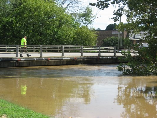
Crabtree from Hodge Rd RR bridge 7 November and 4 days later after “Ida” rains.

                            old bridge 12-31-07_1_1          RR Bridge 11-11-09_1_1

               Hodge Rd. RR bridge Jan 07 and after rains 11–11-09

Creek Levels at Pecans & Mistletoe

*****************

                              box elder beetle at Hodge Rd RR bridge_1_1          barn spider in silhouette_1_1

box elder beetle at Hodge Rd RR bridge; barn spider

gar hole butterfly

gar hole butterfly

August 9, 2009

David Spain, steward of moss

David Spain tends the Urquhart moss garden

David Spain tends the Urquhart moss garden

I recently had an opportunity to document the Southern Living photo shoot of one of Raleigh’s most interesting residential landscapes.  The Southern Living article about the moss garden at the Urquhart residence on Marlowe Drive will come out in about a year – we’ll return to that incredible piece of landscaping, and promote the article, closer to the publication date.  In the meantime, I wanted to introduce Raleigh Nature readers to David Spain, Richard Urquhart’s son-in-law, who has cared for the property since Urquhart’s passing in 2008.  David follows Raleigh Nature and has been very encouraging of my efforts to portray the Lassiter Mill section of Crabtree Creek, which adjoins the Urquhart property.  This post shares some of his photography and offers a sneak peek at the moss garden, which senior writer Steve Bender at Southern Living describes as the finest he’s ever seen.

photograph by David Spain

photograph by David Spain

The landscape of the Urquhart residence is unique in several respects, and David Spain is keenly aware of the ecological and geological wonders of the place.  The property slopes down steeply to the deep stretch of Crabtree Creek just northwest of the dam.  There is a rich stand of mountain laurel on the slope, and above the moss garden and water park of large pools, waterfalls, and huge rocks.  The rocks were unearthed by creek erosion out of the slope, and the Urquhart family has pried them out, hauled them up the hill, and used them to create a magnificent setting for the plants and water.

Urquhart backyard area with landscape boulder

David's newest addition with landscape boulder

David puts into Crabtree in his canoe about as often as I THINK about doing it – which is pretty often- and gets some great pictures, which he has shared and consented to have on the site.  Enjoy some great sights of Raleigh Nature courtesy of David Spain, whose hard work and dedication is maintaining one of the most interesting and valuable residential natural areas in central Raleigh.


photograph by David Spain

photograph by David Spain

duck by D.S._1_1

photograph by David Spain

photograph by David Spain

photograph by David Spain

creekside poplar by D.S._1_1

photograph by David Spain

What a brave poplar tree!  David can walk the creekside and offer endless lore and history about the area.  His contributions and friendship have been a big reward for my work on Raleigh Nature.  Below is his picture of the Urquhart front yard.  I’ll share my own photography of the site when it’s time to celebrate the Southern Living shoot, which was arranged by local super-gardener Helen Yoest, whose acquaintance I made at the shoot.  Her Metro feature on the Urquhart garden is a great introduction to the site, and it will be fun to see how Southern Living shows off the garden and David’s meticulous work with the moss.

photograph by David Spain

photograph by David Spain


*************

A related fun tidbit:  I received a while back the photo below, which depicts what the senders states are gears from Lassiter Mill.  He asked for advice about who might be interested or what might be done with them.  I thought I would post the picture and give my contacts at the Raleigh History Museum and Yates Mill Park a heads-up.  Any ideas?

mill equipment- photo by Jimmy Gordon

mill equipment- photo by Jimmy Gordon


March 2, 2009

March Mad Beauty

snowy-oakwood-trees_1_1

   A late snow and a schoolday off to blog about it!  It didn’t take long to find a snow paradise.  The Oakwood Inn’s block sported the lacy treetops above.  But I was headed to the greenway.  I decided to check out an old favorite – the east end of Buckeye Trail.

   This wonderful view is the edge of the meadow at Buckeye Trail’s east end off Milburnie.  Down this oldest section of Raleigh’s greenways is a vista that provoked one of the first thoughts that originated this project – and it was a book project long before I ever knew what a blog was.  The scene used to look like a cathedral of treetops – but the loss of a huge red oak several years ago changed the look.  What’s left is seen below.

   The missing tree was on the right, and when it was there, I was ready to write a book partly to tell people to come here and take a deep breath.  It is still a very nice section of greenway.  I got to see the baby beeches of a couple of posts ago in a new light, literally.  The gentle snow provided a chance to see water moving across the greenway: in a freshet, and being blocked by the asphalt.  The creek was medium high, which I documented with a current shot of my favorite log-sitting spot.  Once I had done that, I knew I should head over to Hodge Road and take shots of my water level standard spots, which I’m documenting over on the nature projects blog.

snowy-landfill-meadow_1_1

The March snow was mighty pretty!

September 8, 2008

Crabtree Creek Floods The Middle Creek Greenway

Filed under: Central Raleigh, Crabtree Creek, Greenways & Parks — Tags: , , — raleighnaturalist @ 12:44 am

     After Tropical Storm Hannah came through on Saturday, September 6, 2008, Crabtree Creek flooded the intersection of Hodges Road and Atlantic Avenue and also several sections of the Middle Creek portion of the Raleigh greenway.


above is the greenway underpass below Atlantic Ave.  Below is the same view 9/6/08.

This is the first time the greenway has flooded since October 2007 by my count.

creek levels post on Pecans & Mistletoe

photo album of Crabtree flooding after Hannah


August 13, 2008

Ward Transformers – Crime Never Stops Hurting

Filed under: Crabtree Creek, Gems & Surprises, green initiatives — Tags: , , , , — raleighnaturalist @ 2:09 pm

     A recent N&O story reminds us of the reason for these signs, posted all along the Crabtree system:  our city’s water system is tainted by PCBs (polychlorinated biphenyls), a toxic chemical released over many years by the actions of Ward Transformers, a company whose name is etched in the annals of NC corporate crimes, a company STILL OPERATING next to the Superfund site next to RDU airport, where its buried load of poisons is slowly being incinerated through the process pictured below.

Ward Transformer site

Ward Transformer site

Ward Transformers has a long history of environmental crimes in North Carolina.  Long before the discovery that it’s open burning of materials on site to recover copper had applied PCBs to the soil surrounding its plant, Ward Transformers and its contractor, Robert Burns, were found guilty of dumping PCB-laced waste along miles of rural NC highways, using a specially designed dumping apparatus constructed at Ward Transformers.  Burns and “Buck” Ward spent some time in jail, but at some point the EPA or someone in government realized that a bankrupt company couldn’t help pay clean-up costs, so Ward Transformers was left in business.  The state of North Carolina had to scrape up the roadside deposits and figure out what to do with them – leading to a separate whole nightmare with the landfill in Warren County.

That was way back in 1978.  The next year, EPA tests show contamination in the soil around the plant itself.  In 1993, preliminary Superfund action was undertaken and in 2002 it was declared a Superfund site.  Yet much local outcry and promotion took place before clean-up work was begun.  Now, according to the newspaper report, the work is being done, and in a safe manner. Yet concerns remain about the process, as well described in this post at Raleigh Eco News.  I went out to look at the site.  The EPA’s clean-up incinerator really puts out a huge stream of white smoke – apparently almost all water vapor.

     Thank you for listening to my rant.  It just drives me crazy that ole Buck Ward spent a few months in jail and now his company rolls merrily along, though I presume they send a hefty check to the EPA each month.  We will never fully recover from these actions in my lifetime.  And we will never figure out the “best” way to punish such transgressors – justice and reparation are both so tough to achieve.

*************

As a balance to the above, please enjoy a juvenile box turtle living in our garden and a fawn Cara and I saw on a trip last weekend.

June 29, 2008

Bikes Trails RIP – highlights greenway loss

Filed under: Central Raleigh, Crabtree Creek, Greenways & Parks, North Raleigh, waterways — Tags: , , — raleighnaturalist @ 9:08 pm

This post was originally posted on March 6, 2008.            


The destruction of the bike trails described by Joe Miller is not just significant for these bandit bikers: all users of the greenway between Atlantic Avenue and Capital Boulevard should mourn the loss of this old farm site, whose naked hillsides (and future clapboard townhouses) are easily visible from the greenway. Riparian buffer is the term for the ecological value of these wooded areas contiguous with the greenway:  the trees absorb rain as well as pollution, shade and cool the waters of Crabtree.  Of course, the wildlife appreciates wooded areas next to the creek as well.

***********

This is a rich and variegated section of greenway with lots of interesting features in addition to the old farm site.  If you park off Capital Blvd. at its intersection with Yonkers Road, you will have to jump the barrier that tells you this problematic section of greenway deck needs shoring up.  The risk seems minimal, and I’ve done it many times.  From this deck you can see the naked hillsides, and then follow that section of greenway as it heads toward Atlantic Avenue.

************

view-from-atlantic-ave_1_1

A view from the greenway of what Joe Miller describes as the mohawk look. 

 Above is the view from the new development at the south end of Six Forks. 

This lovely path begins at the base of the hillside deck and heads straight toward the southbound ramp off the beltline for Capital Boulevard.  If this stretch survives the development, that will be significant for this greenway section.


From the west end of the problematic deck, you are looking toward Atlantic Avenue.  This stretch parallels Hodges Road and looks across Crabtree at the old site for the State Farmer’s Market.  Below you see a bog visible to the right of this stretch.


Now just across this bog we have an interesting situation. Several fellows have set up a tent just behind the Atlantic Ave marsh area and are creating quite a trash pile nearby.  The trash is visible from the greenway, but won’t be long as things green in. I have observed these camps and also the urban “nesting sites” downtown and under bridges for many years and almost never gotten bad vibes from them.  But that is some nasty trash!  We’ll end the post with the sunset cattails which are literally within sight of the tent and trash.  Be careful out there!


 The marsh below has been short of water since well before the drought.  It appears to me that the greenway construction changed the drainage somehow.  What you’re looking at used to stay under two feet of water most of the year.  I guess the incoming water and sedimentation will re-adjust things over time.  Anybody know?


« Newer PostsOlder Posts »

Blog at WordPress.com.