The Raleigh Naturalist

August 4, 2011

Torn Still, by the Tornado

Filed under: About & reflection, Central Raleigh, East Raleigh, Nature Lore, South Raleigh — Tags: , — raleighnaturalist @ 6:09 pm

Tornado Damage on Marlborough Road 3 Months Later

The April tornado is 3 months past and yet unredressed signs of it  are still scattered about Raleigh.  I haven’t posted in all that time, finishing the school year and having a summer  swallowed by book arts, as I made paper, printed, and started a Paper Plant blog.  Before covering the rich naturing Cara and I have done in spite of my new blogging obsession, I wanted to address the previous post and show that East and Central Raleigh are still reeling as fall approaches.

The tornado totally changed the visual landscape of my regular bike rides.  Looking from the back lower corner of the federal courthouse campus at East and Hargett, an entire city block was just razed.  From that spot on the shoulder of Raleigh’s cap, it now feesl as if you are looking southeast straight down into the coastal plain.

Martin and East Street downtown after April tornado

Mount Hope Cemetery April 16, 2011

Mount Hope Cemetery didn’t get covered in the first post, but a visit last week revealed many of the same sights I had photographed but not published in April.  It and City Cemetery are still closed.

click on cemetery pics to enlarge


old cedar torn by April tornado at Mt Hope

Marlborough Road in East Raleigh still looks like the disaster zone it is.  My old childhood creek runs beside it and has become a tangled mass of dead trees scattered with stagnant pools.  The city is making plans to clean it up, but it will be a while.


torn pine on Marlborough Road

Marlborough Street hit close to home, but the damage is widespread.  The Raleigh Public Record provides this info from the city’s waterway inventory:

The report stated that a total of 1,436 trees were found damaged as part of the inventory. The areas with the most debris were areas near Beehnon Way and Tryon Road, Marborough Road and King Charles Road, Skycrest Road and Capital Boulevard, and Valley Stream Drive and Louisburg Road.

RPR did a good general look at Raleigh damage in this post.  The damage to nature is most relevant to this blog, but we felt very lucky after trees were decapitated 30 yards from our house, and we had many friends who sustained damage anywhere from annoying to catastrophic.   Many of them have praised Chris Crew of FEMA for his TLC to friends in this situation.

Nature knocks!!!  Sometimes hard.  Take care of yourself, now.

Washington School and downtown from Mount Hope Cemetery

April 18, 2011

Nature Knocks Downtown Raleigh

Filed under: Central Raleigh, Gems & Surprises, Nature Lore, Raleigh History, South Raleigh — Tags: , , — raleighnaturalist @ 7:00 pm

piece of Memorial Auditorium roof with damage visible right background

A tornado or series of tornadoes accompanied a quick moving spring storm on Saturday afternoon, April 16th and left a trail of death and destruction across Raleigh, mostly south and east of downtown. Farther north, pine trees crashed into a mobile home at Stonybrook off Brentwood Road and instantly killed three young boys. There were 21 fatalities across the state, and Shaw University closed down for the semester with widespread damage. Raleigh Public Record has a big portfolio of images, as does NandO, and WRAL has a gallery as well – but what I want to see is a track record of these powerful winds, which sheared off trees 50 yards from my house and caused widespread lasting damage. I hope to update this post with more meteorology info later. Below are my images – mainly of the venerable oaks toppled and pruned in City Cemetery and elsewhere downtown.

closer look at Memorial Auditorium damage

City Cemetery at New Bern and East Street

cropped cedar in City Cemetery


The entrance to City Cemetery on New Bern Avenue.  A comment on Goodnight Raleigh’s photos mentiones the extensive damage from here to Tarboro Road.  Clearly the damage was overwhelming and Sunday morning it was amazing to see unattended damage, unpoliced intersections with no stoplights, and downed lines with no crews in sight.  I fully realize they had their hands full elsewhere.

New Bern Avenue closed by tornado damage

New Bern avenue family surveys damage

Martin and East Street downtown

South East Street after tornado

damage at corner of Moore Square

touring the tornado damage Sunday April 17

Blount and South Street after 4-16-11 tornado

damage at Shaw and Memorial Auditorium

cropped trees in Shaw's practice field

uplifted turf in southeast downtown Raleigh

I have another whole set of pictures from the Maywood Street area between S. Saunders and Lake Wheeler Road.  I’ll post them soon with updates on the scientific measure of this storm, which may have generated as many as 8 tornadoes, some at least F3 in scale.  Hope you all are well!

November 1, 2008

Slow Fall at Dix


Raleigh from Dix Hill

Raleigh from Dix Hill

 Dorothea Lynde Dix (1802-87) was perhaps the most famous and admired woman in America for much of the nineteenth century. Beginning in the early 1840s, she launched a personal crusade to persuade the various states to provide humane care and effective treatment for the mentally ill by funding specialized hospitals for that purpose.

     306 acres are left from a huge estate that was given over to the benefit of some of our neediest folks.  As the fall colors take their time this year decorating Raleigh’s skyline, so Dix Hill’s fate lingers in the slow balance of state decision.  Walk the big meadow with me and glimpse some early fall colors.

   We turn from downtown and look down at the gazebo and greenway path which runs along Rocky Branch as it follows its new, straightened course beside Western Boulevard.  On that walk we’ll see lots of elusive birds, wild grape, and some small spots of fall color.

     The campus has many historic buildings, massive white and red oaks that ring the meadow, a small grove of highly productive pecan trees, and one open slope that is the joys of all sledders.  Centennial Campus and the Farmer’s Market have already taken the lion’s share of what once was .  Now the state needs to let Raleigh’s long term interests take precedence over a short-time cash windfall.  The folks at Dix 306 are working hard to make that happen.  We should support them any way we can.

     Below is a trace of fall glory in midst of a glorious lingering summer.  Hopefully this image does not represent the sunset of hopes for the landscapes of Dix Hill.

****************

   I went on this walk partly because of Ashley Sue over at Green Grounded, who complimented me in anticipation of seeing fall colors on Raleigh Nature.  Below are clickable thumbnails of some other sightings at Jones lake off Sunnybrook, and then ending with my all time best fall picture, from the west Beltline.  Happy leafing!


July 15, 2008

From Hwy 50 Horses to Gresham Lake’s Paul Bunyan: Person Street


Straight Streets: nature drives with a Raleigh road theme

     With some finessing, but no turns, you can drive a thoroughfare through Raleigh from Highway 50 in Garner, straight north through the heart of downtown, out to Gresham’s Lake at Capital and 540.  The middle of this 15 mile stretch is called Person Street, and when I was a kid my Dad told me this:

   Son, this piece of asphalt you’re looking at goes from Florida to Maine.  It’s part of one of the country’s great highways – and one of the first.  Indians may have used this path before Columbus came.  This is business US 1.

 Person Street was a big part of my childhood, and now I live on it.  It is the address of the church in which I grew up, Tabernacle Baptist, the Krispy Kreme, a beloved landmark long before they went public, and the Mordecai House, a genuine bridge to another time.  It has been made one way now, so we can count Blount Street as its southbound lane.  It has been extended to the north as Atlantic Avenue, which we will follow out.  But it also has been cut off from its old extension, Wake Forest Road, as seen above, and yet this all intertwines in interesting ways in north Raleigh.
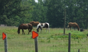
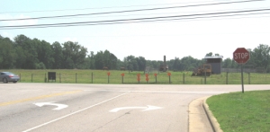
        

      Let’s start at the farthest extensions southward: Person becomes Hammond, which becomes Timber Drive at 70.  Timber crosses 70 and curves under  the south edge of Garner,ending in a horse pasture just past 50.  Reverse your direction, and you are looking at 3 miles of new suburban projects and shopping centers.  The funny thing is, it all exists in what is recognizably old farm fields with mature trees in the lowlands and various stages of pine plantation everywhere else.  There are loblollies everywhere!

                         
      young pine stand –        juvenile loblollies    –    thinned adults    –    mature stand with crowd
please remember to click and enlarge 

   The drive traverses four watersheds: Swift  Creek in Garner, Walnut Creek at 40 and Hammond, Crabtree over the crest at New Bern Avenue, and the Neuse after the Char-Grill on Atlantic.  Below is Wildcat Creek, a north bearing tributary of Walnut, as it crosses Hammond.  This stretch just south of downtown is still heavily wooded, with side lots and a very large swale bordered by the Lake Wheeler Road offshoots.  There are some trash dumps, plenty of kudzu and microstegia, but really some nice spots.


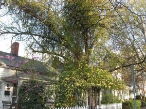
     Proceeding north through downtown, one encounters many fascinating examples of human nature along Person Street.  After sniffing the pet food factory at the transition from Hammond to Person, you cross Bragg Street, one of the most policed streets in Raleigh, but also some nicely renovated homes and parks, as well as the No Hand King at Person and MLK Blvd. – one of the coolest flag-bearers you will ever see.  Moore Square, the Imax at my old church, the Governor’s Mansion – all are just preludes to the real star of Person Street – THE KRISPY KREME!  The Raleigh Naturalist lives across the street.
                                                  

******************


     As you leave downtown, you pass the Mordecai House and its spring, garden, and historic building collection.  It will have its own post soon.  At the bottom of the hill, Person hits an old cowpath of an intersection whose traffic patterns have changed many times in my lifetime.  Brookside, Old Louisburg, Capital, Wake Forest (which is now what Person is named) and Atlantic all crisscross.  Atlantic Ave. is new, but The Circus (originally a Dairy Queen, I believe), and Watkins Grill are ancient and revered blue collar eateries.  Each of them has to watch Pigeon House Creek, which crosses here, very carefully after  heavy rains.  You could take the straightest lane and head up US 1 to Maine.  But let’s do as the city’s design suggests, and take the relatively new Atlantic Avenue north.  On your left, you will see the cut off RR underpass where Person used to merge with Wake Forest Road.  Atlantic rises over the railroad line in a tremendous arc which is achieved by a bridge whose shortsighted design is a travesty and an affront to any biker or pedestrian in this part of the city.  There is a guardrail that forces everyone into the same lanes up in midair, and looks and feels just plain dangerous.
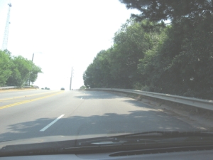
 

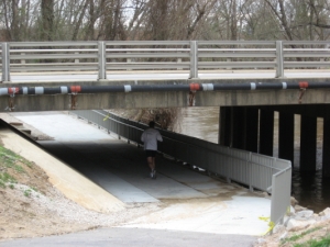
     The view above is approaching south from Whitaker Mill, but the other side is just as bad.  At the bottom of this imposing hill, back to the north, you hit Hodges Road which is one of the more versatile spots in all of Raleigh to begin a greenway trek.  Buckeye beckons to the east, this Middle creek section carries you to Lassiter Mill westward, and several interesting bike trails lead other directions. Below is the north side of Atlantic with the underpass, and the marsh on the south side that leaks its water and is fast becoming a scrub bog.
      

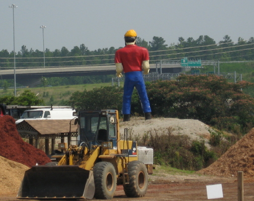
     The drive through northeast Raleigh from here is pretty boring.  There is a huge meadow full of bugs and birds behind and across from the police substation, but both are surely doomed.   Here is the shift from Marsh and Crabtree water to dry hills edging the Neuse drainage.  After Spring Forest, bearing right puts you on Old Wake Forest Road, part of the original route from downtown Raleigh, which leads you directly to – Triangle Town Center!! – no fitting fate for a nature drive.  So finesse to the left and begin your u-turn on Gresham’s Lake Road, which will take you to Litchford, where you can finish your u-turn by turning left and continue in a straight path south all the way back to Garner.   Gresham’s Lake used to be a popular swimming and picnic spot.  It’s eastern end is now part of a quarry operation.  At it’s edge, you can see the huge Paul Bunyan that used to look out from a field on 401.  The Bradshers gave up that property for the Wake Tech campus and moved ole Paul to their landscape business at Gresham’s.
More Person Street another time.  It’s a rich straight street!

 Photo tour of Person Street

December 30, 2007

Dix Hill and the making of a world class city

Filed under: green initiatives, Greenways & Parks, Pecans & Mistletoe, South Raleigh — Tags: , , , — raleighnaturalist @ 4:11 pm


The oak grove above will probably survive whatever is to come, but the old “Dix Hill” where I went sledding has already been truncated by Centennial and the Farmer’s Market, and is now being fought over like a scrap thrown between dogs.  I realize there is going to be more development of some kind,and that the state will hold on to some space – as a matter of fact, the Dix hospital employees I talk to say they don’t expect to leave.  It makes sense for some portion – the juvenile part, say – of the mental health facilities to remain. I am not an activist but I’m glad the Dix group is working so hard to save what they can.  The truth is, the magnificent lower meadow, surrounded by majestic oaks, with Rocky Branch edging it, is the prettiest place inside the beltline.  A park here would go a long way toward establishing Raleigh as the true and enlightened city of oaks.

rocky-branch-at-dix_1_1.jpg

Rocky Branch above, Dix Hill pecan trees below


Create a free website or blog at WordPress.com.