The Raleigh Naturalist

August 9, 2010

Marsh Creek Park – no relation to the creek!

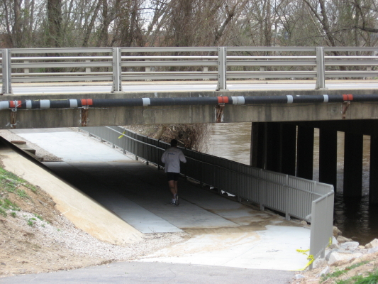
My Google search hits revealed someone looking for Marsh Creek Park, and having featured the creek, I thought we should visit the recently expanded park on New Hope  Road.  The name of the park derives from Marsh Creek Road, which begins just across New Hope and goes straight down to Marsh Creek.  But New Hope Road is a ridge between the Crabtree and Neuse watersheds, and the waterways in the park itself- mostly out of sight without hiking – head north through a large woodlot visible from Southall Road toward the Neuse, just a mile distant.

All pictures click to enlarge

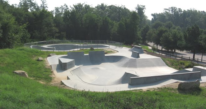
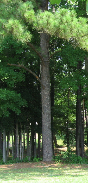
The hot new feature in the park is the skate park, which was featured in a several media articles and is quite popular.  The large recreational center is fairly nondescript, but was constructed with green principles, as described in detail (along with other park amenities) at Get To Know a Park.  Beside the center is a large Piedmont prairie, and the extensive parking areas are adjoined by interesting ecotone areas, though the stilt grass is spreading fast.  The terrain is typical of Piedmont farmland after 50-60 years – upland pines and chestnut oaks with a slope down to loblollies, shrubs, and water.


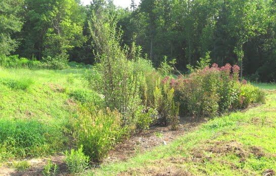
My favorite find at Marsh Creek Park was the rain garden just below the skate park, with a wonderful stand of Joe-Pye-weed, as seen below.  I’ve only seen this handsome plant in the mountains, but it is listed in the Piedmont.  Somebody did a great job with this rain garden.

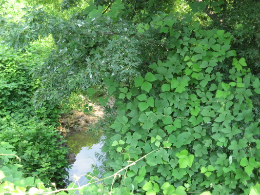
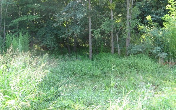
 To make the park’s name issue a little stranger, there is a really nice marshy area below the lower field, which leads to a very pretty old farm pond. It appears to have a fishing shack on the edge.  The expansion doubled the usable space of the park, but most of the acreage is still heavily wooded and ripe for exploring.  Overall, a versatile park with something for everyone.

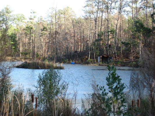
photo album of Marsh Creek Park

Google map of Marsh Creek Park

*************************

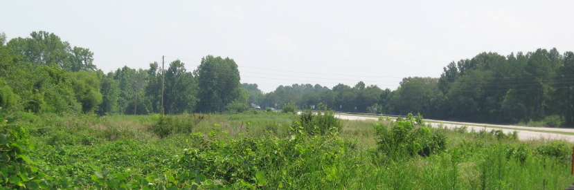
This section of Raleigh – the ridge of New Hope with the valley of the Neuse to the northeast and Marsh Creek’s drainage to the southwest – is of geologic interest because it is one of the transitions between the Piedmont and the Coastal Plain.  If you take Buffalo Road off New Hope, for example, you immediately start seeing sandy soils.  Just down the road from Marsh Creek Park, Skycrest Drive heads down to good old Raleigh Swamp.  Before it gets there, at the intersection with Trawick, you can find this meadow of wildflowers.  It is being sorely threatened by kudzu vines.  We will keep a closer eye on invasive species in our future nature travels.

The kudzu is right behind the dandelions.

An impressive array of wildflowers fronts the dandelions by a slope.

These blackberry flowers are beside Skycrest. This was in May, but this summer I picked almost ten quarts of these things!  They are everywhere.

Kudzu making its way toward the wildflowers.

Kudzu go’ne eat us all!!

July 15, 2008

From Hwy 50 Horses to Gresham Lake’s Paul Bunyan: Person Street


Straight Streets: nature drives with a Raleigh road theme

     With some finessing, but no turns, you can drive a thoroughfare through Raleigh from Highway 50 in Garner, straight north through the heart of downtown, out to Gresham’s Lake at Capital and 540.  The middle of this 15 mile stretch is called Person Street, and when I was a kid my Dad told me this:

   Son, this piece of asphalt you’re looking at goes from Florida to Maine.  It’s part of one of the country’s great highways – and one of the first.  Indians may have used this path before Columbus came.  This is business US 1.

 Person Street was a big part of my childhood, and now I live on it.  It is the address of the church in which I grew up, Tabernacle Baptist, the Krispy Kreme, a beloved landmark long before they went public, and the Mordecai House, a genuine bridge to another time.  It has been made one way now, so we can count Blount Street as its southbound lane.  It has been extended to the north as Atlantic Avenue, which we will follow out.  But it also has been cut off from its old extension, Wake Forest Road, as seen above, and yet this all intertwines in interesting ways in north Raleigh.


      Let’s start at the farthest extensions southward: Person becomes Hammond, which becomes Timber Drive at 70.  Timber crosses 70 and curves under  the south edge of Garner,ending in a horse pasture just past 50.  Reverse your direction, and you are looking at 3 miles of new suburban projects and shopping centers.  The funny thing is, it all exists in what is recognizably old farm fields with mature trees in the lowlands and various stages of pine plantation everywhere else.  There are loblollies everywhere!

                         
      young pine stand –        juvenile loblollies    –    thinned adults    –    mature stand with crowd
please remember to click and enlarge 

   The drive traverses four watersheds: Swift  Creek in Garner, Walnut Creek at 40 and Hammond, Crabtree over the crest at New Bern Avenue, and the Neuse after the Char-Grill on Atlantic.  Below is Wildcat Creek, a north bearing tributary of Walnut, as it crosses Hammond.  This stretch just south of downtown is still heavily wooded, with side lots and a very large swale bordered by the Lake Wheeler Road offshoots.  There are some trash dumps, plenty of kudzu and microstegia, but really some nice spots.


     Proceeding north through downtown, one encounters many fascinating examples of human nature along Person Street.  After sniffing the pet food factory at the transition from Hammond to Person, you cross Bragg Street, one of the most policed streets in Raleigh, but also some nicely renovated homes and parks, as well as the No Hand King at Person and MLK Blvd. – one of the coolest flag-bearers you will ever see.  Moore Square, the Imax at my old church, the Governor’s Mansion – all are just preludes to the real star of Person Street – THE KRISPY KREME!  The Raleigh Naturalist lives across the street.


******************


     As you leave downtown, you pass the Mordecai House and its spring, garden, and historic building collection.  It will have its own post soon.  At the bottom of the hill, Person hits an old cowpath of an intersection whose traffic patterns have changed many times in my lifetime.  Brookside, Old Louisburg, Capital, Wake Forest (which is now what Person is named) and Atlantic all crisscross.  Atlantic Ave. is new, but The Circus (originally a Dairy Queen, I believe), and Watkins Grill are ancient and revered blue collar eateries.  Each of them has to watch Pigeon House Creek, which crosses here, very carefully after  heavy rains.  You could take the straightest lane and head up US 1 to Maine.  But let’s do as the city’s design suggests, and take the relatively new Atlantic Avenue north.  On your left, you will see the cut off RR underpass where Person used to merge with Wake Forest Road.  Atlantic rises over the railroad line in a tremendous arc which is achieved by a bridge whose shortsighted design is a travesty and an affront to any biker or pedestrian in this part of the city.  There is a guardrail that forces everyone into the same lanes up in midair, and looks and feels just plain dangerous.


     The view above is approaching south from Whitaker Mill, but the other side is just as bad.  At the bottom of this imposing hill, back to the north, you hit Hodges Road which is one of the more versatile spots in all of Raleigh to begin a greenway trek.  Buckeye beckons to the east, this Middle creek section carries you to Lassiter Mill westward, and several interesting bike trails lead other directions. Below is the north side of Atlantic with the underpass, and the marsh on the south side that leaks its water and is fast becoming a scrub bog.


     The drive through northeast Raleigh from here is pretty boring.  There is a huge meadow full of bugs and birds behind and across from the police substation, but both are surely doomed.   Here is the shift from Marsh and Crabtree water to dry hills edging the Neuse drainage.  After Spring Forest, bearing right puts you on Old Wake Forest Road, part of the original route from downtown Raleigh, which leads you directly to – Triangle Town Center!! – no fitting fate for a nature drive.  So finesse to the left and begin your u-turn on Gresham’s Lake Road, which will take you to Litchford, where you can finish your u-turn by turning left and continue in a straight path south all the way back to Garner.   Gresham’s Lake used to be a popular swimming and picnic spot.  It’s eastern end is now part of a quarry operation.  At it’s edge, you can see the huge Paul Bunyan that used to look out from a field on 401.  The Bradshers gave up that property for the Wake Tech campus and moved ole Paul to their landscape business at Gresham’s.

More Person Street another time.  It’s a rich straight street!

 Photo tour of Person Street

Blog at WordPress.com.