The Raleigh Naturalist

August 10, 2021

Edisto Island seems 1,000 Miles From Nag’s Head

Filed under: About & reflection, climate change, Exotica, Nature Lore — Tags: , , — raleighnaturalist @ 6:25 pm

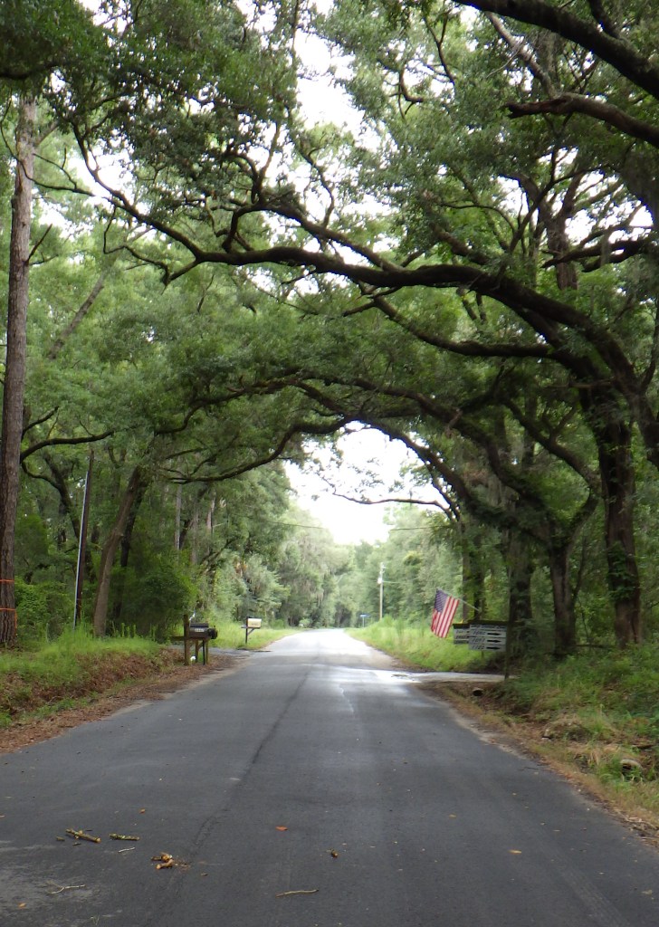
Edisto Island back road – 2 miles from the ocean

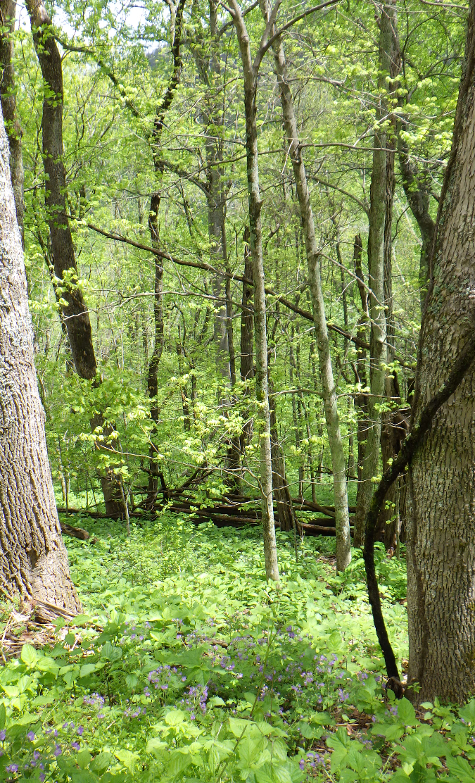
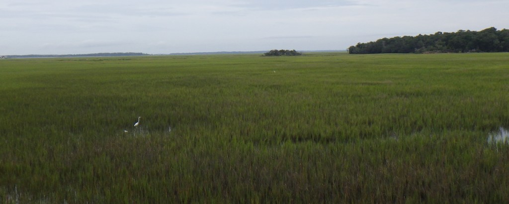
When we traveled with our daughter and her partner to South Carolina Carolina for a week at the beach, I knew we would have nature adventures. After all, Lily was the 2019 Environmental Educator of the Year, and Collin is a bonsai artist and expert botanist who looks for new plant experiences at every opportunity. Sure enough, the back porch of our beach house in Edisto Beach looked out on a vast prairie-sized marsh of cordgrass (spartina) slowly oozing fresh water toward the ocean, crisscrossed by freshwater creeks and a river, (though pushed backward twice daily by the tides),and edged on the other side by a heavily forested state park. Our house was surrounded by beautifully formed live oaks and other hardwoods, which were inhabited by cardinals, blue birds and several kinds of wrens. Thing is, we were two blocks from the beach. All week, I pondered: “How and why is this so different from the North Carolina beaches I grew up visiting?”

Edisto is an example of a Carolina Sea Island, of which there are over 100 between the Santee in SC and St John’s River in Florida. They are a special kind of barrier island that usually faces somewhat southward. These islands are the historic and present home of the Gullah people and culture, of which we saw evidence at the historic museum and in the basket weavers making and selling sweetgrass baskets at the craft market. The accents of the basketmakers and indeed many of the African American folks working all over, sounded Creole. Their history as the dominant population in this land of rice plantations is a wonderful story itself. But my first love in this situation is topography, and I found myself in one of the wettest topographies to be found.

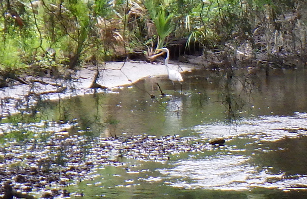
Young greater egret hunts freshwater creek 2 blocks from ocean

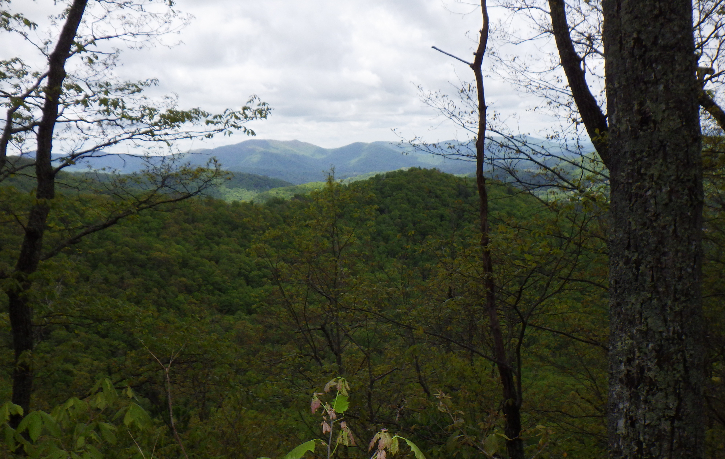
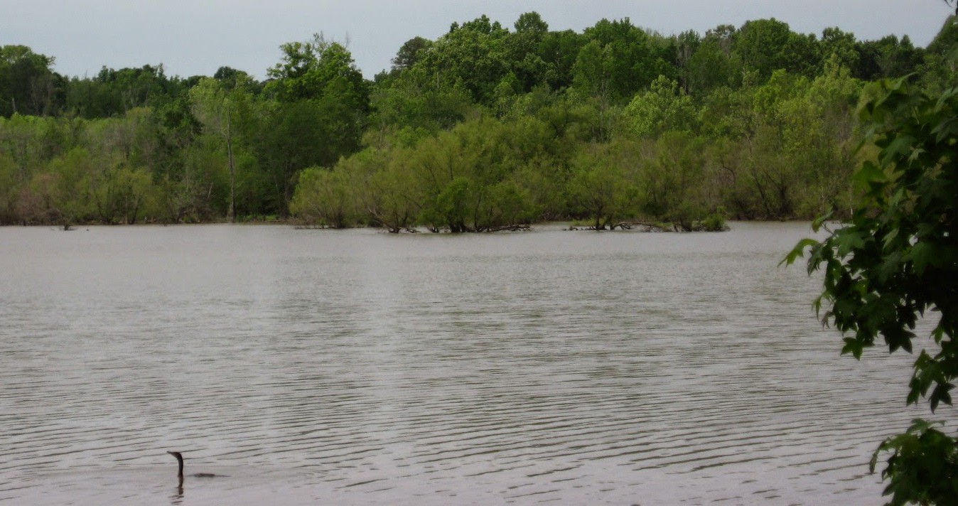
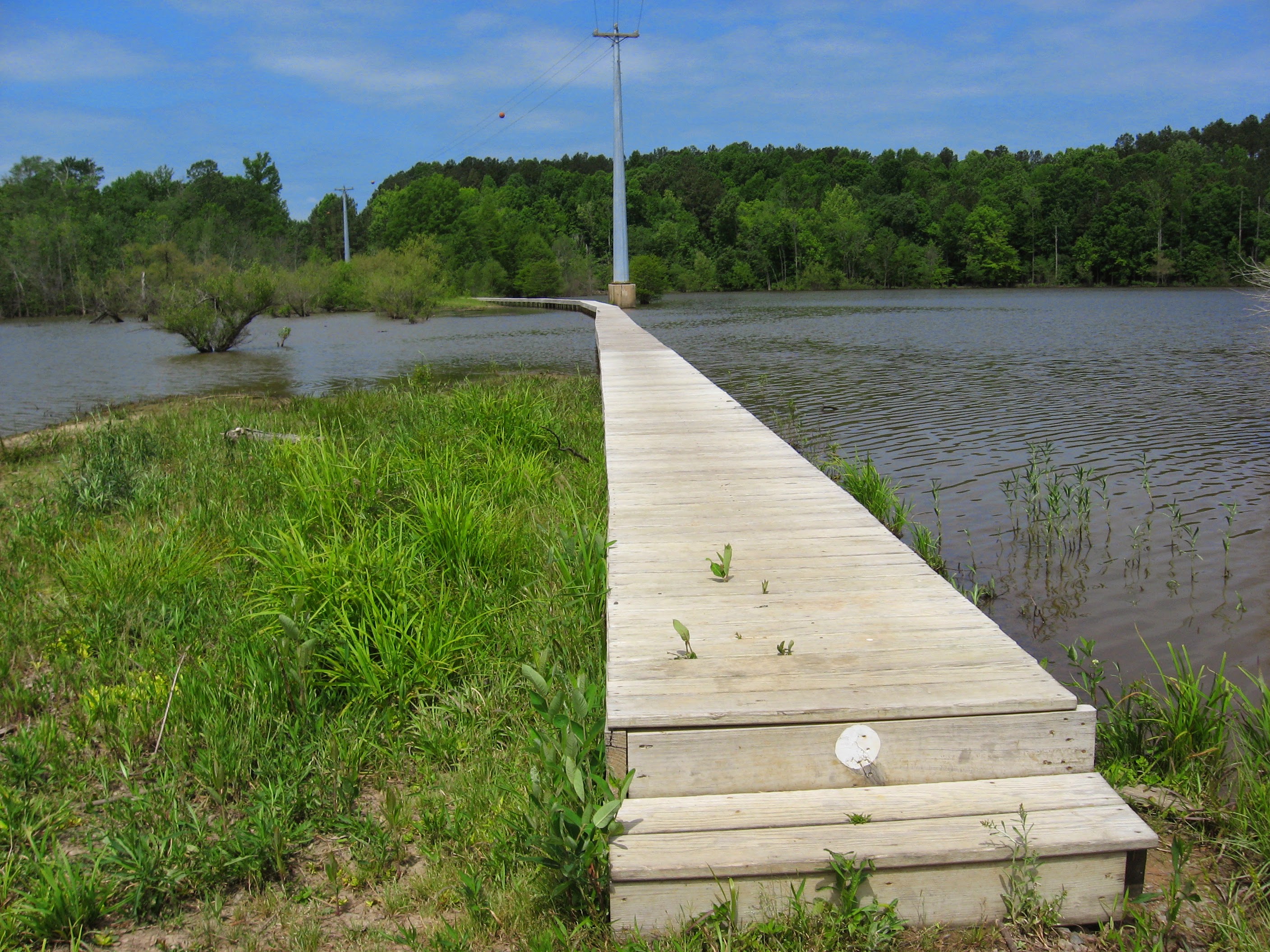
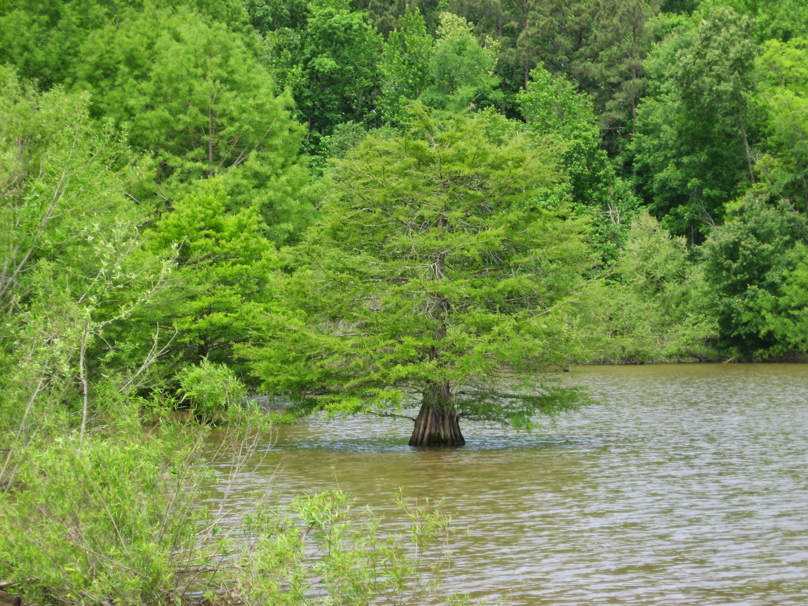
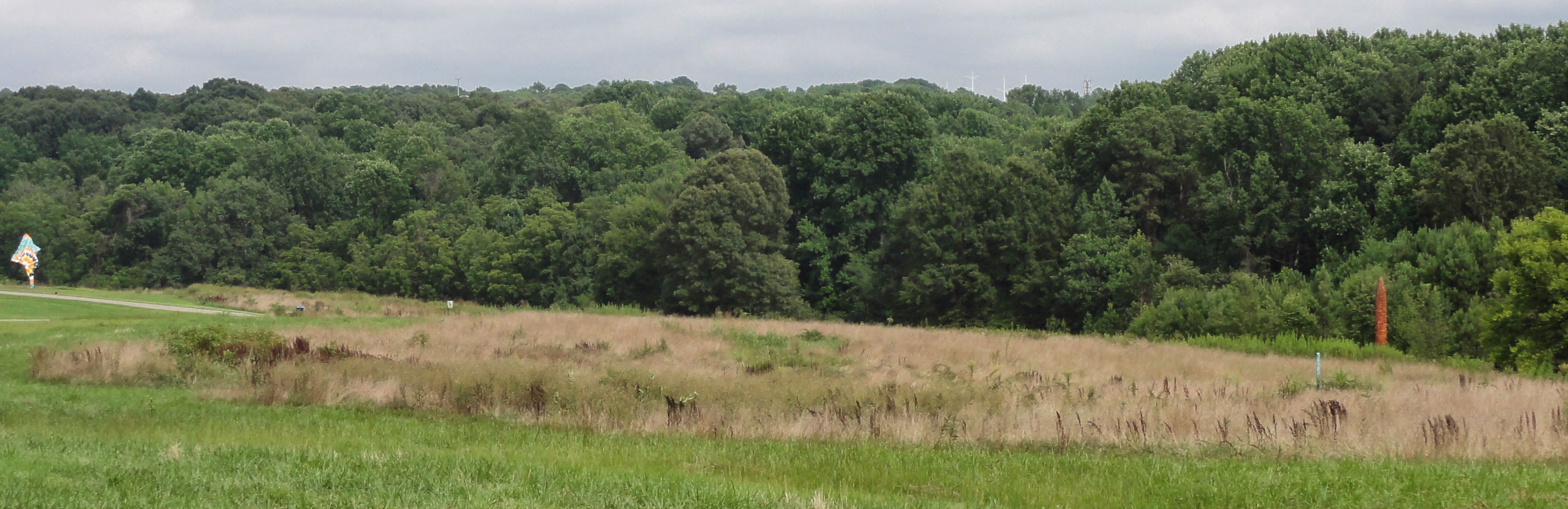
Edisto barely qualifies as an island because at its northern tip, the Edisto River sends part of its flow on a different path toward the ocean, forming the North Edisto. The larger area of which it is part is called the ACE basin, for the Ashepoo, Combahee and Edisto rivers that flow through it. The 350,000 acres are about half wetland, and comprise one of the largest wetland natural areas on the East coast. Our beach house stood at 4 meters above sea level. Ten miles back up Highway 174 toward 17, the marshes beside the road are at 5 meters and the high point at the middle of the area has a wooded rise that is just 18 meters above the sea. That’s flat=wet! This is one of the main reasons excessive development has not reached the area , because very few through roads connect the necks of the woods, which are everywhere fragmented by marshes. The ride pushes back such that even inland where the waterways are not brackish the fresh water rises and falls with the tidal rhythm that allowed rice to be grown and harvested.

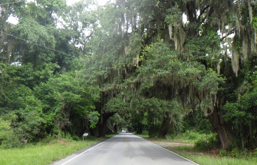
HIghway 174 leading from 17 to Edisto Beach

   The other reasons for the lack of massive development are a fascinating human history. The rice planters made large fortunes using slave labor to clear and dike the wetlands for planting. As the Industrial Revolution produced a new class of wealth in the north, some of those men developed a passion for waterfowl hunting and purchased many of the plantations after the Civil War, maintaining the dikes and managing the landscape for hunting. Alongside these developments, the black residents, who predominated the population and acquired significant land holdings in the aftermath of the Civil War, developed a strong and somewhat isolating local culture that helped maintain the Gullah language, crafts and outlook that permeate the area to this day.

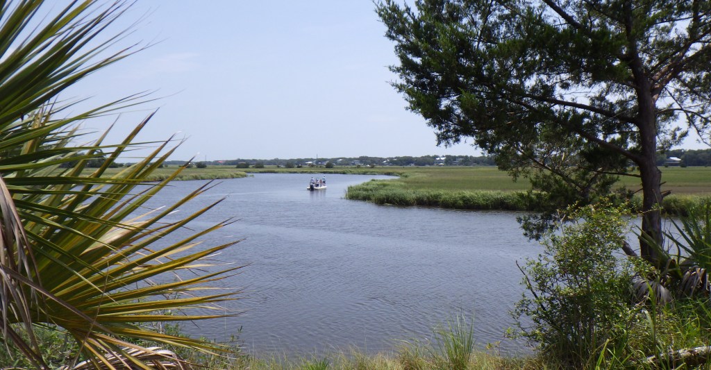
Boat channel beside Spanish Mount, a large shell midden

In the 1980’s duck-hunting organizations joined with the federal government and conservation groups to place permanent protections on well over 100,000 acres in the ACE basin, which has become a premiere legacy of South Carolina’s Low Country and its unique ecosystems. From 250 bird species to loggerhead turtles to shortnose sturgeon, the area’s success at what amounts to ecotourism represents a boon to wildlife and local residents and treasured experiences for the many visitors.

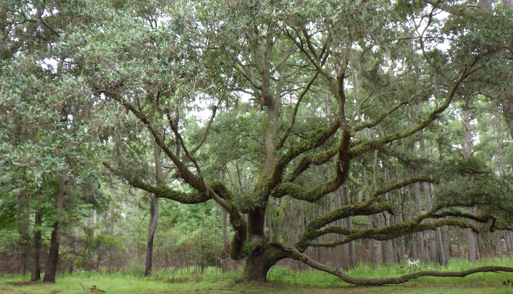
A live oak in the Botany Bay Nature Preserve about 3 miles from the beach

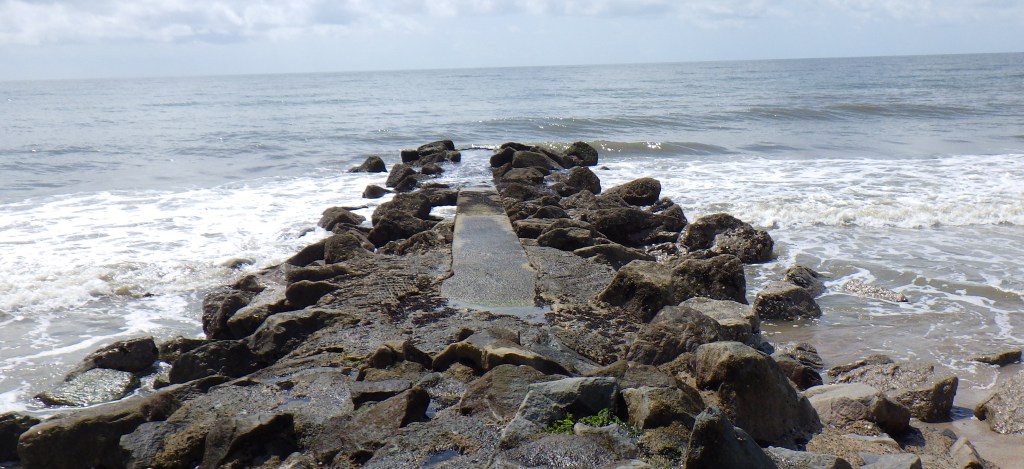
Edisto Beach jetty built to reduce beach erosion. One is at each public access point

Edisto Beach is full of beach houses, but the look and feel is retro – that is the beach towns of my childhood. There is one small Food Lion, with a Subway next door. Otherwise, all the shops and businesses are local. There are no high-rise motels. The only four story building is a residential hotel that is part of the large marina. A Wyndam villa resort shares the interior of the town with civic facilities and a small golf course. Bike sharrows edge all the roads, and the ubiquitous bike and golf cart rentals minimize car traffic. The edge road on which we stayed was so quiet a five year old would be safe bicycling on it (we can’t wait for that – our grandson is three). The beach houses get grander and less rental looking as you travel from the main island out to the point. Many of the sound side houses have boat docks.

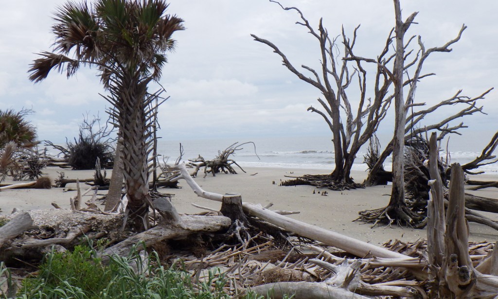
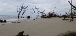
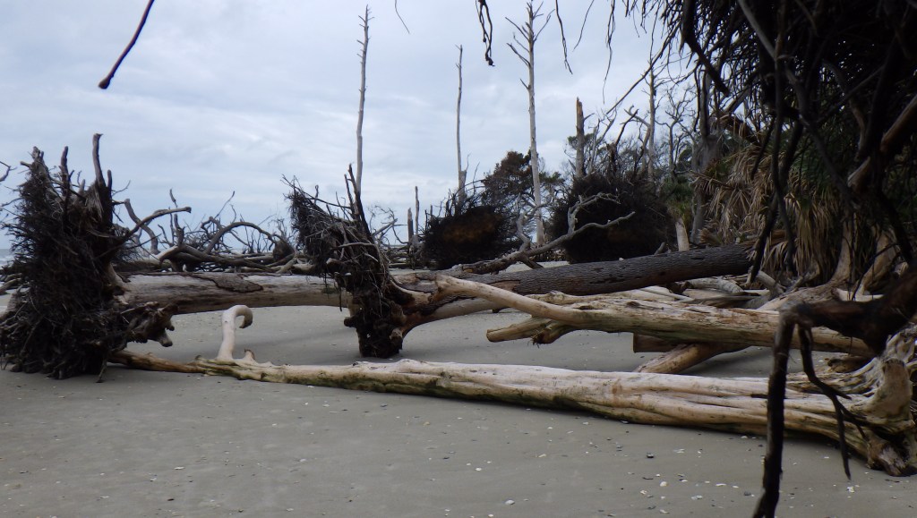
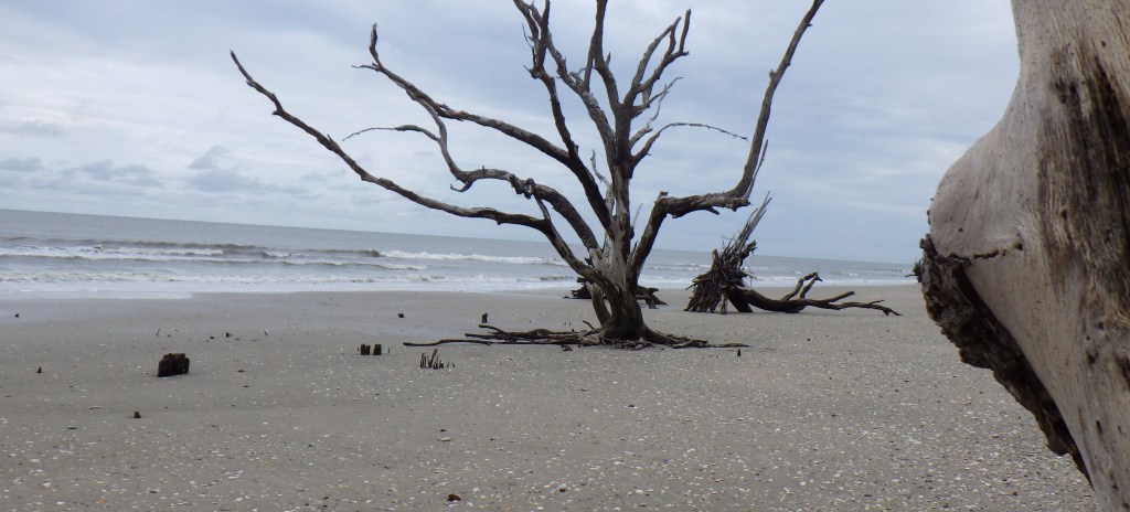
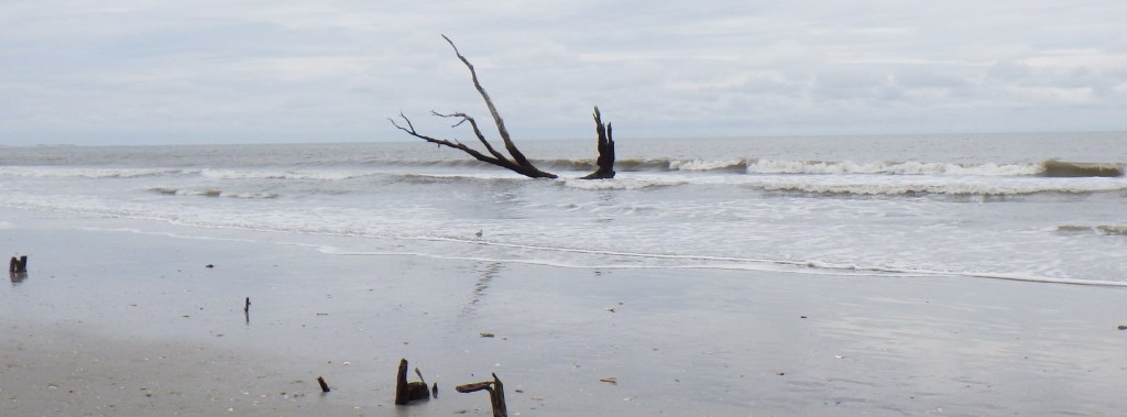
The larger area is filled with wonderful naturalist destinations. The Botany Bay Plantation Heritage Preserve contains the most popular and dramatic: Driftwood Beach, a remote stretch of sand that is inundated with the bleached skeletons of oak, palmetto and pine trees which were washed out of existence by severe erosion over the last 100 years (the shoreline has moved a mile landward in that time), but have persisted in death to create a surreal and quite beautiful tableaux.

2 Roseate Spoonbills hunting the marsh at Botany Bay

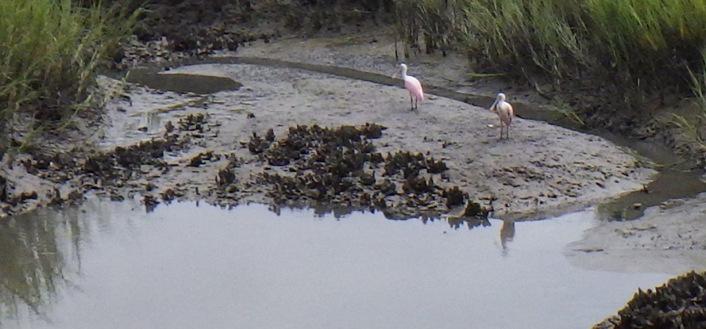
On the half-mile walk to the beach from the parking area, we had the great luck to encounter two Roseate Spoonbills hunting in a marsh creek. When we got to the beach, we wandered among the trees, some toppled, some partly submerged, a few eking their way back up the beach with each tide after being torn out by the roots by a hurricane.

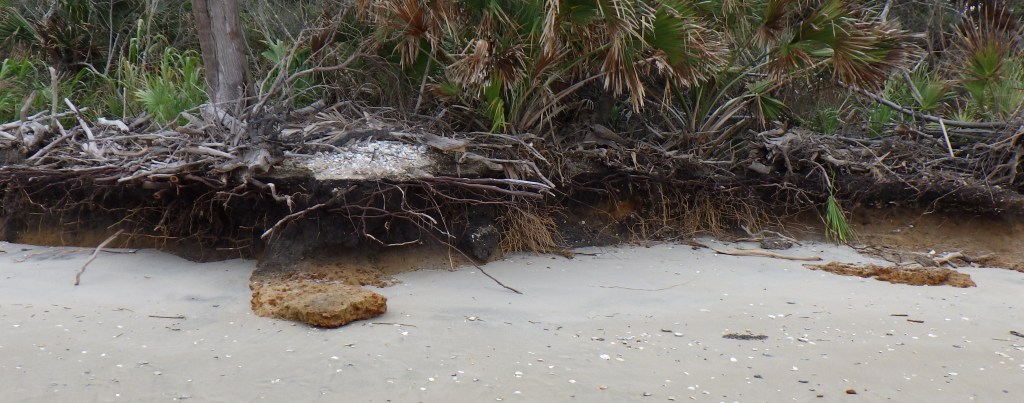
Soil profile created by ongoing erosion at Driftwood Beach

“It was erosion that formed Botany Bay in the first place. One hundred years ago, the shoreline was nearly a mile out to sea, and the area where the beach now stands was a saltwater marsh.  This is evidenced by large strips of slick mud deposits that line areas of the beach called “marsh relicts” which mark the foundations of where the marsh once stood.  Over time, erosion caused by longshore drift currents formed a twomile beach along one of the wooded barrier islands.  The saltwater poisoned the trees, and the sun turned them white.

The erosion that created Botany Bay is now wearing away at the current beach, accelerated by the passing of hurricanes. It was closed for nine months after Hurricane Matthew ripped away the causeway bridge. The beach took a beating again when Hurricane Irma swept through, carving a large, impassible inlet towards one end of the beach, and sweeping almost all the sand away for a period of time.” Kristina Rackley in the Carolina News & Reporter


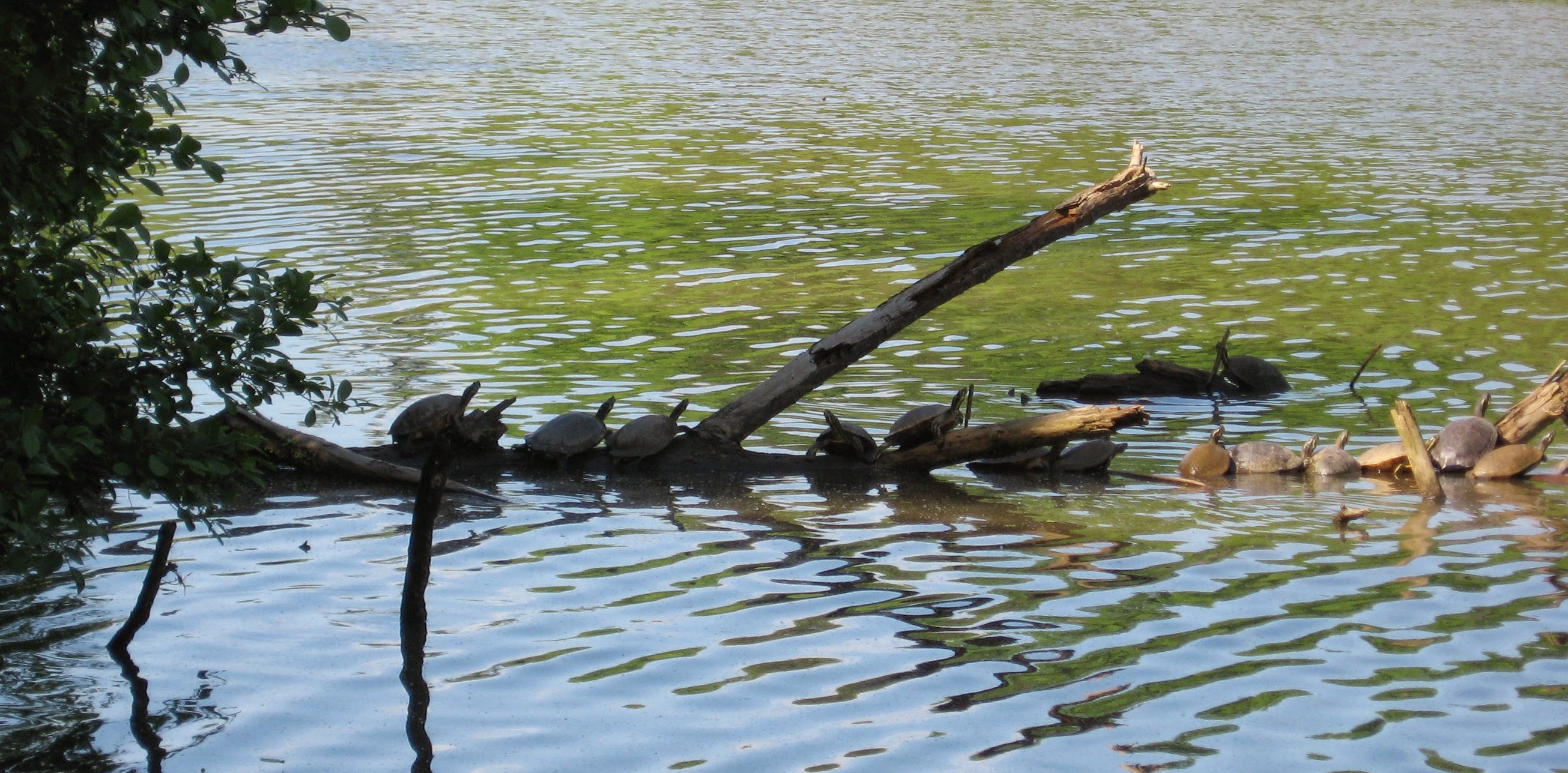
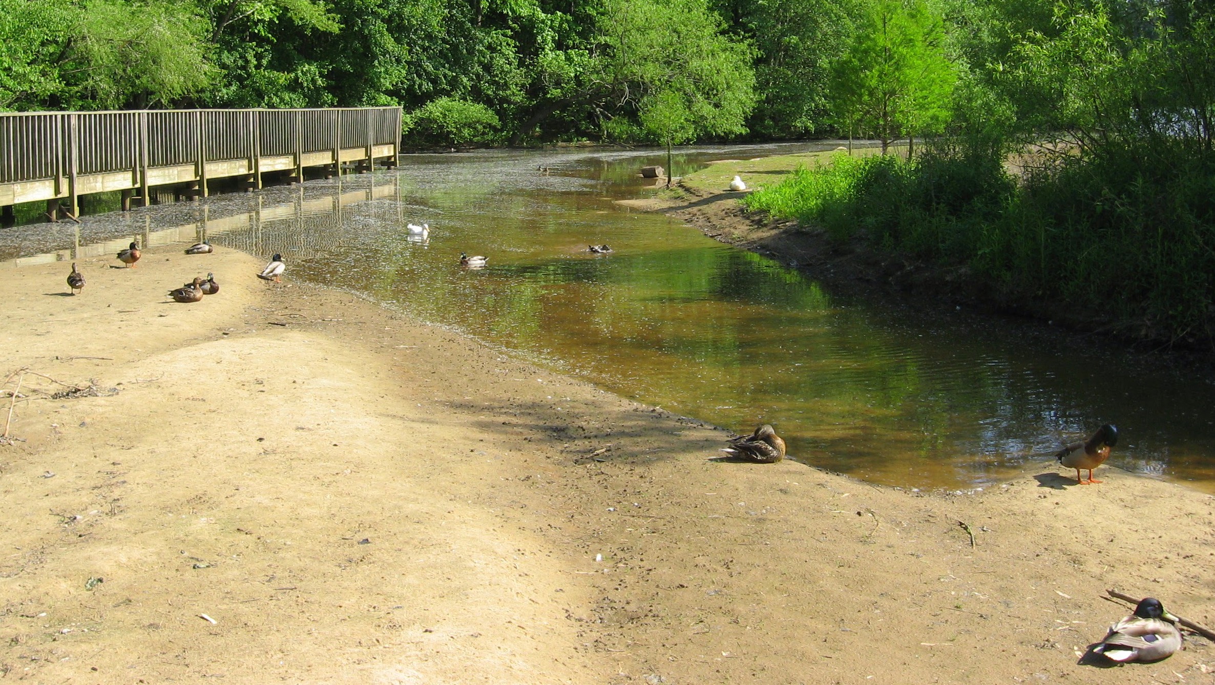
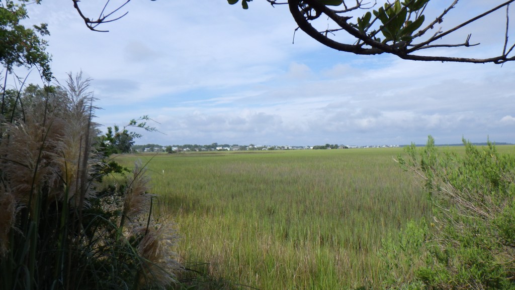
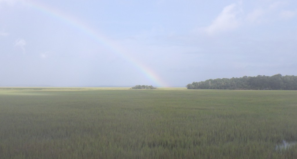
The huge salt marshes that predominate the visual and road landscape are richly populated with species that need patience to observe. The denizens are mostly hidden by the tall cordgrass, but every few minutes, a greater white egret or two will rise up and cruise around looking for a new spot to disappear.Gulls come twisting through, swooping closer to the plants and then resuming long distance flights. Popping shrimp sound like percolating bubbles in the mud, reminding one of all the invisible creatures that depend on and enrich this homogeneous and thus also specialized ecosystem. the cordgrass provides no food for during its life cycle, which confused early developers into undervaluing and destroying it, but the previous year’s rotting cordgrass is the base of the entire rich field of nutrients that nurture so many ocean and shoreline species.

Mother and baby egret below our back porch

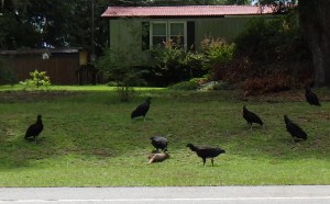
black vultures have at a dead armadillo

Advertisement

May 15, 2021

Spring Flowers on the MTS Trail

Filed under: Greenways & Parks, Nature Lore, Western NC — Tags: — raleighnaturalist @ 12:52 pm
Fire Pink, Silene virginica

Just ten miles from my Asheville homestead is an easy connection to the Mountain-to-Sea Trail, a growing statewide amenity that is “a simple footpath stretching almost 1,200 miles across North Carolina from Clingmans Dome in the Great Smoky Mountains to Jockey’s Ridge on the Outer Banks.” My section climbs Bull Gap from Ox Creek Road to the ruins of Rattlesnake Lodge, just off the Blue Ridge Parkway. In early May, the trail is a stunning showcase of mountain spring flowers.

Trillium patch

Trillium fruits become a food for deer. Wildflowers of the Carolinas by Nora and Rick Bowers states that ants take their seeds home and then eat only the oily coating, thus germinating some of the seeds. Wildflowers of the Blue Ridge Parkway by J.A. Alderman says they are “one of the stars of mountain wildflowers,” sometimes covering acres of forest floor.

Trilium blooms start white and turn pink as they get pollinated. Mountain flowers blossom early before the leaf canopy closed in for the summer. By mid June, most of these blooms will be long gone.

Large-flowered trillium, trillium grandflora
phacelia Looking down the slope
The view across Bull Valley

Yes, I see the poison ivy! The trail criss-crosses as it climbs and you can see folks quite a bit below or above you. Parking on Ox Creek Rd. gets crowded on the weekends. I have yet to get my retired old legs all the way to the top to see the remains of Rattlesnake lodge, said to be an impressive stone foundation. But I’ll get there sometime – maybe this fall to see the other end of this cycle.

wild geranium geranium maculatum
Phacelia bipinnatifida

Fallen logs off the trail are left where they are and there are huge stone outcrops along the way.

Fire pink gets its first name for color: the second is its flower family.
false Solomon seal
wild white violets
bearcorn Conopbolis americana

This is a parasitic plant that lives off of tree roots. It is less respectfully called squaw root, as Native American woman used it medicinally. It grows in dry woods near oaks, so there are several specimans on this trail.

phacelia patch

The Appalachian mountains in North Carolina represent a highly diverse mix of Northern and Southern plant species. You can watch the species change as you gain elevation on this steep trail.

ramps on my own mountain slope in Baird Cove

My own backyard offers quite a few wild spring flowers, but it can be hard to catch them in bloom! Wild iris, rattlesnake plantain (an orchid), jack-in-the-pulpit, star chickweed, and trout lily appear, but some of those just for a few days before taking on their summer form. I have purchased and transplant ginseng and ramps just for the fun of it. Happy trails in your spring flowers findings!

Read the book based on this blog

The Natural History of Raleigh

November 15, 2018

The Natural History of Raleigh is published!!

Filed under: About & reflection, Gems & Surprises, Nature Lore — Tags: , , — raleighnaturalist @ 5:06 pm

I am so proud to share that the book I have been working on for over a decade, for which I started this blog, is in print at last. Published by my own press The Paper Plant, it is an 80 page book with 16 chapters and 30 illustrations that captures the best of what i have learned and seen concerning Raleigh NC’s wonderful greenway system, parks, and other natural areas. This blog has been crucial in developing the book, and several features relate directly to the blog, especially the fantastic comments on Lassiter Mill and it’s history posted on the blog. Thanks to all my Raleigh Nature readers and I hope you obtain and enjoy the book.

cover is hand-laid paper with block print

select illustrations

order through The Paper Plant

order through Amazon

Also available at Quail Ridge Books and So&So Books in Raleigh

May 20, 2015

Raleigh Nature Starts a Shift Westward With Lake Lynn Residency

Filed under: About & reflection, Nature Lore, Rural Raleigh, waterways, West Raleigh — Tags: , , , , , — raleighnaturalist @ 7:25 pm

A red-throated loon shows his Springtime stuff at Lake Lynn  in northwest Raleigh

A cormorant shows his Springtime stuff at Lake Lynn in northwest Raleigh

Blog News June 2015
This blog always centered on a book project: The Natural History of Raleigh, which now exists as a finished manuscript of 25,000 words I am working to get published. Having retired from over twenty years as a special educator, my wife Cara and I are selling our Oakwood home and moving to Asheville, setting up book arts studios as well as a big garden and small greenhouse to grow food, papermaking fibers, and flowers. For Cara’s final year of teaching, we are renting a small apartment that overlooks Lake Lynn. The blog will eventually take on a state-wide perspective, but will always focus on urban natural areas and have plenty of posts about Raleigh. For now, enjoy the Lake Lynn and Falls Lake areas I will pop into when in Raleigh, while I explore and document what to show you up in Baird Cove.  Best,  John

Sliders at Lake Lynn

Many kinds of wildlife inhabit Lake Lynn, but (for enthusiasts) it has a citywide reputation for its turtles.

Lake Lynn, along with Shelley Lake, was created to provide flood protection to Crabtree Valley Mall, which was constructed in a former muddy cow pasture and flooded soon after it was built. Hare Snipe Creek, which feeds Lake Lynn, runs from the back of Tabernacle Church on Leesville nearly due south all the way to Crabtree by the Golden Corral headquarters on Glenwood Avenue. Lake Lynn has a gigantic earthen dam but is normally quite shallow, and its edges are dissected by the numerous small creeks and freshets that formerly found their way to Hare Snipe Creek. A popular greenway with long boardwalks encircles the Lake, and a spur follows the soggy wetlands of its headwaters up to a public park. At uncrowded times (and I’m talking people driving and parking at my apartment complex just to walk here) it’s an opportunity for some remarkable encounters with nature.

ducks

Some of the more interesting  birds to watch are naturalized escapees – dark, red-wattled Muscovy ducks and aggressive white barnyard geese. Lake Lynn itself is a mixture of native and natural features blended with the man-made lake and the surrounding (relatively wooded) apartments and houses. The Canada geese, well described in an earlier post, are so numerous and boisterous as to evoke aquatic chickens as they honk out the rising day outside our windows each morning.

 An Enticing Nearby Area

Cypress trees on the southwestern shore of Falls Lake

Cypress trees on the southwestern shore of Falls Lake

Just a few miles north of Lake Lynn I can cross over the highest spot in Wake County – Crestmont off Leesville Road – and travel out of Crabtree Creek’s watershed into that of the Neuse, inundated by Falls Lake. North of 98, off Baptist Road, is an access point for the Mountain-to-Sea Trail, which traces the southern shore of Fall Lake. Here a juncture of powerline cuts and shallow lobes of the lake provide wide open views and a nifty look at a population of cypress. There is a stunning serpentine boardwalk that serves the trail, and a raised bridge over Lick Creek with gorgeous views. More to come, as well as more on the whole stretch from here to the Rollingview Marina.

Lick Creek footbridge

cypress in Falls Lake

August 7, 2014

Piedmont Prairies in Raleigh

Filed under: Gems & Surprises, green initiatives, Nature Lore, West Raleigh — Tags: , — raleighnaturalist @ 3:17 pm

Museum Field (1)

Fire, hurricanes, and Native American land management all created prairies, or tall grass meadows, across the area in prehistoric times. Almost no original prairies still exist, but Raleigh boasts two right down the road from each other off Blue Ridge Road. The best place to experience and learn about prairies is Prairie Ridge Ecostation, managed by The Museum of Natural Sciences on Reedy Creek Road. Below is the entrance map for this rich and complex facility, which covers 45 acres.

Prairie Ridge sign

 The top right shows the entrance and parking area, right next to the National Guard Armory. There are forest and prairie trails and at the bottom is a tributary of Reedy Creek, heading west to cross under Edwards Mill Road.  A large solar panel array provides power for a Frank Harmon-designed outdoor classroom built with green features. A residential center is in the works. There is a new Nature Play Space for young children with learning stations, a prairie maze, and logs and boulders for climbing.

Prairie Ridge

Trail heads at Prairie Ridge Ecostation

The highly diverse profusion of grasses, herbs and accompanying hordes of insects are riven with well-mowed paths to allow easy access. On each side, this mid-summer stroll revealed masses of seed heads, arching, competing green blades, and the occasional intrusion of pokeweed. Numerous butterflies, hunting spiders and other bugs roam the vegetation.

Prairie Trail

Zooming insects planed down onto the mowed surface every few seconds. Here is a grasshopper taking a short rest.

Prairie Ridge grasshopper

You can see clover enjoys the clear-cutting of the mower.

Prairie Ridge garden

Prairie Ridge flower garden on right, classroom building down slope on left. Note the black-eyed Susans on the roof of the garden shelter.

Fun fact: the Wet Lab, seen below, contains jarred biological specimens contained in over a hunded thousand gallons of alcohol. This huge collection, constantly growing as smaller facilities pass on their own holdings, was originally planned for downtown as part of the new science museum – but legislators decided that such a volatile stash needed a more remote location than across the street from them!

Wet Lab

Just a few hundred yards down the road is the campus of the NC Museum of Art, which maintains slopes of prairie meadows along with wooded trails and large lawns with outdoor sculptures. These prairie spaces are usually maintain by controlled burns, which reduce invading tree species and provide readily used nutrients. Mowing every two or three years works nearly as well.

Museum Field (1)

Museum slope

A slice of Piedmont prairie is no farther away then the nearest power line cut, where tall grasses are allowed to mature and flower but mowing is conducted every few years. To see something close to the original, visit the Horton Grove Preserve, managed by the Triangle Land Conservancy, which is part of the historical Stagville Plantation north of Durham. Another remnant of Piedmont praire is at Temple Flat Rock in Wake County, also managed by the TLC.

Here is the book based on this blog

The Natural History of Raleigh

March 25, 2014

Raleigh Weather

Filed under: Gems & Surprises, Nature Lore, Raleigh History — Tags: , — raleighnaturalist @ 6:44 pm

Black cherry blossoms announce spring

Backyard blossoms announce spring

Raleigh enjoys a temperate climate that can surprise with ease. Hailstorms, blizzards, damaging thunderstorms, and sustained droughts have all played havoc with Raleigh. The Great Blizzard of 1899 brought 17.7 inches, which record was not broken until 1927. In this century, late January 2000 brought 18 inches of snow that closed school for about 3 weeks.  Perhaps the most infamous weather event in Raleigh history was an ice storm in 2005 that lay a mere half inch of slick ice on every surface but created an Armageddon of gridlock across the town, stranding hundreds and keeping dozens of schoolchildren camped at school overnight . Historically we average about 6 inches of snow a year; in the last decade that dropped to under 5 inches. Our diverse seasons provide the outdoor naturalist with challenges and pleasures alike – within two months in fall, one can get short of breath in a stagnant sauna of hot air, then have a sinking cold air mass flow as a discernible fluid over your hat brim and down your cheeks. Each season provides unique natural experiences.

Hurricanes pound North Carolina on a regular basis, and many of these have affected Raleigh.  Hurricane Hazel, which came ashore in October 1954 and was nicknamed “the Bulldozer,” was at full strength when it hit Raleigh and flattened everything in its path. Hurricane Fran in 1996 changed the face of Raleigh dramatically by shearing hundreds of trees across the city. North Carolina, for the first time in history, declared all 100 counties a disaster zone, and 24 deaths were reported statewide.  The most destructive hurricane to ever hit Raleigh made water, not wind, its weapon.  Hurricane Floyd in 1999 was preceded by a tropical storm that saturated the ground and filled the waterways. When Floyd hit Wilmington and slowly moved across the state, some areas in eastern North Carolina had rain for 60 straight hours. The result was a deluge that claimed 52 lives, mostly from flooding, and totaled over 6 billion dollars in damages. The Neuse River reached 500 year flood levels and flooding continued for weeks after the storm.  These storms perform a natural role in opening the canopy of tree cover and letting sunlight promote young trees and diverse ground cover, even when the losses are painful.  Edna Metz Wells Park by Cameron Village presents a good microcosm of Fran damage and the slow fitful succession that occurs in an urban natural setting after such a tree loss. Out at Umstead Park, the same storm’s ravages are being used in a long term study of such recovery processes in a pine forest.

Normal rain in Raleigh follows seasonal patterns, with spring and fall slightly drier, but our generous rainfall of 42 inches or so is relatively evenly spread across the year. Our specific climate classification is humid sub-tropical, with the mountains shielding the Piedmont from Midwestern air masses. Raleigh’s average temperature in January is 40 degrees, in August it is 77 degrees. Summer popcorn storms punctuate the hot dry summer days with occasional quick deluges. Droughts are typical for the area but affect man-made landscapes far more than natural ones, which are adapted to survive them.

downed tree at Shaw University after tornado

downed tree at Shaw University after tornado

Raleigh could experience an earthquake, but that chances of a direct hit in the next 50 years are less than 1%. We do sometimes feel earthquakes, such as the 5.8 tremor that struck Virginia in August of 2011 and rattled homes and businesses across the Triangle. Tornadoes threaten on a regular basis: the April 2011 tornado that created much damage and destroyed almost 1500 trees in Raleigh was part of a massive outbreak of tornadoes across the South. The tree loss in downtown cemeteries was particularly distressing: in Raleigh City Cemetery and Mount Hope Cemetery in south Raleigh, beautiful old cedar trees were torn down or truncated by the winds.

The 2014 year has been unusual, to say the least, with snow flurries late in March and general delays/risks with spring blossoms. But  being in the borderline area between northern cold and southern warm has always been Raleigh’s fate. We can thank that factor for our amazing diversity of trees – and resign ourselves to enjoying the elements of surprise.


to buy the book based on this blog, click below

The Natural History of Raleigh

Older Posts »

Create a free website or blog at WordPress.com.