The Raleigh Naturalist

February 14, 2019

Raleigh Swamp Recovers from a Swamping

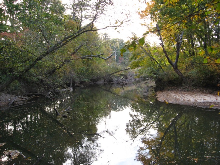
Raleigh Swamp is a prominent, even dramatic feature of the Raleigh Greenway at the intersection of Crabtree Boulevard and Raleigh Boulevard, joining Buckeye Trail to Middle Crabtree Trail and crossing a large shallow body of water with a causeway. The water was never intended to be permanent, but a wetland was turned into a shallow lake by the work of beavers, as explained in this 2013 post.

The place is a paradise for visiting birds, thirsty deer and other wildlife, and an amazing collection of turtles that bask by the piled up dozens on the many logs protruding from the water. The causeway was built with best ecological practices, minimizing disruption, but it has needed repairs recently because of extensive flooding. Cara and I visited in November 2018 and saw some of the work.

The crossing of the greenway with a utility cut has been strengthened and guarded with metal gates. The northwestern end of the site has a short stretch of asphalt that has repeatedly been ruined as the flooded marsh cuts through the shoulder of Crabtree and dumps excess water into the creek. looks like they are going to repair (instead of culvert) it once again, but this spot has closed the causeway, officially that is, for months. Most people just make their way around the mild barricades.

Different species of trees can tolerate shorter or longer periods of flooding. Ash, river birch and of course willows can survive many weeks of inundation. But if flooding lasts too long, trees die and the vegetative regime changes.

This area was a scrubby wetland with a smattering of drier tussocks and paths through it until the construction of the Raleigh Boulevard bridge. Many relics of the former trees dot the wide expanse of water. There is thus a small justiofication for the term used by locals and myself, Raleigh Swamp, though in fact this is a marsh. Whatever you call it, it’s a great place to bike walk, fish, or bird watch.

Below is the illustration I created from the lead photograph for my new book, the Natural History of Raleigh. Raleigh Swamp is featured in Chapter Four.  Happy trails!

The Natural History of Raleigh


January 10, 2019

Lassiter Mill – Most Searched and Commented Post

Lassiter Mill illustration from John Dancy-Jones’ book The Natural History of Raleigh

Lassiter Mill and Raleigh Mill History is by far the most popular post on this blog, with “Lassiter Mill” the biggest search term. That early post has served as a magnet for people looking for information and stories about Raleigh Nature. And the comments on that post, found here, are an amazing collection of memories, from jumping off the bridge to family picnics, from shad runs to visiting Mary Lassiter at her store beside the old mill. Plus local history from a descendant of Issac Hunter! The comments are featured in my newly published book, and have helped it become quite popular at Quail Ridge Books, which is now located just a mile up the hill from Lassiter Mill.

The Natural History of Raleigh

16 chapters, 30 illustrations conveying the sights, nature lore and history of Raleigh’s natural areas and greenways

January 26, 2015

Anderson Point Anchors the Union of Crabtree and the Neuse

moss mountains by Crabtree

moss on a rock outcrop by lower Crabtree Creek

Crabtree is usually a low-flow creek, but after long and heavy rains, its flow can rival the Neuse River, of which it is a major tributary. The newly completed lower Crabtree Trail, featured in my previous post, provides a very long bridge that gives you a good sense of Crabtree’s large size as it approaches Anderson Point to flow into the Neuse.

Crabtree bridge at Anderson

Crabtree begins in Cary and after passing though Morrisville and Umstead Park, arcs across north Raleigh, roughly parallel to 440. It gathers water from Brier Creek in the north to downtown Cary in the south: a huge swath of Wake County’s terrain. As it approaches Anderson Point Park, it is large and wide.

Crabtree Trail crosses the creek at Anderson Point

Crabtree Trail crosses the creek at Anderson Point

Anderson Point Park is a large complex amenity. Off Rogers Lane (from New Bern Avenue or New Hope Road) you can park before the bridge over the 64 bypass to access the Neuse River Trail and canoe put-in, or cross the bridge into the park proper, where large fields, picnic shelters, and specialty gardens attract many local families. At the bottom of this large and open expanse, a wooded path leads to the confluence of Crabtree and the Neuse. The connector with the Crabtree Trail is back at the top of the slope.

Crabtree Trail at Anderson

Following this path northward from the park, one gets a great sense of Crabtree’s lower floodplain forests. Large beeches are profuse, and American holly greens up the dark stands of winter sweetgum and ash.

beech on lower Crabtree Trail

American holly in Crabtree's floodplain

American holly in Crabtree’s floodplain

The ancient age of Crabtree can be inferred from sandstone outcrops – huge rocks built by the creek itself over eons. Just before the creek crosses under Rogers Lane, it crosses over flat sheets of even older, harder rock and is only a few inches deep in times of low water. On the day of this visit, the water was high and the “rapids” were only visible as white ruffles in the brown flow.

rocks by lower Crabtree

My favorite spot on both my recent visits was a rocky overhang where the creek makes a sharp turn before approaching the river. The rocks are covered with a minature forest of moss, and on the second visit they were sunlit and quite photogenic.

moss on rocky overhang

Buckeye Trail, seen below, represents the oldest and “wildest” section of Raleigh greenway. Now it also presents a connection to a huge greenway loop around Raleigh, utilizing the Neuse River trail and the long extension of the Walnut Creek Trail to the River. Anderson Point is a great focal point for these connections, The exciting Mingo Creek Trail connection, just upstream, will have to wait for another post. Happy hiking or biking on our wonderful, ever-growing system!

Winter sycamores guard Buckeye Trail connector on Milburnie Road

Winter sycamores guard Buckeye Trail connector on Milburnie Road

November 6, 2014

Crabtree Trail to the Neuse River

Crabtree from bridge

Crabtree Creek from the new greenway bridge near Sunnybrook Road

I can now ride my bike from my house downtown to the Neuse River! The final leg of Crabtree Creek Trail, from Milburnie Road down to Anderson Point, is completed. A recent post shows the construction off Milburnie, but this one focuses on the wonderfully bucolic, downright meditative bike ride I had through the large, mostly undeveloped area surrounding Crabtree Creek’s intersection with New Hope Road. Several new bridges are part of this project, and contribute to the beautiful views of Crabtree Creek.

connector on Milburnie

From Oakwood, I rode down Milburnie to the trailhead of Buckeye Trail, the subsection of this trail that represents the oldest existing section of Raleigh greenway. Here a sidewalk connector takes you past the old Swain’s Steakhouse, under New Bern Avenue, and over a small bridge to the edge of the apartment complex off Calumet Drive.

new greenway bridge over Crabtree near Calumet Drive

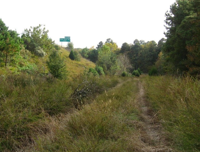
Just past the bridge seen above I found a wonderful detour – a utility road that dives through fields along 440 and goes to the pumping station just below the first ramp for the 64 bypass off 440.

utility road

The dirt road was eroded but a marvelous adventure. I reached a “Robert Frost choice” and ducked into the shady woods for a couple of hundred yards before turning back to the paved greenway.

path to choose

The greenway passes under a maze of highway overpasses, and just off it is a tempting series of railroad beds, more utility roads, and overgrown fields. More tempting detours – but not for today!

highway near trail

 This area, due south of the Wake Animal Control Center and the old landfill, reminded me of old Raleigh, when waste fields and enticing lanes through them were much more common. I’m sure dirt bikers love this spot.

high overpass

The imposing arc of highway above the greenway here is the height of that ramp for the 64/264 Bypass, and it was both beautiful and sad for me to see. The new greenway passes very close to the spot where the borrowed sports car of some teenagers coming home from a ball game at very high speed, flew off this ramp to their deaths. The tragedy left a charred scar for several years, which I would see on forays from the old pecan farm near Poole Road and Sunnybrook (not Oakview, but the non-public part west of 440). Recalling it on this trip, I was again amazed at just how high this ramp soars.

long bridge

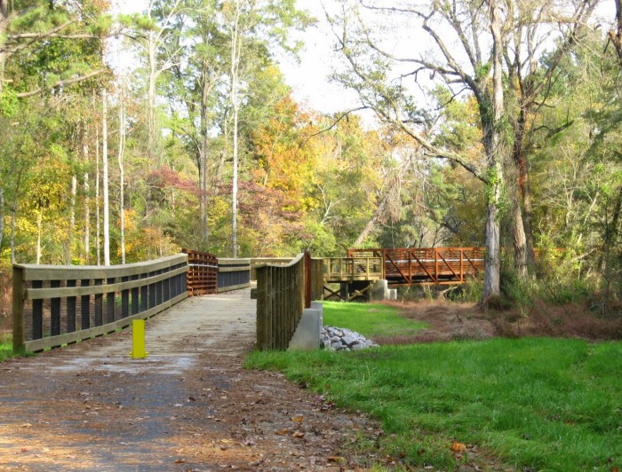
The greenway re-crosses the creek on an extended bridge near a swampy area where the water from Jones Lake and the previously mentioned abandoned farm comes in. There are long stretches with woodland on both sides, and I encountered just enough other bikers not to feel isolated.

rock outcrop

A large granite outcrop marks a sharp turn in the creek just east of New Hope Road. Up stream, the late afternoon light and the fall leaves made for a very nice scene. This would also be a great place to fish.

bend

Crabtree Creek bends as it makes it final approach to the Neuse River

field below New Hope

When I got to a large powerline field, I turned for home. The end of this trail, Anderson Point, is a story in itself, and I hope to take Cara biking on this trail soon, starting at the mouth of Crabtree and traveling upstream. I’ll keep you posted. In the meantime, give this wonderful section, with highly varied landscapes and a few surprises, a try soon.

A shallow Crabtree slides over a gtanite bed near New Hope Road

A shallow Crabtree slides over a granite bed near New Hope Road

October 29, 2014

Mystery Bridge in Crabtree Valley

Filed under: Crabtree Creek, Gems & Surprises, Greenways & Parks, West Raleigh — Tags: , — raleighnaturalist @ 2:50 pm
stop sign at bridge

abandoned bridge over Crabtree Creek just off Glenwood Avenue

Crabtree Creek Trail is 14.6 miles of greenway through the heart of Raleigh, starting at Anderson Point off New Bern Avenue east of town and following the creek all the way to Oak Park in northwest Raleigh. It was until recently the longest continuous stretch of Raleigh greenway, and now has been eclipsed by the Neuse River Walk and Walnut Creek Trail, both newly completed, relatively rural connectors. Of all the wonderful features on this complex trail, the abandoned bridge just upstream of Kidd Brewer’s old cow meadow (now Raleigh’s most floodable mall) wins the honors for mystery and quirkiness.

Crabtree creek from bridge

When and how was this bridge used? I will be crowdsourcing on Facebook, and don’t hesitate to comment here if you know anything. This stretch of greenway picks up across Edwards Mill Road from Crabtree Valley Mall, and meanders through old neighborhoods as well as a sprinkling of new condo developments before dead-ending into Lindsay Road in Oak Park.

abandpned bridge

I do NOT recommend walking on this bridge! It is very rotten. You wouldn’t fall in, but stepping through would be no fun. I stuck to the crossbeams, but was still anxious. Lovely view, though. Any thoughts?

Update

The Facebook post for this piece has produced wonderful information: Foy Beal states that the bridge was installed by the Martin family, namesakes of Martin MIddle School, when they owned property on both sides of the creek. Richard Butner has this info: “Used to go to the Leroy B. and Charlotte M. Martin House, designed by Brian Shawcroft.” Chip Robie has a fun story about using this “driveway” as a shortcut to Edward Mills Road. Others have interesting memories as well, and I am sure more to come.  Thanks!

March 3, 2014

Buckeye Connecting to the Neuse

Filed under: Crabtree Creek, East Raleigh, Greenways & Parks — Tags: , , , — raleighnaturalist @ 8:58 pm

Milburnie greenway entrance

The trail head of Buckeye, the oldest and the beginning of the longest stretch of Raleigh Greenway, is being extended down Crabtree Creek to Anderson Point, the creek’s intersection with the Neuse River. Much progress has been made with grading and a layer of crush-n-run, but a break remains just south of New Bern Avenue, where a freshet ditch needs a bridge or culvert before paving can begin. With an easy hop over that, a hiker or biker can travel from Milburnie down the creek beside Sunnybrook road, toward the pump stations under 440 and the huge off ramp for the 64 Bypass. Here the creek, and eventually the greenway, will travel beside the railroad track through a large undeveloped area as it crossed New Hope Road and heads toward Anderson Point.

Buckeye toward Milburnie

Looking at Milburnie and Longview Creek from Buckeye

The trail head of Buckeye will not connect directly. Here is a view of Longview Creek from Buckeye, where I thought a bridge might be built, but instead there is a short jog down Milburnie Road from the current entrance to the extension, which runs right behind the old Swain’s Steakhouse and then under New Bern Avenue.

New Bern Ave greenway crossing

Past New Bern is the freshet ditch, then a long stretch parallel to Sunnybrook and Wakefield Village.

greenway extension beside Sunnybrook

Crabtree is at full strength as it makes its last swing toward the Neuse.  Across the creek, the railroad cut is terraced into some impressive slopes, and the hardwood bottomland trees along the creek are impressive.

Crabtree past New Bern Ave

This will be an exciting connection and make possible some amazing round trips on bicycle.

future greenway bridge south of New Bern Ave

Now they just need to build this crossing!

Older Posts »

Create a free website or blog at WordPress.com.