The Raleigh Naturalist

April 9, 2013

Raleigh Swamp Shifts with Sewer Project

sewer project meets Raleigh Swamp_1_1

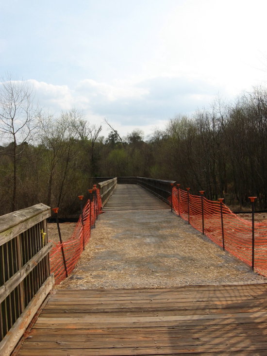
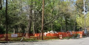
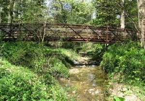
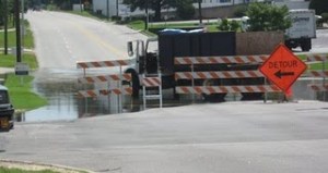
The huge sewer project – seen above at Crabtree Boulevard looking toward the Mouth of Pigeon House Branch – has introduced a new geography to Raleigh Swamp, my name for the body of water off Raleigh Boulevard just north of its intersection with Crabtree Boulevard.  The large wooden causeway and gazebo were wonderful additions to the meeting of Buckeye trail and Middle Crabtree Trail.  Now the sewer project has dictated a large dam and concrete bridge section that bisects the “swamp.”  I know a real swamp is moving water with trees, but this lowland was dotted with dying trees for years after its establishment, and the snags of many remain as resting spots for herons, cormorants, and the occasional wood duck.  Canada geese and mallards breed here, while the turtle population has grown to a staggering level.  It is all thanks to the beavers.

Raleigh Swamp_1_1

When I first returned to Raleigh from Greensboro in 1980, they were starting to build the Raleigh Boulevard bridge over Crabtree Creek.  The caissons they used to sink the bridge piers were impressive, and Dulci, my black lab and I kept a close watch on the process.  At this time, the “Raleigh Swamp” area was a sometime wetland dotted with scrub trees and ribboned with the paths of homeless campers. Like many floodplains in the area, it got wet in the winter but stayed dry most summers.  The Boulevard project changed that, with a little help from the local beavers.  The transition was clarified for me by a city engineer years later through a comment on this blog in 2009.  I quote it in full below:

Was reading through your website after getting the link from the Fletcher Park Watergarden and noted that the “pond” off Raleigh Blvd was one of your favorite places. I thought I’d mention that this was actually a City of Raleigh mitigation project I designed many years ago to offset the environmental impacts from the construction of Raleigh Blvd. It was supposed to be a wetland but the beavers in the area had a different idea as they immediately blocked the culverts under the roadway causing the water to back up and form a permanent pond. Can’t say I object to the result of their efforts. It’s a beautiful spot and the addition of the greenway has made it accessible to the masses.

Mark Senior, PE, Senior Project Engineer, Water Quality Section, Stormwater Divsion of the City of Raleigh Public Works Department

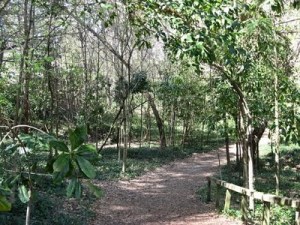
The beavers have indeed made great use of the spot with several different lodges in different spots.  New generations of beavers tend to build their own lodge. Until I got the info from Mark, I assumed the construction of the road bed dammed up the water.  The water on the east side of Raleigh Boulevard acts more normally – rising and falling with rains and seasons.  I know the beavers play over there as well, because you can see their slides into Crabtree Creek as you walk down Buckeye toward Rollingwood.

Raleigh Swamp sewer dam_1_1

sewer pipe dam looking toward Crabtree_1_1

sewer dam bridge on causeway_1_1

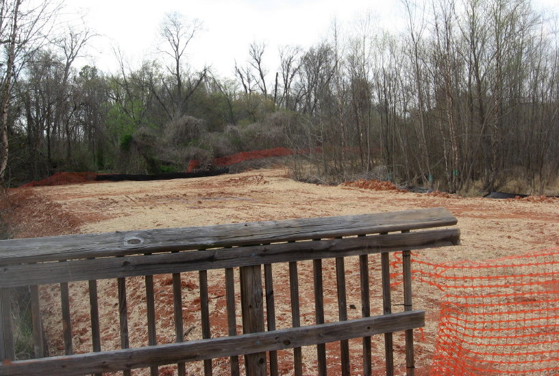
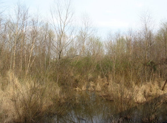
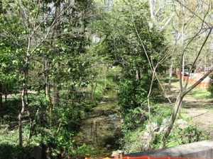
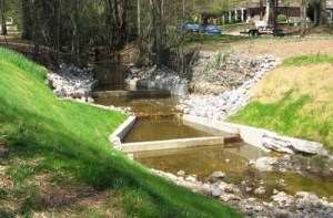
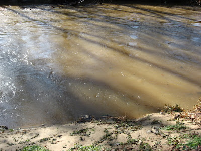
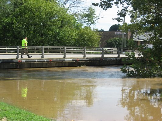
Getting back to the sewer project, you can see above the large dam across the wetland.  This, along with the upgraded line in general, has changed the location and depth of water around the edges of the marsh (which is technically what it is).  Some areas are now totally dry – at least for now – and some are substantially deeper.  No real harm done, since nature and time effect these kinds of changes all the time anyway.  but the newly dry areas, which were beaver playgrounds until now, will undergo an interesting and specialized kind of succession – new plants adapted to the new conditions will take over.   It should be a fascinating transition and Raleigh Nature will keep an eye on it.  Below are shots of the stranded areas.

dry area behind sewer dam_1_1dry wetland near stairs of causeway_1_1new dry area at Raleigh Swamp_1_1

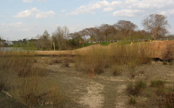
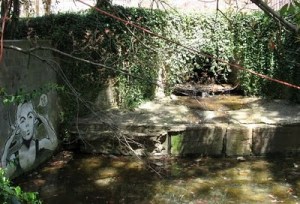
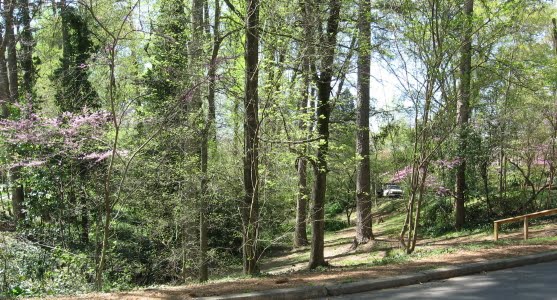
The beavers had a lodge at the very spot pictured below years ago but abandoned it during the drought of the early 2000s.  Perhaps they will rebuild now that the water situation is restored!

former beaver lodge water restored!_1_1

All posts on Raleigh Swamp

previous post on this sewer project

April 12, 2010

Pigeon House Re-Hab Project Helps Edna Metz Wells Park

A wonderful piece of graffiti has garnered some media attention for the stream restoration project along Smallwood Drive just below Cameron Village.  Cameron Village was the first shopping center in the Southeast, and when Willie York built it he diverted, ditched and straightened the headswaters of Pigeon House Branch, which gather between Cameron Village and the Raleigh Apartments.  The creek takes a straight shot right under Clarke Avenue into Edna Metz Wells Park, and after heavy rains the water, which gathers from a large section of the Oberlin Road ridge of Civil War fame, would roar through the tiny park, eroding and scouring and backwashing debris into the tributary water piped down from the glade along Forest Street above the park.  The City of Raleigh is working on a general rehabilitation plan for Pigeon House Branch, and the Smallwood project, which is pretty much finished, is part of that.  Apparently they are going to remove some invasive species before doing final plantings, both on Smallwood and in Edna Metz, in the fall.

From the main approach, the park looks beseiged..  But as you will see below, in the interior, all is well.  This spot is a real haven in Central Raleigh, and was a mainstay for my young children and me in the nineties.

 The Smallwood St. project involved using large boulders and some nice terraces to slow down and complicate the path of the water.


The media interest, started by a nice post from Goodnight, Raleigh, centers on a graffiti portrait of Edie Sedgewick, Andy Warhol’s muse, painted on the culvert where Pigeon House enters Edna Metz.  My picture of the scene is below.

Josh Shaffer called me and asked about the construction and Ena Metz, but never specifically mentioned the graffiti.  I’m pretty sure they won’t scrape it off as part of the re-hab project, but I can’t really say for sure.  Hope not.  It is indeed a nice harmless piece of art.  The figure says “De,” which is the word for power in Taoist philosophy.  I appreciate Josh’s feature of it and the park, as well as his kind words for my work.  And thanks as always to John Morris and his compadres over at another of Raleigh’s “splendid blogs!”

Goodnight ,Raleigh post on Edna Metz Wells Park

photo album of Edna Metz and Smallwood project


to buy the book based on this blog, click below

The Natural History of Raleigh

December 8, 2009

Lassiter Mill Shows Crabtree at Strength


 The previous post talked about Crabtree Creek’s tendency to flood – last week again brought heavy rains over the Crabtree watershed that brought the creek up to the edge of  its large channels.  This also sends an impressive load of water over Lassiter Mill Dam, as seen above.  I shot a video clip of the rushing water from below the tailrace, as linked below.

video- Lassiter Mill dam at high water

What happens at Lassiter Mill vividily and intensely demonstrates what happens lots of places more gradually – the deposition of new soil by spreading flood waters.  This is an essential part of the natural systems of the Piedmont, and our flood control measures prevent the process from periodically enriching the soil with a layer of mud and silt – though the process continues to work just fine in the “waste” lowlands that remain in Raleigh.  An astounding number of these lowlands have become major thoroughfares – roads built relatively later in Raleigh’s long history, on land left undeveloped due to the floodplain.  The Beltline follows the low contours of Walnut Creek, House Creek, Crabtree Creek, Big Branch, Marsh Creek and then Walnut Creek quite precisely as it curves from Cary’s Buck Jones to Glenwood, over the crest of North Hills, and around southeast to Poole Rd and then Lake Wheeler Road.  The water is piped and rushed away from underneath these elevated roadways, carrying its minerals with it.

The suburbs and businesses near these roads certainly don’t need the sediments!  But the stuff has to go somewhere, and these days there is a lot of stuff.  When streams are buffered by a healthy band of water-loving trees and shrubs, erosion material is reduced greatly. In central Raleigh, Crabtree is clogged with lots of dislodged soil, construction materials and unnaturally exposed red clay.   But the deposition process is a vital one, and it gets exaggerated at Lassiter Mill, where the water brings its load of suspended minerals hurtling over the dam and then slows and spreads its course below.  As it slows, it drops much of its sediment load.  The area below Lassiter Mill changes yearly as the creek alternately erodes and builds up materials.  Check out the new load of sand deposited by the recent high waters.

There are several caveats and complications to consider.  This is a large load of sand!  Eight or nine inches at a dose, and not the silt and mud that the plants would prefer. But nature adapts, and the Lassiter “beach” is fun to browse, with a wide variety of weeds incubated from the loads of  soil and debris.  The silt and sand that currently washes down Crabtree is terribly unhealthy for the filtering mussels and other delicate aquatic life.  The red clay that paints Crabtree brown is such a strong pigment that Crabtree often changes the color of the Neuse where it conjoins.

Crabtree builds itself “shoulders”  as it repeatedly overflows, dropping the heaviest particles first as the water disperse into the floodplain.  This is why Crabtree presents such a tall ditched appearance as above at Hodge Road.  The plants arrange themselves in an orderly sequence beside or on top of these embankments according to their tolerance for flooding.

The next time Crabtree rises over it’s banks, put on your rubber boots and check out the glistening mica-rich silt that covers the greenways before the city sends its scrapers to clear it off to the side, where it enriches the plants as well as any landscaper’s mulch.  You are walking in the stuff that makes our floodplain soils, a rich muck delivered by the yearly floods.

Nature.org floodplain info

BBC floodplain story


November 15, 2009

Hodge Road Creek Levels – Crabtree Changes with the Weather

Filed under: Central Raleigh, Crabtree Creek, Gems & Surprises, waterways — Tags: , — raleighnaturalist @ 2:54 am
Atlantic 11-11-09_1_1

Crabtree under Atlantic Ave at Hodge Road Nov. 11, 2009

Crabtree is a low -flow system that has carved itself an impressive channel through Raleigh over hundreds of thousands of years.  That course fills to overflowing fairly often, as Crabtree drains a huge swath of Piedmont terrain, from Brier Creek in north Wake County, out to west Cary and down to Walnut Creek south of Raleigh.  Flood control lakes such as Lynn and Shelley have eased flooding in Crabtree Valley, but Middle Crabtree Greenway in central Raleigh, as well as Walnut in East Raleigh, continues to flood after heavy rains.  Above is 12 hours after high water at Atlantic Avenue and Hodge Road.  Below is a high-low pair of pictures for the same spot.

                           Atlantic Ave greenway underpass_1_1          Atlantic Ave Crabtree bridge
              Crabtree threatens 9-08          Underpass completed 7-08

I have posted about flooding here before at Raleigh Nature, and maintain an ongoing post of comparison pictures at my nature projects blog, Pecans & Mistletoe.  “The Gar Hole” is the most important feature of this favorite stretch of greenway, accessible at Atlantic Avenue on weekends (parking available then at the plumbing supply warehouse) or at the deadend east of the Longbranch on weekdays (unless it’s flooded).  So I take regular shots of the gar hole and the view from the railroad bridge at different seasons and water flows.  Below are some interesting pairs.

                            gar hole with young slider 6-20-07          gar hole 11-07-09_1_1

                              June 07                                       November 09

                              gar hole March 7_1_1          Gar Hole 9-7-07_1_1

                                       March 07                              June 07

Gar Hole after December 07 rains

                                    Hodge View 11-7-09_1_1          Hodge 11-11-09_1_1

Crabtree from Hodge Rd RR bridge 7 November and 4 days later after “Ida” rains.

                            old bridge 12-31-07_1_1          RR Bridge 11-11-09_1_1

               Hodge Rd. RR bridge Jan 07 and after rains 11–11-09

Creek Levels at Pecans & Mistletoe

*****************

                              box elder beetle at Hodge Rd RR bridge_1_1          barn spider in silhouette_1_1

box elder beetle at Hodge Rd RR bridge; barn spider

gar hole butterfly

gar hole butterfly

September 8, 2008

Crabtree Creek Floods The Middle Creek Greenway

Filed under: Central Raleigh, Crabtree Creek, Greenways & Parks — Tags: , , — raleighnaturalist @ 12:44 am

     After Tropical Storm Hannah came through on Saturday, September 6, 2008, Crabtree Creek flooded the intersection of Hodges Road and Atlantic Avenue and also several sections of the Middle Creek portion of the Raleigh greenway.


above is the greenway underpass below Atlantic Ave.  Below is the same view 9/6/08.

This is the first time the greenway has flooded since October 2007 by my count.

creek levels post on Pecans & Mistletoe

photo album of Crabtree flooding after Hannah


Blog at WordPress.com.