The Raleigh Naturalist

May 18, 2009

Grassy Branch Sees Daylight

Pigeon House culvert_1_1

Many waterways in Raleigh travel unseen, as does Pigeon House Branch above.  Recent years have seen efforts to rehabilitate – uncover and often “un-straighten” – creeks.  The process is called daylighting.  It helps with flood control and improves the ecosystem.  It happened in Northeast Raleigh last year, and it’s set to happen for Rocky Branch on the NCSU campus(pdf).  So Raleigh has recognized the process as valuable, but it is still an unusual occurrence.  For one Oakwood resident, stymied in efforts to have the city uncover his backyard branch, the benefits were worth the huge personal effort of unearthing the waterway himself by hand.

Grassy Branch in Oakwood

Grassy Branch in Oakwood

Chris Crew is a longtime Oakwood resident who co-authored the wonderful Oakwood nature essay I recently featured.  He lives on Elm Street, almost at the bottom of Oakwood’s slope.  Grassy Branch is a small but steady flow that passes under Elm Street and edges his backyard. Until a couple of years ago, it passed unseen in a large buried pipe.

Chris's side yard_1_1

Chris learned of the city daylighting program and tried to get Grassy Branch uncovered.  During heavy rains, the water backed up and even spouted out vertically from broken places in the pipes.  The city couldn’t or wouldn’t do the work because other contiguous neighbors would not enlist their properties.  Tired of the geysers and wanting a healthier backyard creek, Chris decided to do the job himself.  So he and his family hand-dug and wenched out two sections of the 42 inch pipes.

Grassy Branch re-exposed below Elm Street

Grassy Branch re-exposed below Elm Street

I don’t have pictures of “the dig” – I just heard about Chris’ project recently.  But there is one more section he can remove before Grassy Branch crosses his property line.  I’m hoping he’ll invite me to help, and I’ll be sure to let you know how it goes!

Grassy Branch re-enters pipe

Grassy Branch re-enters pipe

****************

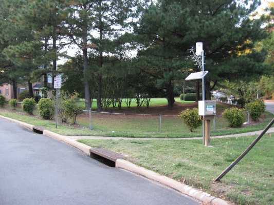
Both Pigeon House and Rocky Branch involve daylighting projects that have or will be addressed in other posts.  An interesting neighborhood daylighting project finished up a couple of years ago near my school, the Fletcher Academy.  The picture below shows the view my students and I have on nature walks at the bottom of Cedar Hills Rotary Park. Three years ago we were looking at the creek disappear into a large pipe.

former pipe entrance for Big Branch_1_1

Today, the adjoining houses have less to fear from flooding, and the biological and geologic interactions missing from pipe existence have been restored to the creek.  One slightly bizarre feature of the project was the city’s purchase and destruction of a house on Mapleridge which sat practically on top of the creek.

site of former house at Big Branch

site of former house at Big Branch

  Big Branch daylighting project_1_1   Big Branch above Mapleridge_1_1   Big Branch re-exposed below Mapleridge_1_1


April 10, 2009

Marsh Creek Meanders

Filed under: Nature Lore, Northeast Raleigh, waterways — Tags: , , — raleighnaturalist @ 3:33 pm

   I had the most nature fun OFF the greenway in a long time, searching the headwaters of Marsh Creek.  This prototypical Piedmont creek – running due Southeast and carrying red clay hills down to sandy flats – ends up dumping its large steady flow of water into a huge wetland at the Yonkers Road section of the Beltline – thus its name.  This lower section is full of treats, and will constitute part two of this post.  Recently I browsed through North Raleigh sewer cuts and subdivisions, climbing up Marsh Creek as I did.  My destination – the headwaters – came as a surprise, and emphasized the fascinating cross section of Northeast Raleigh this creek travels through on its way to Crabtree.

upper-marsh-creek-on-google-map

upper reaches of Marsh Creek on Google Maps

   Marsh Creek actually starts just above the blue line showing the creek on this map – at Sutton Square of Falls of the Neuse, its twin springs cradling one of the busiest – and for pedestrians, one of the most dangerous – stretches of four lane in Raleigh. This major creek, which runs for just over five miles from Spring Forest to its intersection with Crabtree, begins on the west side of Falls of the Neuse as a tiny landscaped pond (next to Northbend), and on the east side as the  rocky ditch seen below.

The little brook picks up size quickly as it travels downhill through Northeast Raleigh neighborhoods – alternating older large-lot subdivisions with newer townhouse projects.  It reaches a large natural area just above Old Wake Forest Road, and that’s where I had such fun.  A wide sewer cut gave access to a scrubby but rich haven tucked between neighborhoods, and I was able to see the deer tracks seen at the top of the post, a deer bedroom of crushed broomstraw, cute little coon prints on a sandbank, and a glimpse of a solemn woodchuck, who quickly scrambled into his hole.

Above, a mossy bank just north of Old Wake Forest Road.  Below is the sewer cut, which travels through several acres of undeveloped lowland.

After crossing Atlantic Avenue, where I found another hillside natural area covered with large, iron-rich boulders, the creek parallels that thoroughfare southward for a couple of miles – once again, touching on large older homes and much denser new developments. Before crossing New Hope Church Road it accepts the run-off from Mini-City to the east, and then enters Brentwood.  Here, the creek is the centerpiece of a long, narrow neighborhood park that runs down the center of the venerable and “transitioning” Brentwood subdivision.  It accepts the water from a neighborhood pond on Huntleigh (doubtless called a lake by the residents), and dives under Capital Boulevard, where we will pick it up the next time we visit Marsh Creek.

upper stretch of Marsh Creek

upper stretch of Marsh Creek

Photo album of upper Marsh Creek


March 19, 2009

Look down, look closely, at Spring’s lovely weeds

Filed under: Central Raleigh, Gems & Surprises, Nature Lore — Tags: — raleighnaturalist @ 2:17 am

 wildflowers-and-dandelion

   Weeds are just plants someone thinks are out of place.  As the season arrives, we can all get some pleasure from these signs of a diverse ecosystem  in your yard.  Take the time to look down and closely!

snowflakes, an early bulbous wildflower

snowdrops, an early bulbous wildflower


snowflake-patch_1_1


blue-wildflowers_1_1

March 2, 2009

March Mad Beauty

snowy-oakwood-trees_1_1

   A late snow and a schoolday off to blog about it!  It didn’t take long to find a snow paradise.  The Oakwood Inn’s block sported the lacy treetops above.  But I was headed to the greenway.  I decided to check out an old favorite – the east end of Buckeye Trail.

   This wonderful view is the edge of the meadow at Buckeye Trail’s east end off Milburnie.  Down this oldest section of Raleigh’s greenways is a vista that provoked one of the first thoughts that originated this project – and it was a book project long before I ever knew what a blog was.  The scene used to look like a cathedral of treetops – but the loss of a huge red oak several years ago changed the look.  What’s left is seen below.

   The missing tree was on the right, and when it was there, I was ready to write a book partly to tell people to come here and take a deep breath.  It is still a very nice section of greenway.  I got to see the baby beeches of a couple of posts ago in a new light, literally.  The gentle snow provided a chance to see water moving across the greenway: in a freshet, and being blocked by the asphalt.  The creek was medium high, which I documented with a current shot of my favorite log-sitting spot.  Once I had done that, I knew I should head over to Hodge Road and take shots of my water level standard spots, which I’m documenting over on the nature projects blog.

snowy-landfill-meadow_1_1

The March snow was mighty pretty!

February 22, 2009

News, Notes, and Promises

Walnut Creek greenway at Wetland Center

Walnut Creek greenway at Wetland Center

 Walnut Creek Wetland Park is approximately 59 acres in size and is located between Garner Road and South State Street and south of Peterson Street in Southeast Raleigh. This site contains extensive wetlands that are located near the downtown urban center and offer an opportunity for the public to easily explore and learn about the value and significance of wetlands for water quality and wildlife habitat.     Raleigh City website

      Construction has begun on  the  Walnut Creek Wetland Center, as reported in NandO on February 11.   The center is the culmination of efforts led by Norman Camp to rehabilitate and protect the wetlands of Raleigh’s Southeast.   This topo map shows the area. The new building, shown below, was designed by Frank Harmon, and will stand six feet above the ground and have a minimal ecological footprint.  An earlier post describes some amenities of this section of greenway.

                         walnut-center-side_1_1                         walnut-wetlands-center-front_1_1

*************

henbit-on-hodge-rd_1_1

    The groundhog definitely saw his shadow, but early signs of spring abound in Raleigh.  Above is henbit between Hodge Road and Crabtree.  Below are red maples blossoms in Oakwood.  There is some cold air coming, so there will be some casualties – though our well-mulched garden parsley and “spinach under glass” on the deck are doing great!

winter-maple-buds_1_1

*************

     One of the exciting things about Raleigh Nature is the wonderful reader input, and I need to follow up and post about more of it.  There’s always a tension between getting around to it and doing it justice.  Here are a few smoldering issues on my draft posts:

First and most behind: responding to the multiple inputs about Lassiter Mill and Raleigh mill history.  From David’s great pics of the upper water, to the amazing Lassiter mill drive wheel images sent by Jimmy, and the history and memories in the comments, we need to return to this subject soon!  I recently got a fascinating inquiry from Carol about the infilled Lake Boone, and the natural springs that fed it, and I want badly to follow that up.  I very much appreciated the mistletoe tips from Meredith, and dream of my “pecans and mistletoe” map of Raleigh!  Scott, a well-known author, my old friend Joe, and Tommy, a songwriter from my past, all greatly helped my still-unfinished exploration of the Pigeon House Branch system and the expensive new Fletcher Water Park that feeds into it.  We’ve been blessed with an explanation of Raleigh Swamp’s waters by Mark, who engineered it, and we’ve been sobered by the plea for resolution from Deborah concerning Ward Transformer’s lifetime of ecological crimes against our area.    I look forward to sharing Patti’s wonderful hawk story, and keeping Michiel in the Netherlands all caught up on Raleigh’s natural scene.  Mentioning these highlights, many thanks to all who have written or commented.  It really helps the work!

**********

Oakwood maple

Oakwood maple

     Chris Crew and Matthew Brown just wrote a wonderful article about Oakwood wildlife for our neighborhood newsletter.They are neighbors at the bottom of the slope at whose crest I reside. Between my house and theirs almost every inch is controlled by humans, and the water flowing downhill is piped or culverted.  Below their house, toward Brookside and Glascock, the land opens up just a bit and has some natural edges. As a matter of fact, Chris is uncovering  the section of Grassy Branch in his backyard, and that’s another topic on my to-do list.  Just across the road, though, is Oakwood Cemetery, a significant oasis for many living things.  According to their article, our neighborhood boasts a huge variety of species. Among many bird species they describe, the cedar waxwing invasion for berries and the long-standing nest of red-tail hawks stood out.  Foxes, possums, and a substantial population of raccoons are described.  There are excellent nature lore tips regarding the colors of 5-lined skinks and owl sounds.  I wish the newsletter were online, but if you have a friend that’s a resident, check it out.  Way to go, Matthew and Chris!

PS:  Hope ya’ll like the revised sidebar.

PPS: Matthew very kindly posted the article referred to above HERE.

February 6, 2009

Pigeon House Branch Part 2

heron-on-rock-outcrop_1_1

     In our previous post, we began with the hidden headwaters of Pigeon House under Cameron Village, and followed it through the the Park Avenue  neighborhood and down West Johnson Street to Peace Street, with a reach-out to Capital at Wake Forest, where the heron above (remember all pictures should click to enlarge) found a rocky spot of wilderness.  This post backs up to Devereux Meadows and follows Pigeon House Branch down to its intersection with Crabtree Creek. An unhappy course, for the most part. The city is trying to rehabilitate it, one tributary at a time. Below is the map of their plan.

pigeon-house-plan-map_1_1

     Pigeon House Branch drains the northwestern quadrant of downtown, gathering water east of the Oberlin Road ridge, bringing it through a series of open stone culverts through the Park Drive neighborhood.  At St. Mary’s Street it enters the Glenwood South business district and is piped under the roads and railroads tracks and down to Devereux Meadows.   The dark blue line is where they want to uncover the creek, and the brown area is where the city wants to create a “Riverwalk”  at Devereux Meadows.  Below we see the creek as it begins its path through this area.

     Pigeon House Branch is under there somewhere!  The creek escapes out a large pipe and continues down between West Street and Capital Boulevard.  About here is where the 42 inch pipe pictured below delivers all the water collected from Fletcher Park and its $700,000 water park!

     Pigeon House crosses back and forth across Capital Boulevard, traveling through wide manmade ditches covered with kudzu.  The water passes over the heron’s rock outcrop and turns northeast.  It dives under Capital yet again and emerges at Watkin’s Grill, a venerable blue-collar breakfast joint at Old Louisburg Road and Atlantic Ave.  Traveling between the north and southbound lanes of Capital, it accepts the water from off the Blount St. ridge (Mordecai to Oakwood), and makes its way through successive parking lots, including Johnny’s Motel, Dunkin’ Donuts, The Foxy Lady and the bowling alley for over a mile, before turning east at Crabtree Boulevard.  Here Pigeon House lends its seepage to a small marsh between it and Crabtree Creek.  It feeds into Crabtree at Raleigh Boulevard, its mouth visible from its bridge over Crabtree as well as the nearby greenway deck.

Pigeon House Branch enters Crabtree Creek

     Pigeon House is decidedly urban and yet makes its way through former waste lowlands turned into thoroughfares, so its riparian buffer is actually less stressed for space than many other creeks in Raleigh.  Thus the heron, thus the opportunity for a high-end greenway at the site where I watched many a minor league baseball game.  Much hope can be found for success with the city’s project to rehabilitate Pigeon House Branch.

pdf. Pigeon House Plan

Pigeon House Part 2 photo album

This is a thorough sequence from Devereux Meadows to Crabtree Creek.

« Newer PostsOlder Posts »

Blog at WordPress.com.