The Raleigh Naturalist

October 4, 2012

Milburnie Dam Removal Moves Forward – Raleigh Nature Approves

The Milburnie Dam on the Neuse River, just upstream of Business 64, is historic, interesting, even fun – but also unhelpful environmentally and surprisingly dangerous.  Having followed the long-planned and much discussed project as an environmental ed. teacher, explored the fascinating history of the structure and its predecessors, and recalled the family trips to the place, I am now ready to see it removed.

The dam was originally built of timbers in 1855 and served a papermaking mill.  in 1900 the current rock structure was built and was used for a gristmill and later for electricity generation.  Dam removal will serve several good environmental purposes: restore natural (shallow, high-oxygen) water flow above dam, promote shallow water species, including threatened and endangered ones, to utilize that stretch, and restore 15 miles of riverine habitat to migrating fish such as striped bass and American shad.  These are excellent outcomes and in and of themselves probably outweigh the loss of black water boating and the probable draining of about 11 acres of wetland currently associated with the dammed water levels, which acres will be offset by Restoration Systems.

Neuse River above Milburnie Dam – a bucolic but unnatural linear lake

But the real clincher is the removal of an inviting, but dangerous and deadly “swimming” area below the dam.  The leading picture (click to enlarge) shows this pool.  It looks quiet, it is shallow at the shore – but if you approach the side of the pool nearest the main outflow of the dam, a powerful undercurrent puts you at real risk of drowning – at least 11 reported in media through the years and probably more.  The YouTube video posted by Restoration Systems explains it all.

I look forward to canoeing this area without needing to portage the dam and I also look forward to watching the restoration efforts above the dam, both by the company and by Nature itself.  The mitigation credits might seem to make the project purely commercial, but another way to look at it is using the laws to finance this expensive project.  Careful work will be needed to avoid dumping pent-up sediment downstream, and above-dam residents will doubtless miss their linear lake but overall the project is  well worthwhile.  If you agree, you can sign their petition here.

Links

Google map of the area

Neuse Riverkeeper analysis of pros/cons

1997 pro-dam article

Facebook pro-dam page

2010 N&O article on dam removal proposal

N&O article about shad migration and the dam

2011 N&O article on revised proposal

2012 North Raleigh News pro-removal article

Charlotte Observer article on dam drownings

YouTube – dog retrieving right out to danger spot

artistic photo of dam with historical caption

Duke University article about removal benefits

Restoration Systems Milburnie Dam page

new video from RS explaining project

Nature Conservancy Report on dam removal(Pdf)

Removal Has Begun

NandO Article November 15, 2017

Key points from above article: It will take some time for recovery of the natural systems, they are lowering the water 6 inches at a time to ease transition for wildlife, most of the restoration credits will get used for SE 540.

August 31, 2012

Buckeye’s Intermittent Closings Remind Us of Its Value

Buckeye Trail, which tracks Crabtree Creek through the largest natural area inside the beltline, runs 3 miles from due east of Raleigh at Milburnie and New Bern to Raleigh Boulevard in Northeast Raleigh. There it meets Raleigh Swamp, the neighborly name for the large shallow body of open water bisected by Raleigh Boulevard just north of Crabtree Boulevard.

But this section will be slightly iffy for the next 12 months as crews work on renovating the sewer lines that also track the creek, usually right next to the greenway. I was startled to see the sign, then realized the closings were going to be based on immediate project need, and that people were utilizing the trail as usual that very morning.  I thoughtfully and slowly biked the entire length, stopping to check on some late summer blooms and the condition of the Rocky Overhang, my sentimental favorite spot from childhood jaunts to Crabtree from Gatewood, my east Raleigh neighborhood.  Raleigh Nature has looked several times at this oldest leg of the Raleigh greenway, but a brief catalog of its wonders seems in order.

First, the old landfill meadow at the Milburnie entrance is apparently not going to get mowed anymore – there are trees of several years age filling up the back third.  The rest is filled with microstegium, stilt grass or bamboo grass: by any name, as nefarious an invasive species as kudzu ever was.  Perhaps the landfill monitoring period is over, perhaps they will bushwack these trees eventually.  Minus the stiltgrass, it was a rich meadow. Two pairs of comparison pictures below (click to enlarge).


Just past this meadow is a large stand of young beeches standing in a floodplain.  As you leave them and approach Crabtree, the sewer line cuts under the greenway on its way to Milburnie Road.  This is where the work is starting.  Necessary work, plus they are protecting the terrain by mulching with what they grind – at least for now. I actually like the new openings and hiking possibilities created by these cuts. Until the poison ivy gets established.

Sewer work at eastern end of Buckeye Trail

I can understand the need for the work.  Above is a section of sewer line inundated by winter floods, seen from the elevated greenway by the pump station at the dead end of Crabtree Boulevard.  This flooding is natural and used to happen with more regularity before the construction of flood controls upstream.

My first nature stop on the bike found me stumped.  I knew I had encountered the triangular, papery fruits and their name, but couldn’t put the two together.  A field guide finally revealed it as American Bladdernut.  Right beside it, pictured below, was a plant I did remember – nettle, whose thin hairy needles inject a stinging but mild toxin that can serve as relief from arthritis, a fact I learned from long-time NC Wildlife photographer Ted Dossett, who used to walk Buckeye almost daily.

Further upstream, the creek takes a big turn, away from Yonkers and toward Milburnie, creating The Point, a triangular beach looking across at the eastern edge of the Marsh Creek marsh.  This broad wetland stretches for about a mile below Yonkers Road and the Beltline. This is a great spot to see the larger birds.  Buckeye is “the birdiest greenway trail” according to the Wake birders’ guide.   As I headed upstream toward Rollingwood, I stopped at a very special place where a big beech uses a rock formation to hang right over the water.  Its roots create undercaves that we used for caching supplies back in grade school – toilet paper, BBs, and matches.  If we left anything long, it would wash away in high water.  The spot beside the beech is pictured below in very low water.

Crabtree on east Buckeye Trail

I continued my ride, briefly surveying the Rocky Overhang, still draped by a large fallen Sycamore that came down across the creek after Floyd in 1999.  Fallen trees are a big part of changes in the creek bed, and the sycamores are notorious for taking up doomed positions on the creek bank.  Sometimes they lean precariously for years, and I will never forget the Buckeye walk when a really large, vine encrusted hickory decided to slowly but powerfully lay itself down into the creek as I walked past.  It was an amazing sound – non-violent but death-dealing forces of gravity and release.

Glimpse of the rocky overhang on Buckeye

Halfway up the trail is the park at the bottom of Rollingwood, where the greenway leaves the creekside and edges the neighborhood. The creek formerly split, creating an “island” which edged the greenway, but that streambed is dry now.  Shrubs and young trees cover the large sandy beach that existed at the head of this island in my childhood.  Unforgettable memories of camping on that beach (even then the water flow was seasonable), drawing a large square in the sand, and boxing with gloves!  It was my first and only experience with that.  The stalwart group of boys with whom I had ingratiated myself screamed and exhorted like we were Lords of the Flies.  We walked the creekside ( no greenway on those days) all the way up to Downtown (Capital) Boulevard to go get milkshakes late that night.  Fun times.

Now the creek goes straight past the former island, and the sand piles up just short of the former split.  Above is Sandy Beach, a favorite spot of my own children (though I never allowed them to camp there).  From here up to Raleigh Boulevard is a straight stretch that is close but not connected to my old gatewood neighborhood at the ends of King Charles and Marlborough.  Those streets took major damage from our April tornado disaster, and the damage shows from and includes the greenway.


This stretch is now VERY sunny and the flowers will make use of that.  A selection is below.  Be sure to visit Buckeye soon!

Jerusalem Artichoke, which has an edible root

August 21, 2012

Crabtree Canoe

Filed under: About & reflection, Central Raleigh, Crabtree Creek, Nature Lore, waterways — Tags: , — raleighnaturalist @ 5:23 pm

Eastern Tiger Swallowtail (click to enlarge)

One of my favorite ways to really plunge into nature inside the Beltline is putting a boat in above Lassiter Mill.  We took my Mad River solo and our blue tub of a kayak and made it up to North Hills Drive in reasonably high water.  That’s just about the first place it’s an issue: the water below Yadkin Drive is always as high as the dam and presents a long narrow lake-like stretch for easy canoeing.  Upstream, just below Glenwood Avenue, the creek is banked with a slate outcrop, hinting at the graphite, or plumbago lead, which is found higher up the slope.  The trip from the Lassiter Mill dam to Crabtree Valley Mall is possible in high enough water; round trip is less than 3 easy hours.

Spanish Moss on Crabtree Creek at Marlowe Drive

rock outcrop on Crabtree Creek at North Hills Drive

Blue heron in flight on Crabtree Creek

Cara spotted the blue heron standing on the side downstream on our return trip.  I was able to get my camera ready as i drifted into his view.  It was a pretty lucky shot, but you can see i was tracking him with the camera at least a little.  The butterfly was sipping from the mud on a small pebble beach where we rested.

***********************

Having retired from fulltime teaching, I am developing my free-lance activities and hope that gigs as the Raleigh Naturalist will be a part of that!  I have taught Environmental Ed with emphasis on local ecology for the last ten years, and presented to the Bain Project artists group and the Wakefield Middle School Ecology Club.  If you know a way to keep me busy sharing about local waterways and nature lore, let me know.  Thanks

John Dancy-Jones  email: paperplantpressATyahoo.com

July 15, 2012

Flowering in 2012

Filed under: About & reflection, Gems & Surprises, Nature Lore — Tags: , — raleighnaturalist @ 7:14 pm

What a wild, wet and wonderful spring!  I retired from fulltime teaching and we had a fantastic gardening spring.  Here are a few goodies from the garden and my greenway walks.  The violets above are one of the first blooms you will see; they are pollinated by ants!

 The big meadow on New Bern Avenue was filled with buttercups.

a stand of purple vetch in Chapel Hill

Red clover, like all legumes, adds fixed nitrogen to the soil with microbial help.

An escaped spider flower on Buckeye with tornado damage in background.  We will be back soon with Buckeye tornado recovery and much more.  in my (early) retirement, I am seeking gigs with book arts, educational services, and of course appearances as the Raleigh Naturalist!  let me hear from you:  paperplantpress@yahoo.com

Enjoy your summer!  Best,  John

photo album of spring flowers

December 7, 2011

Super Spider Passes To That Great World Wide Web In The Sky

Filed under: Gems & Surprises, Nature Lore — Tags: — raleighnaturalist @ 10:59 pm

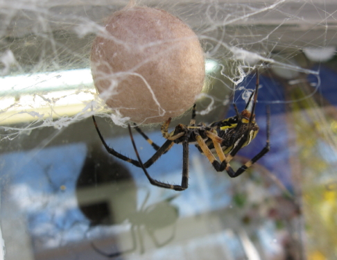
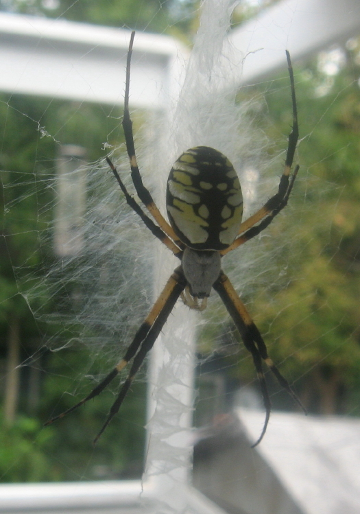
Today, December 6th, after a kind of magnificent  life, this marvelous specimen of  ariope aurantia finally gave up the ghost.  We watched her all summer and fall (recall that winter doesn’t even start until December 20th) and were amazed to watch her lay one eggsac after another.  Just after laying the last one, she was very skinny, as seen above.  Usually, she was plump and very pretty.

Admittedly, she got some feeding help from us. I loved capturing various insects and experimenting to see if they would catch and stay in her web.  Grasshoppers almost always too heavy, but some crickets and almost all stunned houseflies were accepted with swift gratitude and wrapped with alacrity.

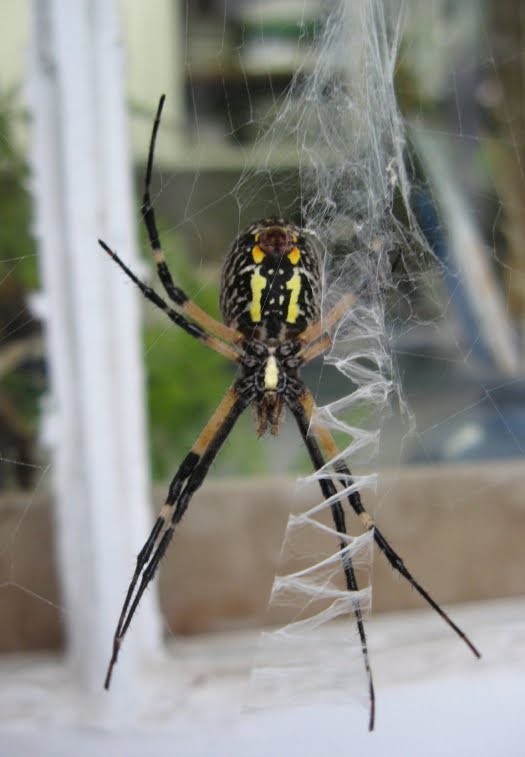
garden spider from underneath

Ariope is a member of the writing spider family, which nickname comes from the white cursive crosses that strengthen the middle of their web.  Charlotte, the most famousest writing spider of all, was a barn spider, a close relative.  These spiders weave a large radial web in a partially sunny spot and sit back, awaiting ambush time.  Our writing spider spent most of her time stock still directly behind her central reinforcements.  When something landed, she was very nimble and rapid in mummifying her prey.

This spider lived a very long time and we really enjoyed watching her all summer.  As fall’s days lengthened, we realized she had laid not one but two egg sacs.  I had given her several “treats” of crickets or other bugs, but we were still impressed.  Then, as the light freezes occurred, we became very aware of her continued existence, and watched as she laid a third and then a FOURTH egg sac.  The last one was light and delicate, but we will certainly leave them all in place and hope for more arachnid entertainment next year!


 Count ’em – four… 1,2,3,4!

Raleigh Nature Photos Fall Spider Album

August 4, 2011

Torn Still, by the Tornado

Filed under: About & reflection, Central Raleigh, East Raleigh, Nature Lore, South Raleigh — Tags: , — raleighnaturalist @ 6:09 pm

Tornado Damage on Marlborough Road 3 Months Later

The April tornado is 3 months past and yet unredressed signs of it  are still scattered about Raleigh.  I haven’t posted in all that time, finishing the school year and having a summer  swallowed by book arts, as I made paper, printed, and started a Paper Plant blog.  Before covering the rich naturing Cara and I have done in spite of my new blogging obsession, I wanted to address the previous post and show that East and Central Raleigh are still reeling as fall approaches.

The tornado totally changed the visual landscape of my regular bike rides.  Looking from the back lower corner of the federal courthouse campus at East and Hargett, an entire city block was just razed.  From that spot on the shoulder of Raleigh’s cap, it now feesl as if you are looking southeast straight down into the coastal plain.

Martin and East Street downtown after April tornado

Mount Hope Cemetery April 16, 2011

Mount Hope Cemetery didn’t get covered in the first post, but a visit last week revealed many of the same sights I had photographed but not published in April.  It and City Cemetery are still closed.

click on cemetery pics to enlarge


old cedar torn by April tornado at Mt Hope

Marlborough Road in East Raleigh still looks like the disaster zone it is.  My old childhood creek runs beside it and has become a tangled mass of dead trees scattered with stagnant pools.  The city is making plans to clean it up, but it will be a while.


torn pine on Marlborough Road

Marlborough Street hit close to home, but the damage is widespread.  The Raleigh Public Record provides this info from the city’s waterway inventory:

The report stated that a total of 1,436 trees were found damaged as part of the inventory. The areas with the most debris were areas near Beehnon Way and Tryon Road, Marborough Road and King Charles Road, Skycrest Road and Capital Boulevard, and Valley Stream Drive and Louisburg Road.

RPR did a good general look at Raleigh damage in this post.  The damage to nature is most relevant to this blog, but we felt very lucky after trees were decapitated 30 yards from our house, and we had many friends who sustained damage anywhere from annoying to catastrophic.   Many of them have praised Chris Crew of FEMA for his TLC to friends in this situation.

Nature knocks!!!  Sometimes hard.  Take care of yourself, now.

Washington School and downtown from Mount Hope Cemetery

« Newer PostsOlder Posts »

Create a free website or blog at WordPress.com.