The Raleigh Naturalist

September 16, 2010

Mushroom Madness

Filed under: Central Raleigh, Nature Lore, North Raleigh — Tags: — raleighnaturalist @ 3:13 am

Heavy (though quite sporadic) rains have brought a veritable plethora of mushrooms this summer. Below is a taste – the whole set of them is over on the Natural History of Raleigh Photos.

These twin babies, found in Cedar Hills Park, might get much bigger.  Check out the grapefruit sized monster below, which was part of a faerie ring at my school, The Fletcher Academy.

North Carolina’s Piedmont and Coastal Plain boasts over fifty species of mushrooms, according to the Duke Mycology page.  I would not begin to identify positively any of these, but they are fun to examine and track as they release their spores and decay.

The shelf or turkey-tail mushrooms above are also from Cedar Hills Park, contiguous with the TFA campus and often visited by “Mr. DJ” and his students.  Below is an ancient, algae encrusted shelf mushroom from the other end of my life’s spectrum – the parking lot at Sadlacks!

The faeries must have had a wild time in THIS circle.  Found in the Capitol Square in downtown Raleigh.  A reminder: mushrooms form these circles because the parent organism, consisting of thousands of intertwined undergound threads, has a central core and radiates outward in all directions.  The mushrooms we see are the spore-producing “fruits” of that organism.

Mushroom photo album

Duke photo site for NC Mushrooms

July 2008 Mushroom post

August 9, 2010

Marsh Creek Park – no relation to the creek!

My Google search hits revealed someone looking for Marsh Creek Park, and having featured the creek, I thought we should visit the recently expanded park on New Hope  Road.  The name of the park derives from Marsh Creek Road, which begins just across New Hope and goes straight down to Marsh Creek.  But New Hope Road is a ridge between the Crabtree and Neuse watersheds, and the waterways in the park itself- mostly out of sight without hiking – head north through a large woodlot visible from Southall Road toward the Neuse, just a mile distant.

All pictures click to enlarge

The hot new feature in the park is the skate park, which was featured in a several media articles and is quite popular.  The large recreational center is fairly nondescript, but was constructed with green principles, as described in detail (along with other park amenities) at Get To Know a Park.  Beside the center is a large Piedmont prairie, and the extensive parking areas are adjoined by interesting ecotone areas, though the stilt grass is spreading fast.  The terrain is typical of Piedmont farmland after 50-60 years – upland pines and chestnut oaks with a slope down to loblollies, shrubs, and water.


My favorite find at Marsh Creek Park was the rain garden just below the skate park, with a wonderful stand of Joe-Pye-weed, as seen below.  I’ve only seen this handsome plant in the mountains, but it is listed in the Piedmont.  Somebody did a great job with this rain garden.

 To make the park’s name issue a little stranger, there is a really nice marshy area below the lower field, which leads to a very pretty old farm pond. It appears to have a fishing shack on the edge.  The expansion doubled the usable space of the park, but most of the acreage is still heavily wooded and ripe for exploring.  Overall, a versatile park with something for everyone.

photo album of Marsh Creek Park

Google map of Marsh Creek Park

*************************

This section of Raleigh – the ridge of New Hope with the valley of the Neuse to the northeast and Marsh Creek’s drainage to the southwest – is of geologic interest because it is one of the transitions between the Piedmont and the Coastal Plain.  If you take Buffalo Road off New Hope, for example, you immediately start seeing sandy soils.  Just down the road from Marsh Creek Park, Skycrest Drive heads down to good old Raleigh Swamp.  Before it gets there, at the intersection with Trawick, you can find this meadow of wildflowers.  It is being sorely threatened by kudzu vines.  We will keep a closer eye on invasive species in our future nature travels.

The kudzu is right behind the dandelions.

An impressive array of wildflowers fronts the dandelions by a slope.

These blackberry flowers are beside Skycrest. This was in May, but this summer I picked almost ten quarts of these things!  They are everywhere.

Kudzu making its way toward the wildflowers.

Kudzu go’ne eat us all!!

February 13, 2010

Snowy Tree Blocks Buckeye Greenway

Downed Tree on Buckeye Trail in East Raleigh Blocks Snowy Greenway

High winds on top of rains toppled quite a few trees in the area, including this pair of medium specimens lying across the Buckeye Trail greenway at the bottom of Suicide Hill, as it was labeled by the cross country runners who used the greenway before its recent upgrade.  Lowered grade, I should say, since the cruelest, steepest stretch was lengthened and terraced to bring this oldest section of greenway into national codes.  Suicide Hill climbs a rugged quartz and sandstone outcrop that forms the Rocky Overhang, one of the seminal pillars of this blog, as it represents my favorite Crabtree hangout.

Raleigh Nature’s  “scoop” on this downed tree is wonderfully fitting as I get back to basics after a bit of hiatus. Enamored of the Ken Burns series, engulfed by teaching responsibilities, and constantly lured by my current intellectual fling, Ray Johnson/Black Mountain/mail art, I have wintered in the blog a bit, but could not resist the lovely, harmless 3 inch fluff that ended on a Saturday morning.  So I took off for my favorite sight-seeing greenway, Buckeye Trail from Milburnie Road. At the edge of Rollingwood, Crabtree has carved out a tall bluff (at least for this part of Raleigh) and under this 40 foot hump the creek has gouged a fishing hole complete with overhanging boulder shelves from which to cast.  Drowning worms  and hauling up the occasional catfish or bream at the Rocky Overhang is a family tradition for me as child and parent.  Heck, I took dates there, I loved the place so much. I was slightly horrified the day soon after Hurricane Floyd came through to see that a very large sycamore tree across the creek had fallen directly onto the Rocky Overhang, and for several years it was too tangled to get down there.  The kids and I mourned but also learned some valuable lessons about how Crabtree changes over time.  Now that tree has finally eased its way mostly into the fishing hole (after forming a hideous litter trap for more than a year on the way in) and the boulders have cleared somewhat.  In the spring, we’ll take a look, but for now here are more snowy scenes from Buckeye Trail, a gall tale, and a link to the photo album from my snow walk.


The baby beeches we have admired before looked nice mixed into the snowy pines.  Below is the scene at the beginning of Buckeye, where Longview Branch parallels Milburnie as it slides into Crabtree.


Below is a  ditched brook that brings water from the slopes of Rollingwood under the greenway and into Longview Branch just before it reaches the creek.

Just off  Milburnie is the old landfill that now forms a rich meadow, a favorite browsing place of the numerous deer living in Crabtree’s floodplains in East Raleigh. 

Below are some deer and coon tracks in the February snow.

The stump of a large oak I miss very much looked just as sad in the beautiful snow.  This tree had the largest gall I ever saw – a triple-grapefruit sized lump that housed the larvae of box elder beetles.  Greenway maintenence brought it down – I doubt the gall was a factor, but I’ve wondered.

the oak gall

Photo Album of my snow walk


December 27, 2009

The Most Dangerous Species Grudgingly Groks Predators

Filed under: About & reflection, Exotica, green initiatives, Greenways & Parks, Nature Lore — Tags: , , — raleighnaturalist @ 9:40 pm

Wolf Face by Photos8

The wolf and bear are perfect bookends for a volume-sized summary of Ken Burns’ enormous film series about the national parks.  We came to this country and decimated the vibrant diverse native human population, mostly through disease, and then scoured the country for dangerous animals, paying bounties to cleanse the land of wicked ferocious predators.

When it came to the emerging national parks, it was no different.  Only until Alaska provided a landscape  huge and truly untamable did wildlife inside the parks begin to hold equal sway with the natural landscapes.  Many park officials recognized the vital role of wildlife all along, but wolves and bears were removed nonetheless.  Now we are slowly coming around to a national policy that recognizes the irreplacable contribution large predators make to an ecosystem.

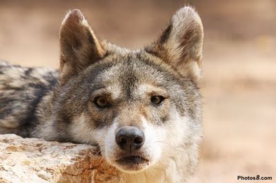
The wolf –  free, wild and dangerous – is portrayed as the symbolic epitome of our estrangment with nature in the final segment of Ken Burn’s film on the national parks.  Wallace Stegner’s ideas frame the parks as a survival necessity – not just  for “the trumpeter swan and bison… but us.”  Stegner knew we needed “sanctuary from a world paved over with concrete by the raw engineering power of the 20th century.”  The ultimate sanctuary, in park terms, was Alaska, where park superintendent Adolf Murie championed the wolf as the crowning jewel of “a glimpse of the primeval.”  From Alaska came the research and experiences that brought about re-introduction of large predators into the continental U.S. parks.

Murie wrote a pro-coyote report concerning Yellowstone that almost got him fired – and did get him packed off to Alaska, where he helped establish the greatest U.S. nature preserves of all. In 1867 “Seward’s Folly” was derided as too remote to be valuable.   111 years later, Morris Udall and Jimmy Carter culminated Alaska preservation by signing off on 17 national monuments comprising 56 million acres (in Alaska communities, all hell broke loose about the feds stealing the state). The Alaska Coalition that facilitated the legislation represented the largest grassroots conservation effort in history.

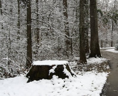
Denali National Park in Alaska

The final segment of National Parks: America’s Best Idea folded an eclectic concoction of historical and policy facts around Alaska and our large mammals.  The crucial theme of preservation balanced against use is applied to various projects as well as the pure numbers.  By 1950, National Park visitors reached 32 million in number: by just the mid-50’s that number hit 62 million – 98% by car. These numbers would have crushed any system, eventually even Alaska, but for the strong atmosphere and policies created by National Park Service professionals, developing park policies based on scientific research from the emerging academic discipline of ecology. Aside from limiting roads and managing tourist hordes, one of the toughest policies to implement was the simple directive:  Don’t feed the bears!  Though wolves were extirpated from Yellowstone, the “cute” black bears were fed and habituated to tourists for years.  We can minimize our contact and effect, but we can’t really avoid interactions with wildlife, and interactions with dangerous predators require intense management.  The thorny problems inferent in the situation are not least of why Dayton Duncan emphasizes that “each generation must re-protect these lands.”

Burns and Duncan are stalwart in offering breathtaking proof of the value of such work.  They also did yeoman’s work in coverage of the National Park Service’s vast mission, which now includes hundreds of National Monuments and National Historic Sites.  This final segment also continued the thread of appealing human interest stories, from fish guiding Biscayne Bay to home movies of Echo Park.  But I was ready for the end, which came beautifully with the 1995 release of wolves into Yellowstone.  The elk are all the better off for it, and the creekside willows they eat are again thriving.  We can get it right sometimes in this great country, and the national parks are a great example.

All Raleigh Nature posts on the Ken Burns film

PBS website for National Parks: America’s Best Idea

*************

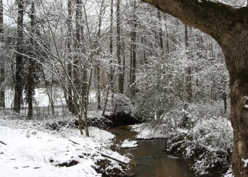
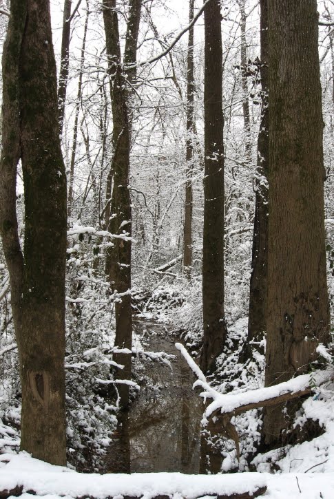
Wildlife in Raleigh is regaining some small aspects of full-fledged wilderness with top-of-the-chain predators.  “Black bears are here to stay,”.  a NandO story just proclaimed.  “Coyote Pyrotechnics at RDU airport” was the title of the WRAL story relating that 2 regional jets carrying about 50 passengers each struck coyotes in a recent week.  Raleigh Eco News has thoroughly documented the establishment of coyotes in the Triangle.  Can we co-exist with coyotes? Probably so, because they are quite discreet. Can we, through the 21st century, co-exist with wolves, mountain lions, and bears of all kinds?  It remains to be seen.

coyote

The Daily Coyote

is an amazing record of human co-existence with a very personable “domesticated” coyote.  Very thought-provoking!

December 8, 2009

Lassiter Mill Shows Crabtree at Strength


 The previous post talked about Crabtree Creek’s tendency to flood – last week again brought heavy rains over the Crabtree watershed that brought the creek up to the edge of  its large channels.  This also sends an impressive load of water over Lassiter Mill Dam, as seen above.  I shot a video clip of the rushing water from below the tailrace, as linked below.

video- Lassiter Mill dam at high water

What happens at Lassiter Mill vividily and intensely demonstrates what happens lots of places more gradually – the deposition of new soil by spreading flood waters.  This is an essential part of the natural systems of the Piedmont, and our flood control measures prevent the process from periodically enriching the soil with a layer of mud and silt – though the process continues to work just fine in the “waste” lowlands that remain in Raleigh.  An astounding number of these lowlands have become major thoroughfares – roads built relatively later in Raleigh’s long history, on land left undeveloped due to the floodplain.  The Beltline follows the low contours of Walnut Creek, House Creek, Crabtree Creek, Big Branch, Marsh Creek and then Walnut Creek quite precisely as it curves from Cary’s Buck Jones to Glenwood, over the crest of North Hills, and around southeast to Poole Rd and then Lake Wheeler Road.  The water is piped and rushed away from underneath these elevated roadways, carrying its minerals with it.

The suburbs and businesses near these roads certainly don’t need the sediments!  But the stuff has to go somewhere, and these days there is a lot of stuff.  When streams are buffered by a healthy band of water-loving trees and shrubs, erosion material is reduced greatly. In central Raleigh, Crabtree is clogged with lots of dislodged soil, construction materials and unnaturally exposed red clay.   But the deposition process is a vital one, and it gets exaggerated at Lassiter Mill, where the water brings its load of suspended minerals hurtling over the dam and then slows and spreads its course below.  As it slows, it drops much of its sediment load.  The area below Lassiter Mill changes yearly as the creek alternately erodes and builds up materials.  Check out the new load of sand deposited by the recent high waters.

There are several caveats and complications to consider.  This is a large load of sand!  Eight or nine inches at a dose, and not the silt and mud that the plants would prefer. But nature adapts, and the Lassiter “beach” is fun to browse, with a wide variety of weeds incubated from the loads of  soil and debris.  The silt and sand that currently washes down Crabtree is terribly unhealthy for the filtering mussels and other delicate aquatic life.  The red clay that paints Crabtree brown is such a strong pigment that Crabtree often changes the color of the Neuse where it conjoins.

Crabtree builds itself “shoulders”  as it repeatedly overflows, dropping the heaviest particles first as the water disperse into the floodplain.  This is why Crabtree presents such a tall ditched appearance as above at Hodge Road.  The plants arrange themselves in an orderly sequence beside or on top of these embankments according to their tolerance for flooding.

The next time Crabtree rises over it’s banks, put on your rubber boots and check out the glistening mica-rich silt that covers the greenways before the city sends its scrapers to clear it off to the side, where it enriches the plants as well as any landscaper’s mulch.  You are walking in the stuff that makes our floodplain soils, a rich muck delivered by the yearly floods.

Nature.org floodplain info

BBC floodplain story


October 4, 2009

Walnut Creek Wetland Center opening

Walnut Creek Wetland Center_1_1

Numerous city and parks officials joined a large crowd of citizens for the ribbon-cutting ceremony celebrating the opening of  The Walnut Creek Wetland Center.

Mr West and Dr. Camp listen to Mayor Meeker

Mr West and Dr. Camp listen to Mayor Meeker

Dr. Norman Camp listened to Mayor Charles Meeker, city councilman James West and park officials speak about the new center.  Then the founder of Partners for Environmental Justice , and the man who sheperded this project into being, got up and spoke of the center as a shining new gem in Raleigh’s crown,” as quoted on Raleigh Eco News.

Walnut Creek crowd_1_1

The crowd listened attentively as the benefits for Southeast Raleigh as well as the ecosystem were described and the many supporters and participants were thanked.  Then they were rewarded with a magnificent poem written for the occasion, by Christopher Rowland, a Southeast Raleigh native who wows the crowds at Artspace’s Stammer under the name Langston Fuze.

Chris Rollins reads_1_1

Click here for a 1 minute video clip of the poem 

for the full text of the poem, see the post at

Raleigh Eco News

wetland musicians_1_1

Musicians entertained on the “longest back porch in the Southeast,” and Erin Sterling, architect of record for the project from Frank Harmon Architecture, explained the details of the green design.  The building is 230 feet long and narrow so that all rooms get light from two sides and often three.  It is sloped up to the north and shelters its southern exposure with the long low porch roof.  Raleigh’s final budget did not allow for the planned rainwater cisterns, but they can come later and the gutters now direct into bioretention areas – long rain gardens that surround the space.  The building is on stilts and allows natural water flow under it – important in this floodplain.  Recycled lumber and building materials were used when possible, and native plantings surround the site.

Walnut Creek Wetland center flower bed

Walnut Creek Wetland center flower bed

On the other hand, several of us gazed from the wonderful porch at a huge stand of Microstegia (bamboo or stilt grass) just at the edge of the construction clearing and bemoaned a bit the vast future work entailed in continued future protection of this site and may others in Raleigh.  The educational center will raise awareness of those issues, and provide a much needed amenity and attraction in this part of Raleigh.

Thanks for all your work, Dr. Camp!

Thanks for all your work, Dr. Camp!

The longest porch in the Southeast

The longest porch in the Southeast

Walnut Creek sign_1_1

« Newer PostsOlder Posts »

Create a free website or blog at WordPress.com.