The Raleigh Naturalist

September 16, 2013

Excavating East Raleigh

Filed under: East Raleigh, Greenways & Parks, waterways — Tags: , , , , — raleighnaturalist @ 6:17 pm

excavating Longview

The massive sewer work that stretches across east Raleigh is accompanied by a different kind of excavation.  Above is upper Longview Lake from Bertie Drive below Enloe High School.  For years silt from construction on the hill behind it has steadily filled this section.  Now they are dredging the silt out and restoring the pond.  The lower section is larger and much more healthy.  All our our lakes and ponds gradually fill in with plant matter and eroded soil, but this happened too fast and I am glad they are fixing it. Now if they would just re-allow fishing!  More pics below – click to enlarge.

Longview low spotupper Longview Lake

Just down the road from this, where Milburnie hits the extension of Sunnybrook across New Bern, the old beginning of the Raleigh Greenway, Buckeye Trail,  will soon be extended all the way down to Anderson Point, where Crabtree hits the Neuse River.  Very exciting! Right now the spot is part of the huge sewer work alluded to in the first sentence.  The first picture below is looking toward Milburnie and is actually the path of the new extension.  The new greenway should be in place this spring.

future greenway to the Neuse

sewer runs under greenway at rocky overhang

Up the trail toward Raleigh Swamp, a fallen tree has created a dump of sand that makes quite a beach.  All the sand and silt seen in this post is terrible for the mussels and microfauna that inhabit the creek’s bottom.

fallen tree creates sandbank

Bonus pic: deer tracks where  I climbed down to view the sandbank.

deer prints at Crabtree

all posts on Buckeye Trail

April 9, 2013

Raleigh Swamp Shifts with Sewer Project

sewer project meets Raleigh Swamp_1_1

The huge sewer project – seen above at Crabtree Boulevard looking toward the Mouth of Pigeon House Branch – has introduced a new geography to Raleigh Swamp, my name for the body of water off Raleigh Boulevard just north of its intersection with Crabtree Boulevard.  The large wooden causeway and gazebo were wonderful additions to the meeting of Buckeye trail and Middle Crabtree Trail.  Now the sewer project has dictated a large dam and concrete bridge section that bisects the “swamp.”  I know a real swamp is moving water with trees, but this lowland was dotted with dying trees for years after its establishment, and the snags of many remain as resting spots for herons, cormorants, and the occasional wood duck.  Canada geese and mallards breed here, while the turtle population has grown to a staggering level.  It is all thanks to the beavers.

Raleigh Swamp_1_1

When I first returned to Raleigh from Greensboro in 1980, they were starting to build the Raleigh Boulevard bridge over Crabtree Creek.  The caissons they used to sink the bridge piers were impressive, and Dulci, my black lab and I kept a close watch on the process.  At this time, the “Raleigh Swamp” area was a sometime wetland dotted with scrub trees and ribboned with the paths of homeless campers. Like many floodplains in the area, it got wet in the winter but stayed dry most summers.  The Boulevard project changed that, with a little help from the local beavers.  The transition was clarified for me by a city engineer years later through a comment on this blog in 2009.  I quote it in full below:

Was reading through your website after getting the link from the Fletcher Park Watergarden and noted that the “pond” off Raleigh Blvd was one of your favorite places. I thought I’d mention that this was actually a City of Raleigh mitigation project I designed many years ago to offset the environmental impacts from the construction of Raleigh Blvd. It was supposed to be a wetland but the beavers in the area had a different idea as they immediately blocked the culverts under the roadway causing the water to back up and form a permanent pond. Can’t say I object to the result of their efforts. It’s a beautiful spot and the addition of the greenway has made it accessible to the masses.

Mark Senior, PE, Senior Project Engineer, Water Quality Section, Stormwater Divsion of the City of Raleigh Public Works Department

The beavers have indeed made great use of the spot with several different lodges in different spots.  New generations of beavers tend to build their own lodge. Until I got the info from Mark, I assumed the construction of the road bed dammed up the water.  The water on the east side of Raleigh Boulevard acts more normally – rising and falling with rains and seasons.  I know the beavers play over there as well, because you can see their slides into Crabtree Creek as you walk down Buckeye toward Rollingwood.

Raleigh Swamp sewer dam_1_1

sewer pipe dam looking toward Crabtree_1_1

sewer dam bridge on causeway_1_1

Getting back to the sewer project, you can see above the large dam across the wetland.  This, along with the upgraded line in general, has changed the location and depth of water around the edges of the marsh (which is technically what it is).  Some areas are now totally dry – at least for now – and some are substantially deeper.  No real harm done, since nature and time effect these kinds of changes all the time anyway.  but the newly dry areas, which were beaver playgrounds until now, will undergo an interesting and specialized kind of succession – new plants adapted to the new conditions will take over.   It should be a fascinating transition and Raleigh Nature will keep an eye on it.  Below are shots of the stranded areas.

dry area behind sewer dam_1_1dry wetland near stairs of causeway_1_1new dry area at Raleigh Swamp_1_1

The beavers had a lodge at the very spot pictured below years ago but abandoned it during the drought of the early 2000s.  Perhaps they will rebuild now that the water situation is restored!

former beaver lodge water restored!_1_1

All posts on Raleigh Swamp

previous post on this sewer project

March 5, 2013

Paving a Little Paradise: Marshall Additions Highlight and Loom Over House Creek Greenway

Filed under: Greenways & Parks, waterways, West Raleigh — Tags: , , — raleighnaturalist @ 4:31 pm

Marshall Park sign_1_1

The sign announces a new park along the recently opened House Creek Greenway.  But dominating the scene is a new housing development, which turns out to belong to land sold to developers by the same Rick Marshall that provided Marshall Memorial Park – a set of amenities arranged along the lower part of the new trail.   The plantings and side trails are nice, but are dwarfed by the impact of these huge retaining walls and future buildings right in the riparian buffer that protects the creek.  An excellent article in the Midtown Raleigh News spells out the tit for tat – planning approval in exchange for a greenway easement to get the trail through this steep, heavily wooded section. (In his comment on this post, Mr. Marshall states that the land and improvements were offered unconditionally.  I got my stated impression not only from the article but from a conversation with Vic Lebsock, head of greenways, about the project – my apologies to Mr. Marshall).

Marshall apartment project_1_1Marshall retaining wall_1_1

These walls are REALLY big!  It’s a rough loss of permeability for this sponge of a slope that slows Blue Ridge water as it makes its way down.  House Creek already has orange algae blooms in the meadow where it meets Crabtree.  The greenway section will still be lovely, once the construction ends, and they have already installed rip-rap troughs to handle the increased flow into the creek.  Below is a look at the Marshall Memorial Park proper, and a tour of the new trail.

Marshall park gazebo and beach_1_1

Side Trail up slope at Marshall Memorial Park

Side Trail up slope at Marshall Memorial Park

new plantings along House Creek Trail

new plantings along House Creek Trail

The rich but tiny linear park is dedicated to Lt. Col. George F. Marshall, a war hero whose son is a Raleigh businessmen.  It contains a side trail to a sandy beach on the creek, a longish side trail up the side of the hardwood slope below Ridge Road, a gazebo area, and some nice trailside plantings.  This is a rich bottomland forest which only lost a portion of itself when the Beltline was built.  The steep slope of Ridge Road’s ridge creates a quick succession of trees toward upland species.   I can remember when some lucky woodlot-dwelling horses were living on this slope in the 60’s.  They were visible on the east-bound Beltline approaching the Ridge Road ramp.  The wooded floodplain has long been valuable to naturalists and neighbors, but inaccessible to most – until the House Creek Trail opened.

bottomland woods by House Creek_1_1

Ridge Rd greenway connector_1_1

House Creek Trail has an inauspicious start indeed, at the Ridge Road Connector.  Directly across 440 and left is the Vet School and the Faculty Club golf course – the headwaters of House Creek.  To the right is the Museum of Art campus, whose greenway follows House Creek, then up to the gorgeous pedestrian bridge over 440.  From here the trail finds the Meredith College greenway.  The connector was built after Meredith starting locking the bridge access to maintain their campus security.  Neighbors raised a hue and cry, having lost evening access to the Museum trails.  Now Meredith can lock at the tunnel seen below, which was originally built under Wade Avenue to give the campus access to their equestrian facilities.

Ridge Road Connectors meets Meredith greenway

Ridge Road Connectors meets Meredith greenway

House Creek Trail officially starts at the pedestrian bridge, and finds the creek at Horton Road, where it borders an apartment complex. As soon as it crosses Lake Boone, the rich slopes offer stunning nature sights.

House Creek Trail officially begins here_1_1House Creek Trail beside Lake Boone_1_1

Ridge road tributary joins House Creek

Ridge Road tributary joins House Creek

House creek Crosses the Beltline

House creek Crosses the Beltline

House Creek Trail crosses 440 to the outside just below Glen Eden.  The park of that name is an excellent central spot from which to explore House Creek.  As you approach Blue Ridge Road and Crabtree Valley, the Marshall Memorial Park offers its amenities and looming walls.  After being piped for its final fifty yards, the mouth of the creek reaches Crabtree as a 72 inch storm drain.  I love the greenways, including this one, but you can never forget when on them that you are in a fast-developing urban environment.  So it goes.

House Creek enters Crabtree_1_1

Raleigh Parks article on House Creek Trail

Raleigh Nature’s post on House Creek Trail construction

December 30, 2012

Raleigh’s Greenways Hook Up With House Creek

Filed under: Greenways & Parks, waterways, West Raleigh — Tags: , , , — raleighnaturalist @ 10:32 pm

House Creek greenway construction

The new House Creek section of Raleigh’s ever-expanding greenways is up and running – the grand opening was September 25th; most of my pictures are from its construction phase.  The trail, which follows House Creek and the Beltline from Wade Avenue to Glenwood, is a vital connection between the Walnut Creek and Crabtree Creek watersheds and their respective stretches of greenway.  With the inclusion of the pedestrian bridge over 440 and the NC Art Museum Park, it has earned recognition from National Recreation Trails as a unique, multi-partner amenity.  It enables many long trip options across Raleigh, as detailed by that inimitable outsider, Joe Miller.

future beginning of House Crk greenwayThe new trail begins here, looking down the powercut from the Meredith side of the pedestrian bridge, which we should remember is the longest in North Carolina.  This is before construction, when I used to ease down this powercut to see deer.

House Creek tributary joins at Lake BooneAt Lake Boone, a tributary enters and there is a sturdy concrete bridge installed in this spot, seen below.

House Creek greenway bridge

The trail follows a long slope that sides the long and narrow floodplain of House Creek, which begins up near the Vet School and Faculty Club and cuts through the Museum campus before edging 440 all the way around to Crabtree Mall.  This is yet another example of how Raleigh’s Beltline was built on the under-used floodplains of the creeks surrounding central Raleigh.  House Creek is clean and lovely in this stretch, and is bordered by rich mixed pine and hardwood slopes.  There is even an unpaved side trail that explores this slope.

House Creek side trail

House Creek slope near Beltline

House Creek slope near Beltline

The project crosses the Beltline with a tunnel at Glen Eden and then hits Blue Ridge Road  and connect with the Crabtree Trail.  the pictures below ( and all others) click to enlarge.

greenway tunnel at Glen EdenHouse Creek crosses BeltlineHouse Creek greenway NW side of Beltline

The end near Crabtree is quite level (and swampy).  The side trail was an earlier alternate for this reason, I think, but now the trail sports a nice boardwalk over the lowest part as well as some kind of structure I haven’t yet seen finished.

House Creek boardwalk

House Creek Trail structure in progress

House Creek Trail structure in progress

New House creek greenway seen from Blue Ridge Road

New House creek greenway seen from Blue Ridge Road

Blue Ridge road connector

Blue Ridher road connector

This was a fun project to watch because of some engineering challenges and the heavily wooded setting. I will end with some of that.  Happy New Year to the Raleigh greenway system – 78 miles and going strong!

House Creek bank

House Creek bank

House Creek beside Beltlinerasied section of greenway

House Creek Trail construction above Lake Boone

House Creek Trail construction above Lake Boone

Raleigh greenway information

October 4, 2012

Milburnie Dam Removal Moves Forward – Raleigh Nature Approves

The Milburnie Dam on the Neuse River, just upstream of Business 64, is historic, interesting, even fun – but also unhelpful environmentally and surprisingly dangerous.  Having followed the long-planned and much discussed project as an environmental ed. teacher, explored the fascinating history of the structure and its predecessors, and recalled the family trips to the place, I am now ready to see it removed.

The dam was originally built of timbers in 1855 and served a papermaking mill.  in 1900 the current rock structure was built and was used for a gristmill and later for electricity generation.  Dam removal will serve several good environmental purposes: restore natural (shallow, high-oxygen) water flow above dam, promote shallow water species, including threatened and endangered ones, to utilize that stretch, and restore 15 miles of riverine habitat to migrating fish such as striped bass and American shad.  These are excellent outcomes and in and of themselves probably outweigh the loss of black water boating and the probable draining of about 11 acres of wetland currently associated with the dammed water levels, which acres will be offset by Restoration Systems.

Neuse River above Milburnie Dam – a bucolic but unnatural linear lake

But the real clincher is the removal of an inviting, but dangerous and deadly “swimming” area below the dam.  The leading picture (click to enlarge) shows this pool.  It looks quiet, it is shallow at the shore – but if you approach the side of the pool nearest the main outflow of the dam, a powerful undercurrent puts you at real risk of drowning – at least 11 reported in media through the years and probably more.  The YouTube video posted by Restoration Systems explains it all.

I look forward to canoeing this area without needing to portage the dam and I also look forward to watching the restoration efforts above the dam, both by the company and by Nature itself.  The mitigation credits might seem to make the project purely commercial, but another way to look at it is using the laws to finance this expensive project.  Careful work will be needed to avoid dumping pent-up sediment downstream, and above-dam residents will doubtless miss their linear lake but overall the project is  well worthwhile.  If you agree, you can sign their petition here.

Links

Google map of the area

Neuse Riverkeeper analysis of pros/cons

1997 pro-dam article

Facebook pro-dam page

2010 N&O article on dam removal proposal

N&O article about shad migration and the dam

2011 N&O article on revised proposal

2012 North Raleigh News pro-removal article

Charlotte Observer article on dam drownings

YouTube – dog retrieving right out to danger spot

artistic photo of dam with historical caption

Duke University article about removal benefits

Restoration Systems Milburnie Dam page

new video from RS explaining project

Nature Conservancy Report on dam removal(Pdf)

Removal Has Begun

NandO Article November 15, 2017

Key points from above article: It will take some time for recovery of the natural systems, they are lowering the water 6 inches at a time to ease transition for wildlife, most of the restoration credits will get used for SE 540.

August 31, 2012

Buckeye’s Intermittent Closings Remind Us of Its Value

Buckeye Trail, which tracks Crabtree Creek through the largest natural area inside the beltline, runs 3 miles from due east of Raleigh at Milburnie and New Bern to Raleigh Boulevard in Northeast Raleigh. There it meets Raleigh Swamp, the neighborly name for the large shallow body of open water bisected by Raleigh Boulevard just north of Crabtree Boulevard.

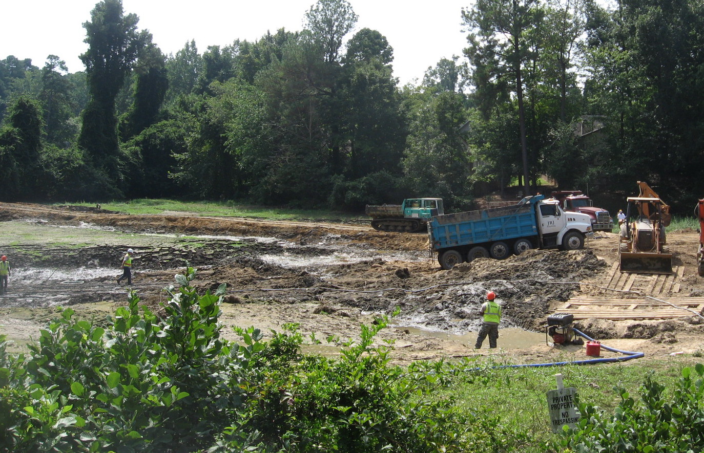
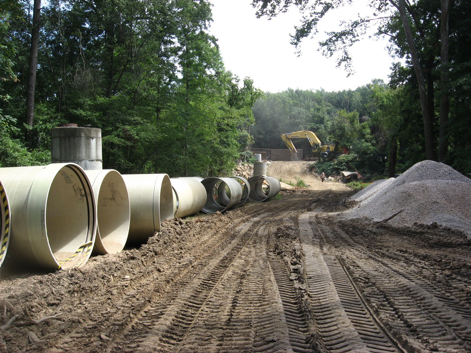
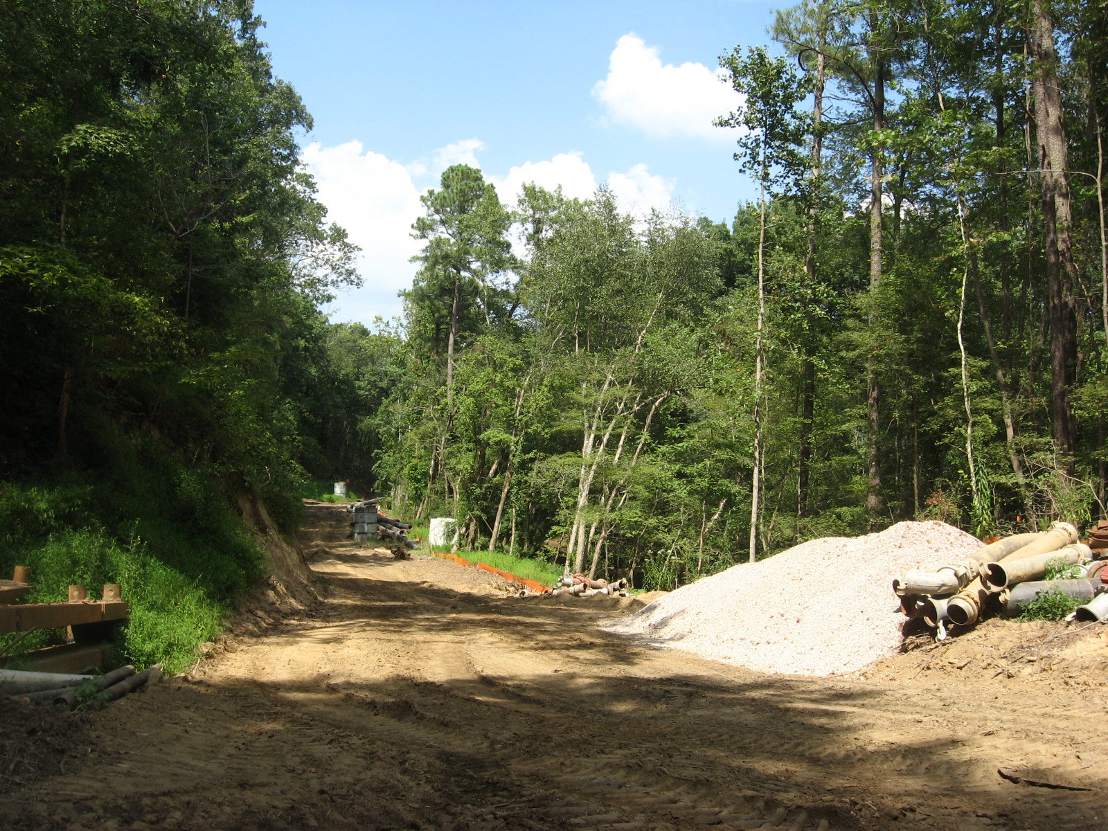
But this section will be slightly iffy for the next 12 months as crews work on renovating the sewer lines that also track the creek, usually right next to the greenway. I was startled to see the sign, then realized the closings were going to be based on immediate project need, and that people were utilizing the trail as usual that very morning.  I thoughtfully and slowly biked the entire length, stopping to check on some late summer blooms and the condition of the Rocky Overhang, my sentimental favorite spot from childhood jaunts to Crabtree from Gatewood, my east Raleigh neighborhood.  Raleigh Nature has looked several times at this oldest leg of the Raleigh greenway, but a brief catalog of its wonders seems in order.

First, the old landfill meadow at the Milburnie entrance is apparently not going to get mowed anymore – there are trees of several years age filling up the back third.  The rest is filled with microstegium, stilt grass or bamboo grass: by any name, as nefarious an invasive species as kudzu ever was.  Perhaps the landfill monitoring period is over, perhaps they will bushwack these trees eventually.  Minus the stiltgrass, it was a rich meadow. Two pairs of comparison pictures below (click to enlarge).


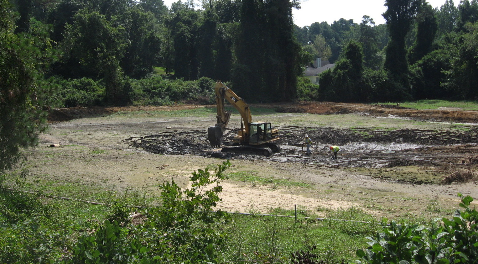
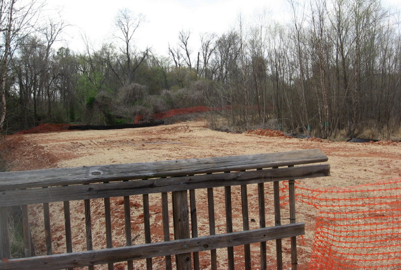
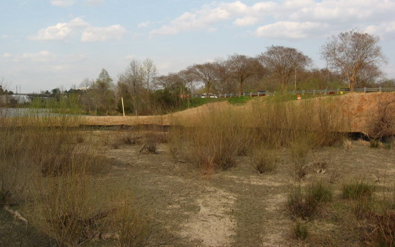
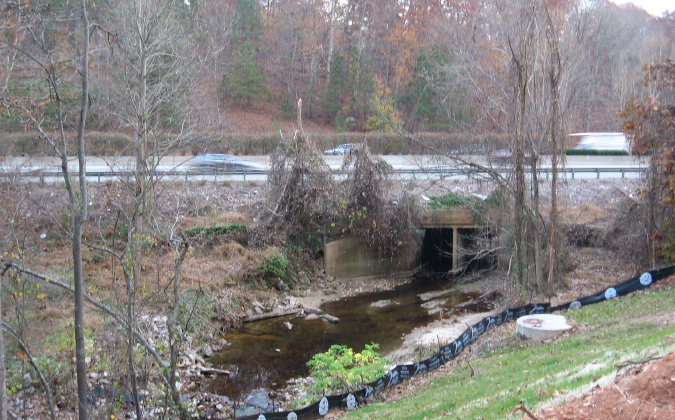
Just past this meadow is a large stand of young beeches standing in a floodplain.  As you leave them and approach Crabtree, the sewer line cuts under the greenway on its way to Milburnie Road.  This is where the work is starting.  Necessary work, plus they are protecting the terrain by mulching with what they grind – at least for now. I actually like the new openings and hiking possibilities created by these cuts. Until the poison ivy gets established.

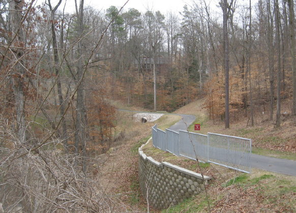
Sewer work at eastern end of Buckeye Trail

I can understand the need for the work.  Above is a section of sewer line inundated by winter floods, seen from the elevated greenway by the pump station at the dead end of Crabtree Boulevard.  This flooding is natural and used to happen with more regularity before the construction of flood controls upstream.

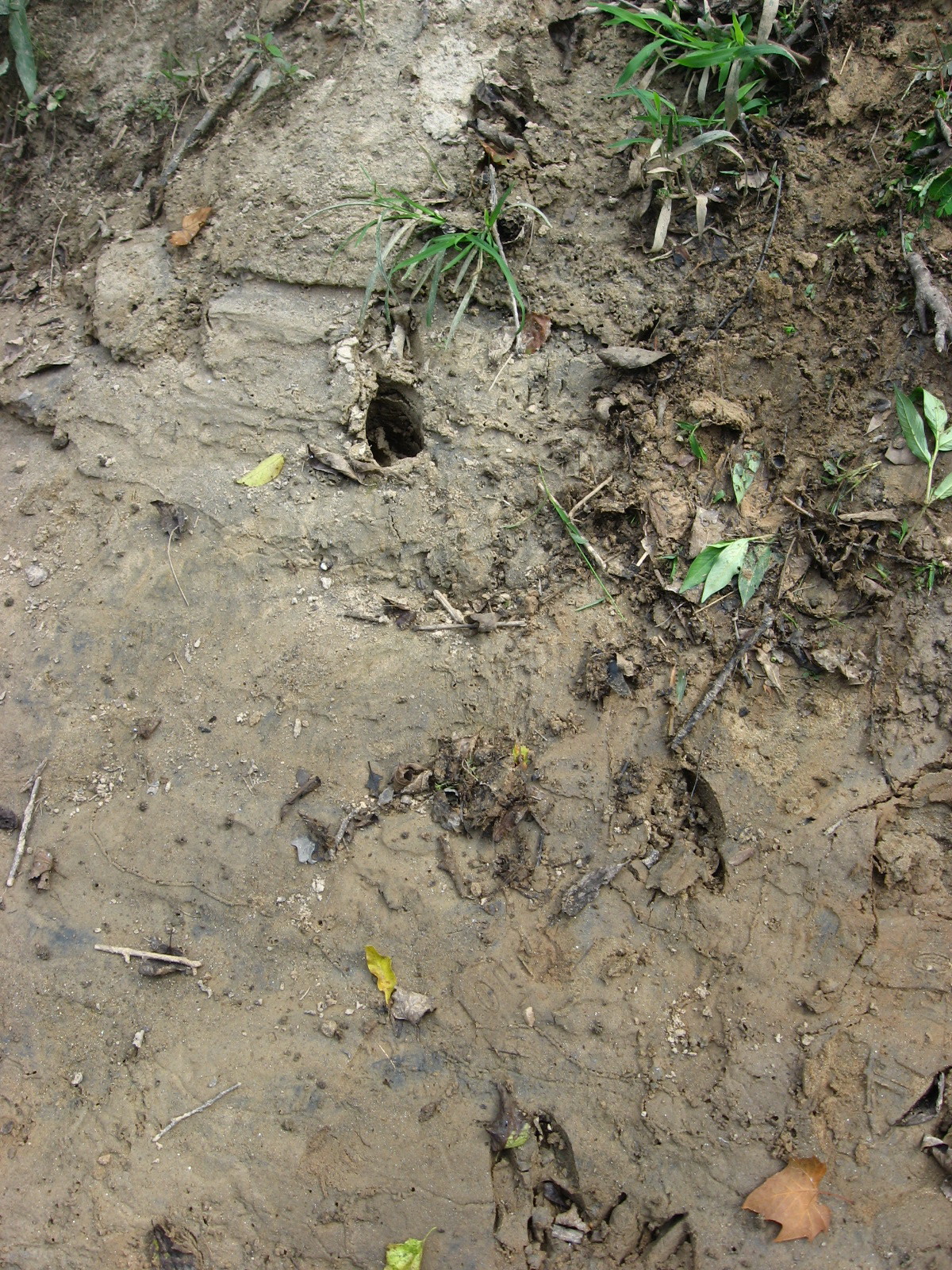
My first nature stop on the bike found me stumped.  I knew I had encountered the triangular, papery fruits and their name, but couldn’t put the two together.  A field guide finally revealed it as American Bladdernut.  Right beside it, pictured below, was a plant I did remember – nettle, whose thin hairy needles inject a stinging but mild toxin that can serve as relief from arthritis, a fact I learned from long-time NC Wildlife photographer Ted Dossett, who used to walk Buckeye almost daily.

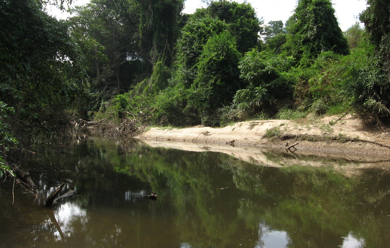
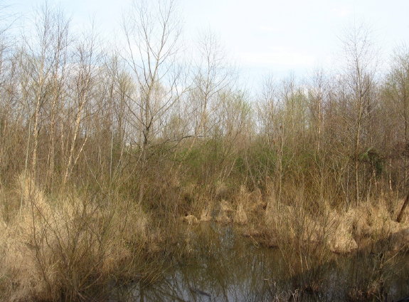
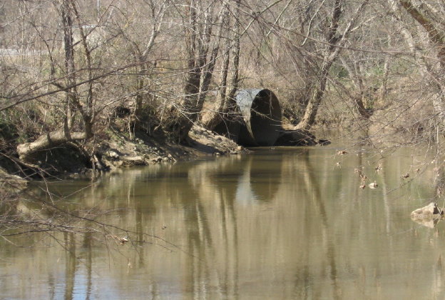
Further upstream, the creek takes a big turn, away from Yonkers and toward Milburnie, creating The Point, a triangular beach looking across at the eastern edge of the Marsh Creek marsh.  This broad wetland stretches for about a mile below Yonkers Road and the Beltline. This is a great spot to see the larger birds.  Buckeye is “the birdiest greenway trail” according to the Wake birders’ guide.   As I headed upstream toward Rollingwood, I stopped at a very special place where a big beech uses a rock formation to hang right over the water.  Its roots create undercaves that we used for caching supplies back in grade school – toilet paper, BBs, and matches.  If we left anything long, it would wash away in high water.  The spot beside the beech is pictured below in very low water.

Crabtree on east Buckeye Trail

I continued my ride, briefly surveying the Rocky Overhang, still draped by a large fallen Sycamore that came down across the creek after Floyd in 1999.  Fallen trees are a big part of changes in the creek bed, and the sycamores are notorious for taking up doomed positions on the creek bank.  Sometimes they lean precariously for years, and I will never forget the Buckeye walk when a really large, vine encrusted hickory decided to slowly but powerfully lay itself down into the creek as I walked past.  It was an amazing sound – non-violent but death-dealing forces of gravity and release.

Glimpse of the rocky overhang on Buckeye

Halfway up the trail is the park at the bottom of Rollingwood, where the greenway leaves the creekside and edges the neighborhood. The creek formerly split, creating an “island” which edged the greenway, but that streambed is dry now.  Shrubs and young trees cover the large sandy beach that existed at the head of this island in my childhood.  Unforgettable memories of camping on that beach (even then the water flow was seasonable), drawing a large square in the sand, and boxing with gloves!  It was my first and only experience with that.  The stalwart group of boys with whom I had ingratiated myself screamed and exhorted like we were Lords of the Flies.  We walked the creekside ( no greenway on those days) all the way up to Downtown (Capital) Boulevard to go get milkshakes late that night.  Fun times.

Now the creek goes straight past the former island, and the sand piles up just short of the former split.  Above is Sandy Beach, a favorite spot of my own children (though I never allowed them to camp there).  From here up to Raleigh Boulevard is a straight stretch that is close but not connected to my old gatewood neighborhood at the ends of King Charles and Marlborough.  Those streets took major damage from our April tornado disaster, and the damage shows from and includes the greenway.


This stretch is now VERY sunny and the flowers will make use of that.  A selection is below.  Be sure to visit Buckeye soon!

Jerusalem Artichoke, which has an edible root

« Newer PostsOlder Posts »

Create a free website or blog at WordPress.com.