The Raleigh Naturalist

January 5, 2009

Favorite Raleigh spots – 2008

Filed under: About & reflection, Gems & Surprises — Tags: , , , , , — raleighnaturalist @ 12:49 am

atlantic-ave-farm

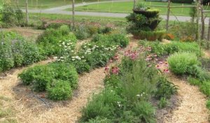
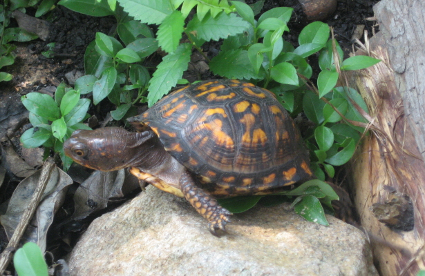
     Well, Raleigh Nature is a year old – and haven’t we been through a lot, and boy, have I learned a lot!  This blog is just getting started in ways – more broad coverage of ALL of Raleigh ITBL, pages on invasive species, turtles and record trees, and addressing concerns and questions from readers, are all on my list.  But it was a good year and I’m very happy with the blog and most grateful for the responses.

     Above is a Google Earth snapshot of what this blog is really all about – lost in wilderness inside the beltline – in this case,  the woodlot off the greenway at Atlantic Ave and Hodge Road, which was recently destroyed.   Let’s enjoy them while they’re here!  Below are my Raleigh Nature favorites for 2008.

**************

Crabtree near Milburnie Rd.

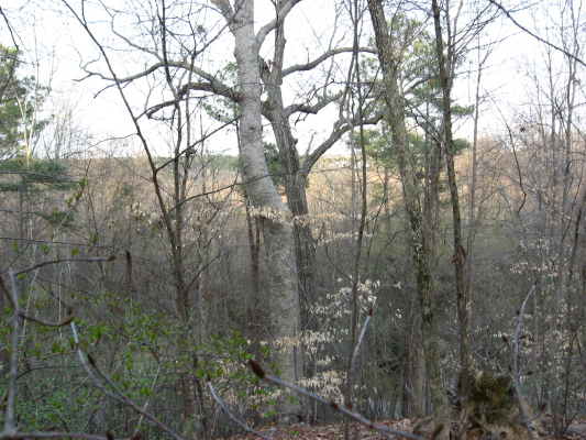
My favorite place to sit on a log. 

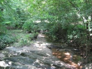
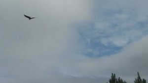
   Amidst the large tree stands that line Buckeye Trail, the oldest and easternmost section of Raleigh’s greenways threads its way beside the deep meandering banks of Crabtree.  Here we are looking at the spot where Marsh Creek marsh spills over into Crabtree after a heavy rain.  Nice spot for animals to come down for a drink, and above is the marsh skyline to scour for hawks and herons.

***********

Lassiter Mill Dam

My favorite spots to drown worms.

   Lassiter Mill, above and below the dam, is a wonderful place to fish with children, for turtle food, or even to fool around with your flyrod.

************

Yates Mill Pond

My favorite place to take a guest.  

   Yates Mill, with the old millworks, the gorgeously built new center displaying its history, a marked tree i.d. walk, a high ridge, a marshy meadow, and a fishing deck, has all anyone could desire from a nature outing.  It’s well outside the beltline but I love it too much to exclude it.

***************

Meadow off Sunnybrook

My favorite place to meadow tramp.

  The privately owned section of the old pecan farm surrounding Jones Lake is eventually doomed but is the best spot for seeing foxes, deer and footprints of those and more in the same trip.  Once it’s developed, I’ll have to settle for the county park across the highway.

************

Rocky Branch at Dix Hill

My favorite place to jump rocks.

   Dix and the greenway that connects it to Centennial and Washington School represents a fantastic dog walk, frisbee throw, pecan pick, or walk of any length you desire.  Rocky Branch, displaced by the Western Boulevard extension, has retained some of its good character.

************

Raleigh Swamp

My favorite place to watch birds

   Raleigh Swamp, which used to be irregular but has been made permanent by the damming effects of Raleigh Boulevard, has a large consistent and varied population of breeding and visiting birds.

************


waterfall-close-up_1_1

My favorite place to listen to water.

   Jaycee park has a rock waterfall that, at two feet, is perhaps the largest inside the beltline.  It certainly is the prettiest of which I know.

***********

Longstreet greenway off Sawmill

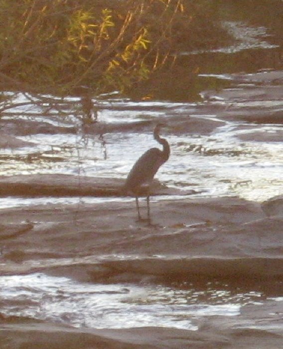
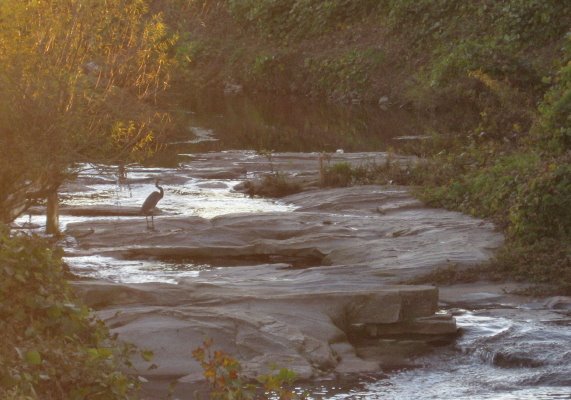
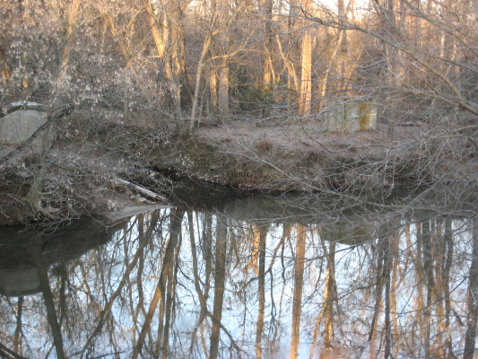
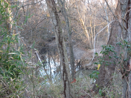
My favorite place to photograph.

   This must be it, because this is my favorite photograph so far.  This creek borders the greenway which runs south beside Longstreet off Sawmill in north Raleigh. I’ll keep working on finding, and shooting, one even better.  Ya’ll have a great new year!!  Love, John

November 22, 2008

Pigeon House Branch

     A great blue heron browses Pigeon House Branch where it crosses over a granite outcrop.  The scene is tucked away in a very industrial part of central Raleigh – Capital Boulevard’s warehouse district, where the creek flows through huge kudzu-covered ditches on alternating sides of the thoroughfare.  Pigeon House is the most prominent waterway in central Raleigh, but also its most abused. (last text link is info, all others are pictures).

sw-tributary_1_1The streamwatch station denotes a creek under these storm sewers at the SE edge of Cameron Village.

Transportation Plan map of Pigeon House creek

  It gathers its headwaters in Edna Metz Park  just off Cameron Village, and this upper part of the creek was shifted and ditched in order to build Cameron Village.  From Edna Metz, concrete culverts carry it through Cameron Park and east down Johnson Street, where it crosses under Peace Street to be culverted again through the former Devereux Meadows, which is now a city facility for trash trucks and a salt barn.

    Flowing north beside Capital Boulevard, the creek drains two railroad lines as well as a massive entertwining of concrete roadways.  A highlight of this stretch is the Light+Time art tower, which presides over the union of Pigeon House with the waters from Fred Fletcher Park. As it borders the service road for the warehouse strip, it finds the rock outcrop frequented by the heron. It dives under Capital to emerge almost underneath the venerable Watkins Grill on Louisburg Road, then criss-crosses Capital back and forth again before heading east toward Crabtree Creek. We will pick it up at The Foxy Lady and follow it down to Raleigh Swamp another post soon.

The heron has found a beautiful spot in unlikely territory.  As the city makes efforts to rehabilitate its tributaries, Pigeon House Creek continues to flow as naturally as it can through northwest downtown.  We should notice it and help it out anyway we can.

Pigeon House Creek photo sequence

(from Cameron Village to Dennis Ave and Capital)

All RN post on Pigeon House Branch

September 25, 2008

Fallon Park – a long, fine necklace in Raleigh’s greenway jewels

 Fallon Park, just northeast of Five Points, and sloping with its long narrow shape down to Crabtree Creek at Anderson Drive, is a long necklace in Raleigh’s park jewels. The remains of a small mill structure lend even more interest to a wonderful rockfall along the creek that defines the park.  Fallon Creek is short : its headwaters gather right in the front yards of the very well appointed houses along White Oak Road off Anderson Drive.  The long skinny park has an unpaved path that is heavily used by joggers, walkers and doggers.  I never go on the weekend, but I have such fond memories of going there on weekday afternoons with my small children, chasing crawfish in the rockpools and climbing around the old mill structure.  It is a clean, rock-filled creek with a wide range of trees and plants arranged around its slopes.  There are small grass meadows at the top and bottom.  It serves a surrounding community that maintains rich, semi-organic plantings in its large yards, and it drains steep wooded slopes with older houses and little construction.  The creek’s quality reflects all of that.

Rockpools where Lily and Dori and I fished many times.

Rockfall and brick mill structure.

Fallon Park photo tour

*****************

I posted at Raleigh Rambles about the Carolina Farm Stewardship’s  farm tour.  It was a fun couple of drives, and we saw plenty of nature to go along with the agriculture, as pictured below.

Above, a native plant area at the Piedmont Biofuel Lab Farm.  Below a large bird, perhaps a raven , that swooped down toward the highway for some time in front of us.  I suppose it’s probably a vulture, but it certainly didn’t act like one.

August 13, 2008

Ward Transformers – Crime Never Stops Hurting

Filed under: Crabtree Creek, Gems & Surprises, green initiatives — Tags: , , , , — raleighnaturalist @ 2:09 pm

     A recent N&O story reminds us of the reason for these signs, posted all along the Crabtree system:  our city’s water system is tainted by PCBs (polychlorinated biphenyls), a toxic chemical released over many years by the actions of Ward Transformers, a company whose name is etched in the annals of NC corporate crimes, a company STILL OPERATING next to the Superfund site next to RDU airport, where its buried load of poisons is slowly being incinerated through the process pictured below.

Ward Transformer site

Ward Transformer site

Ward Transformers has a long history of environmental crimes in North Carolina.  Long before the discovery that it’s open burning of materials on site to recover copper had applied PCBs to the soil surrounding its plant, Ward Transformers and its contractor, Robert Burns, were found guilty of dumping PCB-laced waste along miles of rural NC highways, using a specially designed dumping apparatus constructed at Ward Transformers.  Burns and “Buck” Ward spent some time in jail, but at some point the EPA or someone in government realized that a bankrupt company couldn’t help pay clean-up costs, so Ward Transformers was left in business.  The state of North Carolina had to scrape up the roadside deposits and figure out what to do with them – leading to a separate whole nightmare with the landfill in Warren County.

That was way back in 1978.  The next year, EPA tests show contamination in the soil around the plant itself.  In 1993, preliminary Superfund action was undertaken and in 2002 it was declared a Superfund site.  Yet much local outcry and promotion took place before clean-up work was begun.  Now, according to the newspaper report, the work is being done, and in a safe manner. Yet concerns remain about the process, as well described in this post at Raleigh Eco News.  I went out to look at the site.  The EPA’s clean-up incinerator really puts out a huge stream of white smoke – apparently almost all water vapor.

     Thank you for listening to my rant.  It just drives me crazy that ole Buck Ward spent a few months in jail and now his company rolls merrily along, though I presume they send a hefty check to the EPA each month.  We will never fully recover from these actions in my lifetime.  And we will never figure out the “best” way to punish such transgressors – justice and reparation are both so tough to achieve.


25th anniversary of PCB Landfill protests

*************

As a balance to the above, please enjoy a juvenile box turtle living in our garden and a fawn Cara and I saw on a trip last weekend.

July 31, 2008

White Squirrels and the Brevard fault: PFI rules!!

Filed under: Exotica, Gems & Surprises, Nature Lore — Tags: , , , , , , — raleighnaturalist @ 7:54 pm


    Teachers in the woods!  Climbing rocks and jumpin’ in waterfalls! That’s what I call a workshop! For 5 very full days, two dozen educators traveled the Land of Waterfalls, centered around the Brevard fault, seeing some amazing geology, flora, and fauna with the staff of, and presenters for, the Pisgah Forest Institute.  We got treated like teacher queens for a day (okay, one other guy besides me as kings in this group of elementary school teachers).  We got free stuff, wonderful information and some great hikes.

teachers in the Little River!

teachers in the Little River!

   The Pisgah Forest Institute is an initiative of Brevard College – a beautiful campus that is ancient as a 2 year college but only 14 years old as a 4 year.  PFI focuses on “the earth and environmental science needs educators encounter in their classrooms. ”  The workshops are funded partly through grants from the USDA Forest Service.  This part of the mountains receives more annual rainfall than anywhere in the continental U.S. except for the Northwest temperate rain forests (or would if there weren’t a severe drought).  There is a unique feel to the wilderness areas and even more so to the farmland, it seemed to me this trip.  Rich, well cultivated fields and not so much the hard scrabble feel you see (disappearing) in the northern section of our mountains.

     The town of Brevard hosts a Music Center, has a nice college/tourist shop and bar scene, and is famous for – did I mention them?, – the white squirrels.  These little guys just blew me away, and set me off on an extended online chase to research white squirrels.  There was a lot to find. The local history traces their origin to an overturned carnival truck in 1949.  There is a research institute devoted to them, a White Squirrel Festival each year in Brevard, and of course a White Squirrel Lover’s blog.  The very best picture I found online is on a realty site, and clearly the white squirrel is a promotion bonanza for the town of Brevard, though their claim to fame is not without controversy (other “homes of the white squirrel”).

on the move

on the move

White Squirrel Photo Album

     The PFI would educate and inform us and then take us on a related field trip.  We made 3 major expeditions: Holmes Educational State Forest, Caeser’s Head State Park, and a new amenity, Dupont State Park, which contains several spectacular waterfalls.  We also conducted a stream activity at the trout hatchery on the Davidson River. Each place offered valuable lessons and experiences.  At Holmes, which is open to the public, we practiced tree i.d. and took the “talking tree” walk.  Caeser’s Head offered spectacular views of the Piedmont vista as seen from the edge of the Blue Ridge system.  So many wonderful pictures – I offer an album at the end of the post, and many of the following text images are linked to a picture.

     The park gots its name from a head-shaped rock that protrudes from the highest viewpoint.  Across the chasm, you see Tablerock Mountain, a monolith of intruded younger rock whose side is painted by the staining action of rainwater.

      Dupont, after a decent hike, offered beautiful waterfall views, including some used in The Last of the Mohicans.  Here the Brevard Fault is in full view, fracturing and pushing til some of the huge blocks become square tree planters.  The Little River winds its way down the rock cascades, though it was quite low the day my pictures were taken.

  The young lady below is leaping from Hooker Falls, another fault-block structure in the park.  We learned some background geology at Caeser’s Head and then put it into action at Dupont, locating the folded layers in a piece of gneiss that represent eons of slow bending pressure.

     Kevin, program director for PFI, holds a northern water snake from the Davidson River.  We measured stream quality parameters and took a tour of the trout hatchery, which attracts vultures from miles around.  Back at the Brevard campus, we saw a stream rehabilitation process and surveyed native as well as invasive plant species on campus.  Below is a picture of hemlock infested with wooly adelgid (the small white spots).  Just one of the many ecological challenges faced in the Southern Appalachian mountains.  Thanks, PFI, for such a great trip and for helping me learn so much! 

PFI Brevard Fault Photo Tour


July 4, 2008

Back to Basics – East Raleigh beginnings

Filed under: East Raleigh, Gems & Surprises, Greenways & Parks, Nature Lore — Tags: , , , — raleighnaturalist @ 6:35 pm
lower Longview Lake from south

lower Longview Lake from south

    This is the first picture I took with my new camera for this blog, in late January 2007.  Longview Lake was the big body of water in my childhood.  I was more familiar with the upper section, just below  Enloe, which has been surrounded by development and is filling up with silt.  This lower section is in good shape, and some of the homes have small docks, of which I’m quite envious.

   Longview temporarily collects the waters of Bertie Creek, coming down Bertie Drive below Enloe, which then crosses Milburnie at Peartree Lane and makes its way down to Crabtree as seen below.  This lowest stretch of Bertie, which parallels Milburnie and crosses under Buckeye Trail’s beginning, gets some interesting visitors exploring upstream from the larger creek.  Just below the Buckeye bridge over it, the small creek pools up, and I have seen large sliders and snappers meditating a climb over the partly submerged sewer pipe blocking their way.  Above the greenway bridge, there are some nice rock riffles, and I was once amazed ( and too startled to act) by lifting up a large flat rock to reveal an Amphiuma – my only sight ever of this huge, biting salamander.

Bertie Creek hits Crabtree

Bertie Creek hits Crabtree

    Crabtree and Bertie enclose a diagonal of East Raleigh neighborhood, east Rollingwood, that is bordered by rich upland woods.  These high areas surround a large rock outcrop that turns the creek right after it has absorbed the waters of Marsh Creek.   That union, Marsh Creek and Crabtree, creates a huge marshy area highlighted by Raleigh Swamp at Capital Boulevard.  Below that, after the rocky overhang, Crabtree is steadily on its way to becoming a coastal plain waterway.  It’s flat, meandering path is lined with deep, silt-lined walls of clay, gouged regularly by floods.  It is not a pretty creek – the banks give the impression of accumulated eons of ring around the bathtub.  But there are interesting tangles of trees  and the occasional surprise.

Marsh Creek floodplain from Rollingwood

Marsh Creek floodplain from Rollingwood

Crabtree at Milburnie

Crabtree at Milburnie

This “surprise” was a heron which scattered from behind a sewer tower and managed to get caught in my uplifting camera lense.  As I’ve mentioned elsewhere, this easternmost section of Buckeye is very “birdy,” with all three kinds of local woodpeckers, hawks being harassed by crows, and plenty of herons.

Nature News

The Wake County Quarterly

Here, like usual, are so many opportunities to learn about and interact with nature.  Even if you don’t need the structured activities, it’s nice to be reminded of the beavers at Blue Jay Point, the farm history at Oak View Park, the bats at Crowder Park on Ten-ten, and the restored gristmill  at Yates Mill.

« Newer PostsOlder Posts »

Blog at WordPress.com.