The Raleigh Naturalist

January 15, 2009

Fletcher Park Meets Top and Bottom

Filed under: Central Raleigh, green initiatives, Greenways & Parks — Tags: , — raleighnaturalist @ 2:43 am

   Fletcher Park’s new water garden has been finished, as well documented in a News and Observer article by Tommy Goldsmith.  Mr Goldsmith kindly quotes me about the site:

John Dancy-Jones, a science teacher at Fletcher Academy, has been keeping up with the water garden on his blog at www.raleighnature.com.

“The greenway path beside the water winds around and unifies what used to seem like a very bifurcated setting,” of the park’s upper and lower levels, Dancy-Jones said.

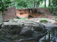
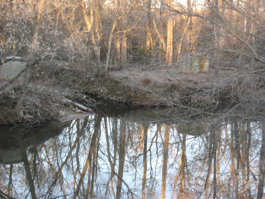
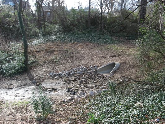
The purpose of the water garden is to slow and filter the water being drained into Pigeon House Branch, down the hill at Capital Boulevard.  Mr. Goldsmith did not quote me on my main reservation about the project, which is that our notoriously low water flow periods might render the ponds stagnant and perhaps slow to fill in the first place.  He stated in a phone conversation that  several springs had been discovered during the course of construction.  I have high hopes for this water garden , but the photo below seems to show seeps rather than springs in the highest portion of the water garden proper.

    What Mr. Goldsmith does do is start his article with a wonderfully appropriate joke about residents of a new $710,00 residence (the mallards in the largest, lowest pond).  Ironically appropriate because the need for this system, paid with mostly state and EPA funds, was created by the dense, impermeable developments right across the street from the park.  But if the designers accomplish their goal – a balanced wetwater ecosystem with rich food chains that keep down mosquitoes, then Fletcher Park can become a gem that represents a small scale model of what will probably happen in the end at Dix: development, and compensation for it that provides valuable amenities for all.  The N&O article cites science evidence that the system is already benefiting Pigeon House Branch, and that waterway needs all the help it can get.

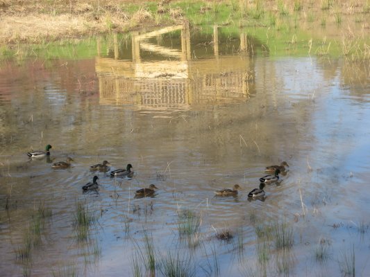
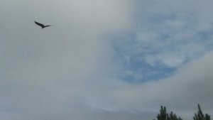
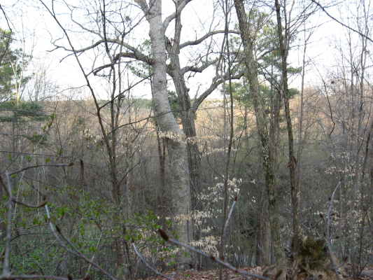
Above, the expeditious mallards. Below, looking toward Glenwood.

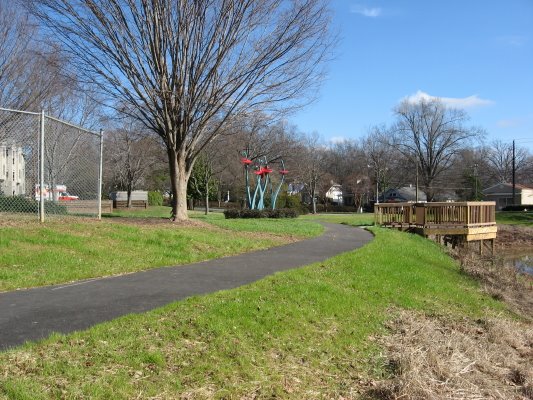
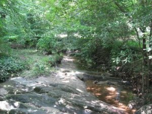
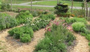
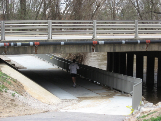
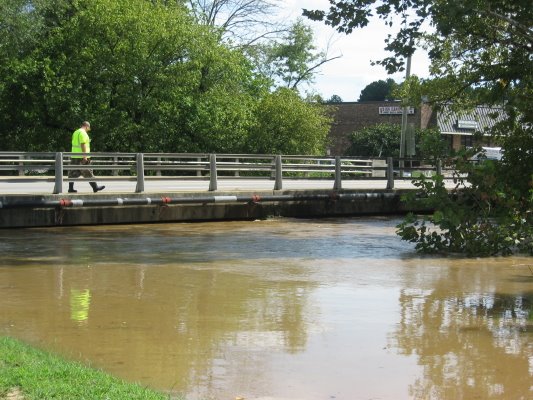
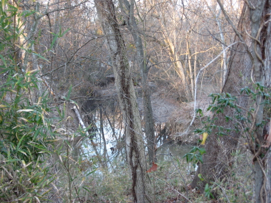
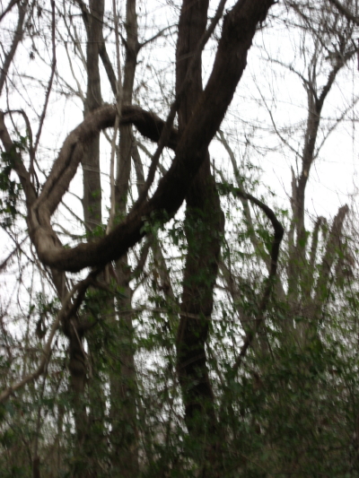
Photo tour of finished water garden

 previous posts on Fletcher Park:

September 3rd, 2008

March 23, 2008

November 1, 2008

Slow Fall at Dix


Raleigh from Dix Hill

Raleigh from Dix Hill

 Dorothea Lynde Dix (1802-87) was perhaps the most famous and admired woman in America for much of the nineteenth century. Beginning in the early 1840s, she launched a personal crusade to persuade the various states to provide humane care and effective treatment for the mentally ill by funding specialized hospitals for that purpose.

     306 acres are left from a huge estate that was given over to the benefit of some of our neediest folks.  As the fall colors take their time this year decorating Raleigh’s skyline, so Dix Hill’s fate lingers in the slow balance of state decision.  Walk the big meadow with me and glimpse some early fall colors.

   We turn from downtown and look down at the gazebo and greenway path which runs along Rocky Branch as it follows its new, straightened course beside Western Boulevard.  On that walk we’ll see lots of elusive birds, wild grape, and some small spots of fall color.

     The campus has many historic buildings, massive white and red oaks that ring the meadow, a small grove of highly productive pecan trees, and one open slope that is the joys of all sledders.  Centennial Campus and the Farmer’s Market have already taken the lion’s share of what once was .  Now the state needs to let Raleigh’s long term interests take precedence over a short-time cash windfall.  The folks at Dix 306 are working hard to make that happen.  We should support them any way we can.

     Below is a trace of fall glory in midst of a glorious lingering summer.  Hopefully this image does not represent the sunset of hopes for the landscapes of Dix Hill.

****************

   I went on this walk partly because of Ashley Sue over at Green Grounded, who complimented me in anticipation of seeing fall colors on Raleigh Nature.  Below are clickable thumbnails of some other sightings at Jones lake off Sunnybrook, and then ending with my all time best fall picture, from the west Beltline.  Happy leafing!


September 25, 2008

Fallon Park – a long, fine necklace in Raleigh’s greenway jewels

 Fallon Park, just northeast of Five Points, and sloping with its long narrow shape down to Crabtree Creek at Anderson Drive, is a long necklace in Raleigh’s park jewels. The remains of a small mill structure lend even more interest to a wonderful rockfall along the creek that defines the park.  Fallon Creek is short : its headwaters gather right in the front yards of the very well appointed houses along White Oak Road off Anderson Drive.  The long skinny park has an unpaved path that is heavily used by joggers, walkers and doggers.  I never go on the weekend, but I have such fond memories of going there on weekday afternoons with my small children, chasing crawfish in the rockpools and climbing around the old mill structure.  It is a clean, rock-filled creek with a wide range of trees and plants arranged around its slopes.  There are small grass meadows at the top and bottom.  It serves a surrounding community that maintains rich, semi-organic plantings in its large yards, and it drains steep wooded slopes with older houses and little construction.  The creek’s quality reflects all of that.

Rockpools where Lily and Dori and I fished many times.

Rockfall and brick mill structure.

Fallon Park photo tour

*****************

I posted at Raleigh Rambles about the Carolina Farm Stewardship’s  farm tour.  It was a fun couple of drives, and we saw plenty of nature to go along with the agriculture, as pictured below.

Above, a native plant area at the Piedmont Biofuel Lab Farm.  Below a large bird, perhaps a raven , that swooped down toward the highway for some time in front of us.  I suppose it’s probably a vulture, but it certainly didn’t act like one.

September 8, 2008

Crabtree Creek Floods The Middle Creek Greenway

Filed under: Central Raleigh, Crabtree Creek, Greenways & Parks — Tags: , , — raleighnaturalist @ 12:44 am

     After Tropical Storm Hannah came through on Saturday, September 6, 2008, Crabtree Creek flooded the intersection of Hodges Road and Atlantic Avenue and also several sections of the Middle Creek portion of the Raleigh greenway.


above is the greenway underpass below Atlantic Ave.  Below is the same view 9/6/08.

This is the first time the greenway has flooded since October 2007 by my count.

creek levels post on Pecans & Mistletoe

photo album of Crabtree flooding after Hannah


September 3, 2008

Fletcher Park water feeds Pigeon House Creek

Filed under: Central Raleigh, green initiatives, Greenways & Parks — Tags: , , , — raleighnaturalist @ 10:10 pm

There is not a lot to update on the earlier post about Fletcher Park’s new water park, which remains in a distinctly unlovely stage of construction, but this project is interesting from several angles and seems worth another look.  The large cavities being excavated from the red clay are designed to hold the water headed down to Pigeon House Creek, which is the long-suffering waterway that parallels Capital Boulevard as it flows north toward its intersection with Crabtree Creek at Raleigh Swamp.  What look like huge pits will allow the water to deposit sediment and be filtered by plant activity before flowing on down the hill.

      A nice description of the benefits, which include hopes for “A new ecosystem for this area of the park [with] butterflies, dragonflies, and frogs, among other animal species,  ”  can be found at The Raleigh Connoiseur.  But that post was in May, and the plan was for the water garden to be finished soon after.  But there it sits.  The upper pool shown below will cascade or slide down to the larger lower pool.

      This site was a Methodist orphanage, built in 1900 and still operating well into my lifetime.  The City purchased the property in 1982 and named the park for A.J. Fletcher’s recreation-loving son.  Fred Fletcher was inducted into the Raleigh Hall of Fame in 2007.

     The outlet seen above is the water’s exit toward Pigeon House Creek.  From this point the water dives underground and is piped under the railroad line and across N. West Street.  I cannot find a spot to view that intersection yet.  Below is a  picture of Pigeon House Branch just downstream.  We will follow it’s grim journey down Capital sometime soon.

Fletcher Park and Pigeon House Creek photo album

July 4, 2008

Back to Basics – East Raleigh beginnings

Filed under: East Raleigh, Gems & Surprises, Greenways & Parks, Nature Lore — Tags: , , , — raleighnaturalist @ 6:35 pm
lower Longview Lake from south

lower Longview Lake from south

    This is the first picture I took with my new camera for this blog, in late January 2007.  Longview Lake was the big body of water in my childhood.  I was more familiar with the upper section, just below  Enloe, which has been surrounded by development and is filling up with silt.  This lower section is in good shape, and some of the homes have small docks, of which I’m quite envious.

   Longview temporarily collects the waters of Bertie Creek, coming down Bertie Drive below Enloe, which then crosses Milburnie at Peartree Lane and makes its way down to Crabtree as seen below.  This lowest stretch of Bertie, which parallels Milburnie and crosses under Buckeye Trail’s beginning, gets some interesting visitors exploring upstream from the larger creek.  Just below the Buckeye bridge over it, the small creek pools up, and I have seen large sliders and snappers meditating a climb over the partly submerged sewer pipe blocking their way.  Above the greenway bridge, there are some nice rock riffles, and I was once amazed ( and too startled to act) by lifting up a large flat rock to reveal an Amphiuma – my only sight ever of this huge, biting salamander.

Bertie Creek hits Crabtree

Bertie Creek hits Crabtree

    Crabtree and Bertie enclose a diagonal of East Raleigh neighborhood, east Rollingwood, that is bordered by rich upland woods.  These high areas surround a large rock outcrop that turns the creek right after it has absorbed the waters of Marsh Creek.   That union, Marsh Creek and Crabtree, creates a huge marshy area highlighted by Raleigh Swamp at Capital Boulevard.  Below that, after the rocky overhang, Crabtree is steadily on its way to becoming a coastal plain waterway.  It’s flat, meandering path is lined with deep, silt-lined walls of clay, gouged regularly by floods.  It is not a pretty creek – the banks give the impression of accumulated eons of ring around the bathtub.  But there are interesting tangles of trees  and the occasional surprise.

Marsh Creek floodplain from Rollingwood

Marsh Creek floodplain from Rollingwood

Crabtree at Milburnie

Crabtree at Milburnie

This “surprise” was a heron which scattered from behind a sewer tower and managed to get caught in my uplifting camera lense.  As I’ve mentioned elsewhere, this easternmost section of Buckeye is very “birdy,” with all three kinds of local woodpeckers, hawks being harassed by crows, and plenty of herons.

Nature News

The Wake County Quarterly

Here, like usual, are so many opportunities to learn about and interact with nature.  Even if you don’t need the structured activities, it’s nice to be reminded of the beavers at Blue Jay Point, the farm history at Oak View Park, the bats at Crowder Park on Ten-ten, and the restored gristmill  at Yates Mill.

« Newer PostsOlder Posts »

Blog at WordPress.com.